Bute, Kingarth
Field Boundary(S) (Period Unassigned), Long Cist Cemetery (Early Medieval)(Possible)
Site Name Bute, Kingarth
Classification Field Boundary(S) (Period Unassigned), Long Cist Cemetery (Early Medieval)(Possible)
Canmore ID 309172
Site Number NS05NE 138
NGR NS 09900 56416
Datum OSGB36 - NGR
Permalink http://canmore.org.uk/site/309172
- Council Argyll And Bute
- Parish Kingarth
- Former Region Strathclyde
- Former District Argyll And Bute
- Former County Buteshire
NS05NE 138 09900 56416
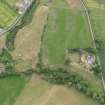
Parchmarks recorded on oblique aerial photographs (RCAHMSAP 2010) in the improved field immediately SW of Kingarth Manse (NS05NE 65) show what are probably field boundaries and a possible long cist cemetery. The ditched field boundaries are aligned from NNE to SSW in keeping with the 19th and 20th century field pattern. At the eastern end of the field, immediately to the S of the Manse there are 13 subrectangular parchmarks, measuring about 2.5m from WNW to ESE by 1m transversely on average, which are probably grave pits in a long cist cemetery. The supposed site of St Catan’s church lies some 200m to the NE (NS15NW 6). A ditch, aligned from NNE to SSE runs through the scatter of grave pits, and may be a further field boundary.
Information from RCAHMS (GFG) 18 March 2011
Note (18 March 2011)
Parchmarks recorded on oblique aerial photographs (RCAHMSAP 2010) in the improved field immediately SW of Kingarth Manse (NS05NE 65) show what are probably field boundaries and a possible long cist cemetery. The ditched field boundaries are aligned from NNE to SSW in keeping with the 19th and 20th century field pattern. At the eastern end of the field, immediately to the S of the Manse there are 13 subrectangular parchmarks, measuring about 2.5m from WNW to ESE by 1m transversely on average, which are probably grave pits in a long cist cemetery. The supposed site of St Catan’s church lies some 200m to the NE (NS15NW 6). A ditch, aligned from NNE to SSE runs through the scatter of grave pits, and may be a further field boundary.
Information from RCAHMS (GFG) 18 March 2011


