Following the launch of trove.scot in February 2025 we are now planning the retiral of some of our webservices. Canmore will be switched off on 24th June 2025. Information about the closure can be found on the HES website: Retiral of HES web services | Historic Environment Scotland
Braemar, Braemar Castle
Castle (Medieval)
Site Name Braemar, Braemar Castle
Classification Castle (Medieval)
Alternative Name(s) Mar Castle
Canmore ID 29748
Site Number NO19SE 4
NGR NO 15604 92374
Datum OSGB36 - NGR
Permalink http://canmore.org.uk/site/29748
First 100 images shown. See the Collections panel (below) for a link to all digital images.
- Council Aberdeenshire
- Parish Crathie And Braemar
- Former Region Grampian
- Former District Kincardine And Deeside
- Former County Aberdeenshire
NO19SE 4 15604 92374
(NO 1561 9238) Braemar Castle (NAT)
OS 6" map, Aberdeenshire, 2nd ed., (1903)
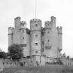
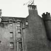
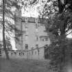
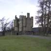
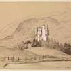
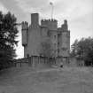
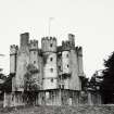
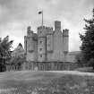
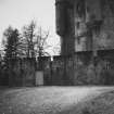
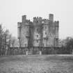
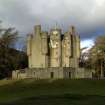
Braemar Castle is a tall, five storeyed turreted house of the L-plan, measuring 51 feet by 47 feet, with a large round stair tower in the re-entrant angle. It was built in 1628, burned in 1689, and remained a ruin until 1748 when it was leased and garrisoned by the Government after the erection of the rectangular curtain wall. The British Museum library has engineers' drawings of this reconstruction which show a large well in the north salient.
W D Simpson 1949; D MacGibbon and T Ross 1887.
Braemar Castle, in good condition and open to the public during the summer months. Later single storey constructions have been added
between the 18th century curtain wall and the 17th century tower house on the N and W sides.
Visited by OS (N K B) 26 October 1967.
Listed.
Scottish Castle Survey 1988; N Bogdan and I B D Bryce 1991.
Visible on air photograph AAS/93/11/G23/4. Copy held by Grampian Regional Council.
Information from M Greig, Grampian Regional Council, March 1994.
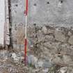
NO 1560 9237 A watching brief was undertaken on 25-6 October 2007 during the excavation of two service trenches
between the curtain wall and the N side of the castle. Braemar Castle was built in 1628 and burnt down in 1689. It remain a ruin until 1748 when it was rebuilt and used as a government garrison, and the star-shaped curtain wall was built. The stratigraphy observed during the watching brief appears to demonstrate that a well or cistern (which is depicted on a 1750 plan of the castle) within a salient of the wall was almost certainly built as part of the mid-18th-century renovations. A similar feature occurs at Corgaff Castle, also garrisoned at the same time.
Reports deposited with Aberdeenshire SMR and RCAHMS.
Funder: Aberdeenshire Council.
H K Murray and J C Murray, 2007.
OWNER: Invercauld Estates
NMRS REFERENCE:
PLANS
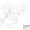
Copies of plans, the originals of which are held in the British Museum, dated 1753 and 1750. See C 21065 P, C 21066 P and C 21067 P.
NATIONAL ARCHIVE OF SCOTLAND:
Braemar Castle, Corgarff Castle, Kildrummie Castle.
Burning of the Earl of Mar's castles during the rebellion of the Highlanders. Representation of losses states that these amount to ?3,400. (post 1690). GD124/10/427.
Burning of the Earl of Mar's Castles, his lands in Braemar and his sawmill there. Representation of looses states that the damage amounts to ?3,400. (post 1690) GD 124/10/427.
Situated in South West Aberdeenshire, in the valley of the River Dee, and according to Groome's Ordanance Gazetter of Scotland (1901 edition), the new Braemar Castle was built about 1720 by owners who had acquired the forfeited estates of the Earl of Mar. About 1730 it passed by purchase into possession of Farquharson of Invercauld: and was leased to the Government about 1748 for the uses of a garrison.
In the National Library of Scotland is a series of Military Maps and Drawings, many coloured, of the Board of Ordnanace, dealing with the works executed in the 18th century. Reference 'MSS 1645-1652'. Among these, and contained in case or volume no. 1649, are the following relating to Braemar Castles:-
Number. Year.
Z 3/33.1748. 'Plan(s) of Braemarr Castle as it stands at present'. Scale 10 feet to an inch. Dated Edinburgh 25th April, 1748. Docketted on back. 'Reed with Copy of Colonel Watson's letter to Mr.Skinner dated 12 May, 1748'.
Z 3/33.1748. 'Section of Braemarr Castle as it stands at present'. Same scale at last, and evidently same date'
Z 3/33.1748 'Plan(s) of Repairs for Braemar Castle'. Scale 10 Feet to an inch. Date 25th April, 1748, and docketted on back as drawing above.
Z 3/31.1750. 'Plans of Brae-marr Castle in the year 1750', shewing Enclosing Wall with Crenaux, and Well. Scale 10 Feet to an inch. Bears the name of W. Skinner. There are 2 copies.
Z 3/34.1750. 'Elevations and sections of Braemarr Castle in the year 1750'. Scale 10 feet to an inch. Drawn by Chas. Tarrant. Signed by W,Skinner. There is a copy.
Z 3/37. No date. 'Old Plans and Section of Corgarff Castle' and plans and section shewing 'Repairs; and on the same Sheet Castle'. To the small scale of 20 feet to an inch. There is no date. There is also a copy. This drawing and that following is also indexed under Corarff Castle'.
Z 3/36.1785. 'Sketch of the loop-holed Walls built round the Castles of Cargarff and Braemar'. Scale is noted not shown. Signed by A.Frazer 31st December, 1785. It is noted that Cargarff was first taken possession of by the troops in March, 1748 and Braemar first occupied in February, 1749'.
Non-Guardianship Sites Plan Collection, DC23098- DC23104, 1748 & 1750.
Photographic Survey (July 1962)
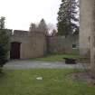
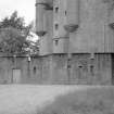
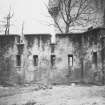
Photographic survey of Braemar Castle, Aberdeenshire, in 1962 by the Ministry of Works, including several photographs of the curtain wall.
Watching Brief (25 October 2007 - 26 October 2007)
NO 1560 9237 A watching brief was undertaken on 25-6 October 2007 during the excavation of two service trenches between the curtain wall and the N side of the castle. Braemar Castle was built in 1628 and burnt down in 1689. It remain a ruin until 1748 when it was rebuilt and used as a government garrison, and the star-shaped curtain wall was built. The stratigraphy observed during the watching brief appears to demonstrate that a well or cistern (which is depicted on a 1750 plan of the castle) within a salient of the wall was almost certainly built as part of the mid-18th-century renovations. A similar feature occurs at Corgaff Castle, also garrisoned at the same time.
Reports deposited with Aberdeenshire SMR and RCAHMS.
Funder: Aberdeenshire Council.
H K Murray and J C Murray, 2007.
Standing Building Recording (26 February 2009)
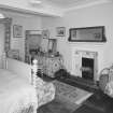
NO 1560 9237 Braemar Castle is an L-plan tower house which was built in 1628 and burnt down in 1689. It remained a ruin until 1748, when it was leased by the Government and used as a garrison with the addition of a star-shaped curtain wall. It was subsequently re-used as a house in the 19th century. Current restoration required the dating and recording of two chimneys built against the inside of the curtain wall. These proved to be part of the 19th-century kitchens built between the castle and the curtain wall. This work was carried out on
26 February 2009.
Report: Aberdeenshire Council SMR and RCAHMS
Funder: Aberdeenshire Council
HK Murray and JC Murray – Murray Archaeological Services Ltd
Field Visit (31 July 2013)
NO 1560 9237 A desk-based assessment and walkover survey were undertaken on 31 July 2103 of the castle environs, as part of a wider landscape survey. The castle was built in 1628 as a strategic stronghold and hunting lodge for John Erskine, the Earl of Mar. It was burnt in 1689 by the neighbouring John Farquharson. Attempts to repair it are recorded in 1689 and in 1715 but the castle may have been partly habitable during this period. In 1715, after the Earl of Mar rose against the crown, the estate was forfeit. It was bought in 1724 by the Earl of Mar’s relatives, Lord Dun and Lord Grange, and in 1732 Braemar Castle was sold to the Farquharsons. In 1748 it was leased to the Crown as a barracks and it was not until 1832 that the Farquharsons made it into a family home.
A good series of detailed 18th-century plans show the structural changes during its military use, and a number of prints and photographs add considerable detail of changes to its grounds in the 19th and early 20th century. All identified landscape features were photographed and recorded and archaeologically sensitive areas were identified.
Archive: RCAHMS (intended). Report: Aberdeenshire Council HER
Funder: Braemar Community Ltd
HK Murray and JC Murray, Murray Archaeological Services Ltd, 2013
(Source: DES)
Field Visit (10 July 2015)
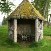
NO 15664 92373 The summerhouse is listed as an ancillary structure within the listing of Braemar Castle, and the listed building description reads ‘round rustic timber summerhouse with conical thatched roof to W’. The timber summerhouse, of unknown date, has a hexagonal heather thatched roof, which has been capped at the apex with lead and a decorative timber finial. The heather itself, whilst intact, is covered in a large amount of mossy vegetation growth across a large percentage of the roof surface. The thatch has been left uncovered and appears to be fixed to the roof using metal pegs and wire. The roof interior of the structure has been covered over with modern timber panelling, and there appears to be a membrane, which looks like felt, directly underneath the heather. Braemar Castle is now a museum and the summerhouse is open to the public for access at all times.
Visited by Zoe Herbert (SPAB) 10 July 2015, survey no.004
Project (10 January 2022 - 11 April 2022)
NO 1560 9237 A metal-detecting survey, standing building survey
and a watching brief over groundbreaking works were carried out during a programme of building works including reharling, drainage and other external works. Coins and a small number of finds were recovered during the metal-detecting and trench excavations. A complete building survey was carried out after the harling was removed and number of windows and gun slits were recorded.
Information from M. Simon and A. Cameron – Cameron Archaeology, 2022.
(Source DES Volume 23)
OASIS ID: camerona1-529298
Standing Building Recording (10 January 2022 - 11 April 2022)
NO 15600 92370 A complete building survey was carried out after the harling was removed and number of windows and gun slits were recorded.
Information from A. Cameron and M. Simon - Cameron Archaeology, 2022.
OASIS ID: camerona1-529298
Metal Detector Survey (January 2022)
A metal detector survey was conducted in the immediate vicinity of the castle in January 2022. The finds were mixed and included modern coins, miscellaneous ferric objects such as nails and more personal items such as decorative pins. Of note were two coins found adjacent to each other; one Charles 1st two pence (Bodle) and one Charles 2nd sixpence (Bawbee).
Information from A. Cameron and M. Simon - Cameron Archaeology, 2022.
OASIS ID: camerona1-529298
Watching Brief (10 January 2022 - 8 February 2022)
NO 15600 92370 Cameron Archaeology carried out a watching brief over groundbreaking works. A small number of finds were recovered during trench excavations. Two areas of pitch floor were encountered. The pitch floor is thought to be 19th century, dating from the period when the area to the N of the castle was enclosed and used as a kitchen. The foundation of a wall aligned N-S which extended from the interior face of the curtain wall to the castle was located. Several apparent pit features were found. Interpretation of these features was difficult; instability of the trench walls meant they could not be examined closely. Some were identified as decayed tree boles and 19th/ 20th century ceramic sherds were visible within others. Two ditches containing numerous finds 19th / 20th century date were also discovered.
Information from A. Cameron and M. Simon - Cameron Archaeology, 2022.
OASIS ID: camerona1-529298


