
Grave Of Diarmid


Four Poster Stone Circle (Bronze Age)
Site Name Grave Of Diarmid
Classification Four Poster Stone Circle (Bronze Age)
Alternative Name(s) Diarmid's Grave
Canmore ID 29594
Site Number NO17SW 1
NGR NO 11718 70174
Datum OSGB36 - NGR
Permalink http://canmore.org.uk/site/29594


- Council Perth And Kinross
- Parish Kirkmichael (Perth And Kinross)
- Former Region Tayside
- Former District Perth And Kinross
- Former County Perthshire
NO17SW 1 1171 7017.
(NO 1167 7020) Stone Circle {NR}
OS 6" map, Perthshire, 2nd ed. (1900)
A mound surmounted by four upright stones is the reputed grave of Diarmid. It was excavated in 1894 and proved to be simply an isolated remnant of glacial detritus. The four stones are natural boulders taken from the adjacent hillside. They vary from 1ft. 2ins. to 2ft. 3ins. in height and from 6ft. to 7ft. 6ins. in circumference.
W M Smith 1895
Field Visit (18 July 1968)
NO 1171 7017. The four stones are embedded in the top of this natural mound. No reason for the setting can be established: there is no evidence that they form an antiquity.
Visited by OS (RD) 18 July 1968
Field Visit (October 1986)
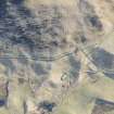
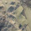
The remains of this four-poster, which commands extensive views of Glenshee, are situated on the top of a glacial moraine 550m ESE of Old Spittal farmhouse.
In 1894 the natural mound on which the stones are placed was excavated to a depth of 6.71m, and it is unclear if the stones are now in their original positions. The stones lie at the corners of a trapezium, with the two largest at the W end of the long axis; their heights are: A-0.75m, B-0.7m, C-0.3m, D-0.8m. No finds or structural features were recorded during the excavation, and the slight mound at the centre of the stones marks the site of the excavation.
Visited by RCAHMS (JBS) October 1986.
RCAHMS 1990
Measured Survey (7 October 1986)
RCAHMS surveyed the stone circle at Grave of Diarmid by alidade and plane-table on 7 October 1986 at a scale of 1:125. The resultant plan was redrawn in ink and published at a scale of 1:250 (RCAHMS 1990, Fig. 75B).

