Ranageig
Cairn (Early Prehistoric)
Site Name Ranageig
Classification Cairn (Early Prehistoric)
Alternative Name(s) Ranageig 1
Canmore ID 28794
Site Number NO14NW 13
NGR NO 11335 49133
Datum OSGB36 - NGR
Permalink http://canmore.org.uk/site/28794
- Council Perth And Kinross
- Parish Blairgowrie
- Former Region Tayside
- Former District Perth And Kinross
- Former County Perthshire
Field Visit (18 March 1971)
(NO 1133 4912) Cairn (NR)
OS 6" map, Perthshire, 2nd ed. (1901)
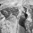
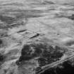
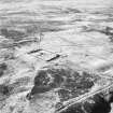
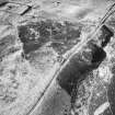
On a slight S-facing slope below the crest of a ridge is a partially turf-covered cairn, destroyed on the N by a track. It measures 18.8m in diameter and 0.8m in height and has a retaining kerb. In the SW quadrant, a cist is exposed measuring 0.9m in length, 0.7m in width, 0.6m in depth and oriented E-W.
Surveyed at 1:10560 scale.
Visited by OS (RD) 18 March 1971
Field Visit (19 February 1975)
The cist, c. 2.0m SW of centre, appears to be at the original ground level and cannot be said to be secondary. The floor is formed by a stone slab. The cap stone (1.4m x 1.0m x 0.2m) lies broken in two on the S edge of the cist.
Visited by OS (AA) 19 February 1975
Measured Survey (15 June 1987)
RCAHMS surveyed the cairn at Ranageig by alidade and plane-table on 15 June 1987 at a scale of 1:125. The resultant plan was redrawn in ink and published at a scale of 1:250 (RCAHMS 1990, Fig. 37.2).
Field Visit (4 March 1987)
NO14NW 13 1133 4913
About 40m SE of cairn NO 14 NW 22 there is a second cairn measuring 18m in diameter over a kerb of at least fifteen large boulders: it is in height from 0.2m at the edge to at least 1m towards the centre and the N side has been clipped by the modern track. At the centre there is a cist which comprises four side-slabs and a floor-slab. The cist probably sits on or just above the original ground level and measures 0.9m from E to W by 0.65m and 0.35m in depth; a broken coping-stone (originally about 1.55m by 1.2m and 0.2m in thickness) lies close to the S edge of the cist.
Visited by RCAHMS (JRS) 4 March 1987.
RCAHMS 1990


