Pricing Change
New pricing for orders of material from this site will come into place shortly. Charges for supply of digital images, digitisation on demand, prints and licensing will be altered.
Burleigh Castle
Tower House (Medieval)
Site Name Burleigh Castle
Classification Tower House (Medieval)
Canmore ID 27879
Site Number NO10SW 1
NGR NO 12890 04597
Datum OSGB36 - NGR
Permalink http://canmore.org.uk/site/27879
- Council Perth And Kinross
- Parish Orwell
- Former Region Tayside
- Former District Perth And Kinross
- Former County Kinross-shire
NO10SW 1 12890 04597
(NO 1289 0459) Burleigh Castle (NR)
(Remains of)
OS 6" map, (1950)
The keep appears to belong to the latter half of the 15th cent.
D MacGibbon and T Ross 1887-92.
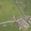
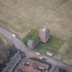
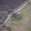
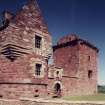
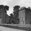
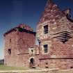
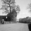
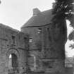
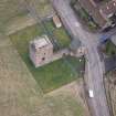
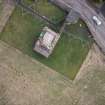
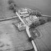
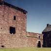
The remains of Burleigh Castle consist of an early 16th century tower, 32ft 2ins by 27ft externally, with one wall and the SW tower of an enclosure wall built in 1582. The SW tower is entire and the north skew-put bears the date 1582 and initials S.I.B. & M.B. - evidently representing Sir James Balfour of Pittendreich, who died in 1583, and his wife Margaret Balfour.
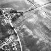
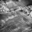
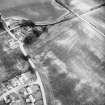
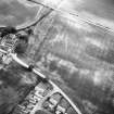
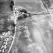
On the west side the lines of a ditch can still be seen.
RCAHMS 1933.
As described above. On the west side of the castle the ditch appears as an irregular turfed-over depression about 25.0m long.
Earthwork surveyed at 1/2500.
Visited by OS (W D J), 19 December 1963.
Field Visit (20 June 1928)
Burleigh CastIe.
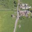
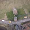
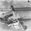
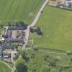
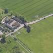
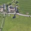
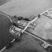
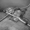
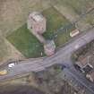
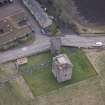
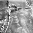
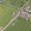
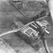
The ruin of Burleigh Castle, the necessary steps to preserve which have recently been taken by H.M. Office of Works, is situated less than half a mile east of Milnathort, on a small plateau rising from low and once marshy ground on the right bank of the Burleigh Burn near Loch Leven. The approach has been from the west, and on that side there has been a ditch, the line of which can still be made out.
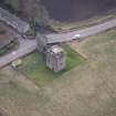
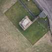
The oldest part of the castle is the tower, which stands at the northern end of the site, and which dates from the early 16th century. Presumably it had a barmkin attached to it. Of this, however, no trace remains. The later enclosure, now represented only by one of its outer walls and by the south-west tower, was built in the last quarter of the 16th century.
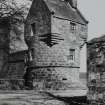
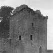
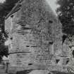
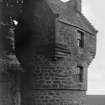
The old tower-is oblong on plan, measuring 32 feet 2 inches by 27 feet externally. It contains four main storeys, and the remains of an attic storey appear above the wall-head. The masonry is of rubble brought to courses. Two of the windows are built with rough relieving arches. In all of them the arrises are chamfered or rebated. There are no gun-holes. The wallhead has finished in a parapet and walk, borne on the existing triple-membered corbel-course, the outer members of which are continuous, while the inner one consists of separate corbels. At three of the angles there have been' rounds,' while the north-eastern angle has been surmounted by the cap-house in which the turnpike finished.
On the east is the entrance, the jambs of which have been repaired, while the head is modern. It opens into a lobby, on the north side of which is the turnpike. The latter has been restored up to the hall or first-floor level, but originally it rose to the cap-house. The ground floor, into which the lobby projects, contains a single cellar, lit from the east and south and vaulted. The hall similarly occupies the whole of the floor above, except the space required for the turnpike. It has a window in-each wall, the southern one being provided with seats, while the one opposite has given access to a small projecting wing, subsequently erected against the north wall of the tower but now demolished. The north-west corner of the room has an angled garderobe with a flue. In the east wall is the fireplace and in the south wall an aumbry. The one chamber on the second floor is lit from east and west, both windows having seats within their embrasures; the fireplace is in the south wall, and there is an angled garderobe in the north-east corner. That on the third floor has a fireplace on the north and a small window beside it, a second window on the east, and an aumbry in the south wall.
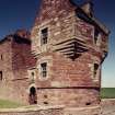
The accommodation and its arrangement, as just described, represent what is usually found in a laird's house of the period. In 1582 an outbuilding or range was built in alignment with the west wall of the tower and ran southwards, forming the western boundary of a courtyard and terminating at the south-western angle in a small tower. This tower is entire. Of the range all that has survived is two storeys of its outer or west wall, but corbels on the inner side of that wall and a raggle for its roof, cut in the south wall of the old tower, are sufficient to indicate that there was a third storey which can only have been a narrow gallery, constructed mainly of timber. The southern side of the courtyard was bounded by a three-storeyed building, which also abutted on the south-west tower. This building was latterly reduced a storey in height and, finally, demolished. The entrance to the courtyard, an archway wrought with a quirked edge-roll and sheltered beneath a hood-mould, is situated in the surviving wall and is surmounted by a space for an armorial panel. On either side of it is a gun-hole, and others are formed in the ground floor of the south-west tower where shown on the plan; the small circular openings formed in the breasts of the upper windows of the south-west tower may also be for defence, but are more likely to have been provided for ventilation and so, strictly to be 'shot-holes' (=shut-holes, shutter-holes). At its lower part the south-west tower is circled but it has a rounded projection at the northern angle containing a turnpike which, in a later arrangement, could be entered directly from the outside, but the doorway is now filled in. The upper part of the south-west tower is developed to a rectangular plan for simplicity in roofing. The gables finish in skew-stones and not in the more usual crowsteps. The north skew-put bears the date 1582 on its upper surface, and on the lower part is a shield accompanied by the initials S.I.B. and M.B., evidently representing Sir James Balfour of Pittendreich, who died in 1583, and his wife Margaret Balfour, heiress of Burleigh. The shield bears: On a chevron an otter's head erased, in base a rose, for Balfour of Burleigh. The rose is a difference for Burleigh and is represented on the south-east skew-put.
The transe which passed beneath the western range and gave access to the enclosure has not been vaulted; the remains of the range are so fragmentary that no details of its arrangement can be given. The south-west tower was originally entered, as at present, from within the enclosure. The entrance opens at the foot of the turnpike. The lowest chamber, which is irregularly shaped and is covered with a vault, is entered through the stair-well. It is provided with a sink and locker, and is lit only from the four gun-holes looking out towards the southeast, south, west, and north - west. The embrasures are fitted for gun-mountings, two of which remain, though greatly decayed. The stair now rises to the first floor only, where the chamber is pentagonal in shape and has a late fireplace on the east with a locker on each side of it; in the back of the southern locker is a gun-hole. There are windows to south and west with 'shot-holes' in their breasts, and on the north-west is a close garderobe. Near the west window is another locker. The chamber on the second floor is very similar, and the windows have 'shot-holes' in their breasts. On its two upper floors this tower has communicated with the contemporary range which formerly enclosed the courtyard on its southern side.
RCAHMS 1933, visited 20 June 1928.
Publication Account (1987)
Burleigh Castle presents a series of interesting elements which in themselves are unusual and which, when considered as a group, are not satisfactorily explained. The oldest part of the castle is the tower at the northern end of the site. This dates from the early 16th century. It has a simple rectangular plan rising to four storeys and an attic. In 1582, a second range was built, in alignment with the west wall of the original tower, running southwards to form the western boundary of a courtyard layout This range terminates in a small tower at the south-west angle of the courtyard. This small tower is complete but the rest of the extension including a south range has all but disappeared leaving only the west wall of the west range. These demolished buildings hold the key to the domestic arrangements of the entire building. The remaining evidence is slight and can only give an indication of the size of these buildings. The raggle in the south wall of the original tower suggests that the west range was of three storeys and the surviving two storey west wall, with no evidence of tusking for the third storey, suggests that the upper storey was constructed of timber. The south range is also known to have been three storeys, but was reduced in height prior to its final demolition. The south-west tower appears to have been entered from within the angle of the south and west ranges.
Information from ‘Exploring Scotland’s Heritage: Fife and Tayside’, (1987).
Watching Brief (7 September 2010 - 15 September 2010)
NO 1291 0459 and NO 1287 0458 A watching brief was maintained 7–15 September 2010 during the excavation of small trenches to allow the installation of new gates in the wall to the SW of the castle (NO 1287 0458) and in the fence to the E (NO 1291 0459). The excavations indicated that both areas had been subject to alteration, but that in situ deposits might exist below the landscaping layers. It was therefore recommended that any future groundbreaking works should be monitored.
Archive: RCAHMS (intended)
Funder: Historic Scotland
OASIS ID: kirkdale1-249878
Watching Brief (29 September 2011)
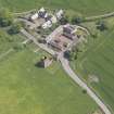
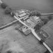
NO 1288 0458 A watching brief was maintained on 29 September 2011 during the excavation of a single trench for the footings of a new interpretation board. The excavation revealed ‘fill’ deposits over earlier ground surfaces. As the threshold of the main gateway is at the current ground level, this means that there may have been sloping ground (a ditch) within 5m of the main façade of the late 16th-century castle. The presence of the ‘fill’ deposits suggests that the ditch was more prominent in the relatively recent past, i.e. until the ground was levelled, perhaps during the late 19th century/early 20th century. This landscaping activity may be contemporary with the development of the neighbouring 19th-century steading. The reduced castle sits in conjunction with a series of carefully planned buildings, the cottages and outbuildings located on either side of the present A911 road. The ditch appears to have followed a wide and curving alignment, which cuts across the S end of the castle façade, suggesting it relates to an earlier period of fortification (mid-16th century or earlier).
Archive: RCAHMS (intended)
Funder: Historic Scotland
Kirkdale Archaeology, 2011
Information also reported in Oasis (kirkdale1-122351) 10 April 2012
Field Visit (22 March 2023)
NO 12892 04599 The ruin of Burleigh Castle keep dates from the latter half of the 15th century with substantial additions in the 16th century. A stone inscription dates the SW tower to 1582 and it was the ancestral seat of the Balfour family.
Information from D Bowler - Alder Archaeology Ltd.
OASIS ID: alderarc1-518134


