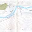
Tonnagaoithe
Farmstead (Post Medieval)(Possible), Hut(S) (Post Medieval)
Site Name Tonnagaoithe
Classification Farmstead (Post Medieval)(Possible), Hut(S) (Post Medieval)
Alternative Name(s) Mar Lodge Estate; Tomnagaoithe; Glen Dee
Canmore ID 27754
Site Number NO08NW 7.01
NGR NO 0255 8866
NGR Description Centred NO 0255 8866
Datum OSGB36 - NGR
Permalink http://canmore.org.uk/site/27754
- Council Aberdeenshire
- Parish Crathie And Braemar
- Former Region Grampian
- Former District Kincardine And Deeside
- Former County Aberdeenshire
NO08NW 7.01 centred 0255 8866
Previously entered as NO08NW 8.
Longhouse 8m by 5m due east of head-dyke on moorland, and another 10m by 5m, just outside dyke, both beside the modern track.
J A Smith 1987
Observation (1987)
Longhouse 8m by 5m due east of head-dyke on moorland, and another 10m by 5m, just outside dyke, both beside the modern track.
J A Smith 1987
Field Visit (21 July 1993)
There are three huts situated to either side of the track along the N bank of the River Dee, about 680m ENE of White Bridge and some 600m SW of the township of Tonnagaoithe (NO08NW 7.00). One hut (MAR93 378) lies to the S of the track and is overlain by the ruinous drystone wall which is depicted on the 1st edition of the OS map (Aberdeenshire 1869, Sheet xcvii). The other huts (MAR93 379-80) lie along a low heather-covered ridge created by the migration of the river and to either side of the drystone wall; the larger hut (MAR93 379) measures 8.5m by 2.4m within faced-rubble footings up to 0.8m in thickness and 0.4m in height.
(MAR93 378-80)
Visited by RCAHMS (DCC) 21 July 1993
Field Visit (10 October 1996)
Re-examination of this site lead to the recognition that there is a long building, aligned roughly E-W, to the N of the track (NO 0255 8866), the S side of which has been truncated by the construction of the track. This unrecorded building, in combination with the previously recorded hut (MAR93 378) to the S of the track, forms the nucleus of what may be a farmstead, comprising two buildings at right angles to one-another. The head-dyke, which stops short of the long building on the N and overlies the smaller building on the S, post-dates the farmstead. The additional building has rounded corners and measures 10.5m in length by at least 4m in breadth over faced-rubble walls, 0.9m thick and about 0.35m high.
(MAR93 378, 631)
Visited by RCAHMS (PJD) 10 October 1996


