RCAHMS Afforestable Land Survey, Mar Lodge Estate
Date 1993
Event ID 622929
Category Project
Type Project
Permalink http://canmore.org.uk/event/622929
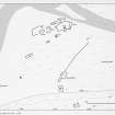
Before fieldwork began, the size of the Mar Lodge estate (33,000ha) seemed to preclude its completion in a single season of survey, particularly as the future management of the archaeological remains, in the face of natural woodland regeneration programmes, necessitated a high level of recording. To meet this requirement it was decided that, although the Ordnance Survey basic scale maps for most of the area were at a scale of 1:10,000, all archaeological features should be mapped, including rig cultivation, at the level normally reserved for 1:2500 scale recording. In consequence, it was intended that a central block of eight 1:10,000 mapsheets, which comprised the core of the settled areas, should be surveyed in the 1993 season, leaving open the option of returning to complete the remainder of the estate in another year. However, the first week's reconnaissance indicated that beyond this core area there were few sites to be recovered, and it was decided to complete the whole estate in a single season.
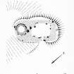
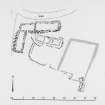
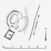
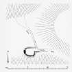
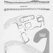
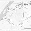
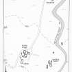
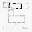
All structures were recorded on to a database following standard RCAHMS practice (RCAHMS 1994); these were then cross-referenced to an overlay of the 1:10,000 map by means of a number tag. The overlay was created using AUTOCAD, with colour coding of the different types of feature. The grid references of individual structures were also calculated on AUTOCAD and transferred to the survey database (MAR93) by merging the file of grid references created on AUTOCAD with the database on DBASEIV, thus removing any possibility of typographical error. A hard copy of the ALS database is deposited, along with the field-map overlay, in the NMRS, providing the basic survey data, to which the entries in the NMRS ORACLE database refer. Some 608 structures were located, mapped and recorded, and sixteen 1:10,000 overlays were created to depict them and other associated features. Eight sites were planned in greater detail and all are published in this volume. Geographical analysis of the distribution of sites was carried out using GENAMAP, a geographical information system (GIS).
RCAHMS 1995


