 |
On-line Digital Images |
SC 1029397 |
RCAHMS Aerial Photography |
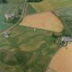
Oblique aerial view centred on the cropmarks of the possible pit-defined enclosure, pits, linear cropmarks and promontory fort with church, mausoleum and cemetery adjacent, taken from the WSW. |
17/7/2000 |
Item Level |
|
 |
On-line Digital Images |
DP 163950 |
RCAHMS Aerial Photography Digital |
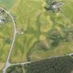
Oblique aerial view of the cropmarks of the fort, linear feature, enclosure, and pits at Gilchrist, looking SE. |
17/7/2013 |
Item Level |
|
 |
On-line Digital Images |
DP 163951 |
RCAHMS Aerial Photography Digital |
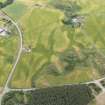
Oblique aerial view of the cropmark fort, linear feature, enclosure, and pits at Gilchrist, looking SE. |
17/7/2013 |
Item Level |
|
 |
On-line Digital Images |
DP 163952 |
RCAHMS Aerial Photography Digital |
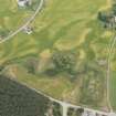
Oblique aerial view of the cropmarks of the fort, linear feature, enclosure, and pits at Gilchrist, looking E. |
17/7/2013 |
Item Level |
|
 |
On-line Digital Images |
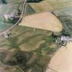
SC 1695224 |
RCAHMS Aerial Photography |
Oblique aerial view centred on the cropmarks of the possible pit-defined enclosure, pits, linear cropmarks and promontory fort with church, mausoleum and cemetery adjacent, taken from the WSW. |
17/7/2000 |
Item Level |
|
 |
On-line Digital Images |
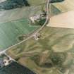
SC 1695225 |
RCAHMS Aerial Photography |
Oblique aerial view centred on the cropmarks of the possible pit-defined enclosure, pits, linear cropmarks and promontory fort, taken from the W. |
17/7/2000 |
Item Level |
|
 |
On-line Digital Images |
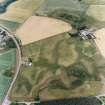
SC 1695226 |
RCAHMS Aerial Photography |
Oblique aerial view centred on the cropmarks of the possible pit-defined enclosure, pits, linear cropmarks and promontory fort with church, mausoleum and cemetery adjacent, taken from the WNW. |
17/7/2000 |
Item Level |
|
 |
On-line Digital Images |
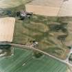
SC 1695227 |
RCAHMS Aerial Photography |
Oblique aerial view centred on the cropmarks of the possible pit-defined enclosure, pits, linear cropmarks and promontory fort with church, mausoleum and cemetery adjacent, taken from the N. |
17/7/2000 |
Item Level |
|
 |
On-line Digital Images |
SC 1695228 |
RCAHMS Aerial Photography |
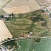
Oblique aerial view centred on the cropmarks of the possible pit-defined enclosure, pits, linear cropmarks and promontory fort with church, mausoleum and cemetery adjacent, taken from the NE. |
17/7/2000 |
Item Level |
|
 |
On-line Digital Images |
SC 1695229 |
RCAHMS Aerial Photography |
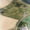
Oblique aerial view centred on the cropmarks of the possible pit-defined enclosure, pits, linear cropmarks and promontory fort with church, mausoleum and cemetery adjacent, taken from the ENE. |
17/7/2000 |
Item Level |
|
 |
On-line Digital Images |
SC 1695243 |
RCAHMS Aerial Photography |
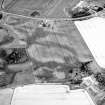
Oblique aerial view centred on the cropmarks of the possible pit-defined enclosure, pits, linear cropmarks and promontory fort with church, mausoleum and cemetery adjacent, taken from the SSW. |
17/7/2000 |
Item Level |
|
 |
On-line Digital Images |
SC 1695244 |
RCAHMS Aerial Photography |
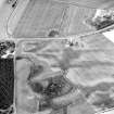
Oblique aerial view centred on the cropmarks of the possible pit-defined enclosure, pits, linear cropmarks and promontory fort, taken from the SW. |
17/7/2000 |
Item Level |
|
 |
On-line Digital Images |
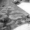
SC 1695245 |
RCAHMS Aerial Photography |
Oblique aerial view centred on the cropmarks of the possible pit-defined enclosure, pits, linear cropmarks and promontory fort with church, mausoleum and cemetery adjacent, taken from the SW. |
17/7/2000 |
Item Level |
|
 |
On-line Digital Images |
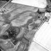
SC 1695246 |
RCAHMS Aerial Photography |
Oblique aerial view centred on the cropmarks of the possible pit-defined enclosure, pits, linear cropmarks and promontory fort with church, mausoleum and cemetery adjacent, taken from the W. |
17/7/2000 |
Item Level |
|
 |
On-line Digital Images |
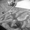
SC 1695247 |
RCAHMS Aerial Photography |
Oblique aerial view centred on the cropmarks of the possible pit-defined enclosure, pits, linear cropmarks and promontory fort, taken from the WSW. |
17/7/2000 |
Item Level |
|
 |
On-line Digital Images |
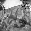
SC 1695248 |
RCAHMS Aerial Photography |
Oblique aerial view centred on the cropmarks of the possible pit-defined enclosure, pits, linear cropmarks and promontory fort with church, mausoleum and cemetery adjacent, taken from the WNW. |
17/7/2000 |
Item Level |
|
 |
On-line Digital Images |
SC 1695249 |
RCAHMS Aerial Photography |
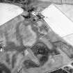
Oblique aerial view centred on the cropmarks of the possible pit-defined enclosure, pits, linear cropmarks and promontory fort with church, mausoleum and cemetery adjacent, taken from the NW. |
17/7/2000 |
Item Level |
|
 |
On-line Digital Images |
SC 1695250 |
RCAHMS Aerial Photography |
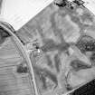
Oblique aerial view centred on the cropmarks of the possible pit-defined enclosure, pits, linear cropmarks and promontory fort with church, mausoleum and cemetery adjacent, taken from the NW. |
17/7/2000 |
Item Level |
|
 |
On-line Digital Images |
SC 1903112 |
Papers of James Sloan Bone, landscape historian, Inverness, Highland, Scotland |
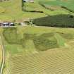
Aerial view of Gilchrist, Muir of Ord, Easter Ross, looking NE. |
1999 |
Item Level |
|
 |
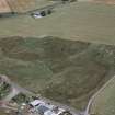
On-line Digital Images |
SC 1903113 |
Papers of James Sloan Bone, landscape historian, Inverness, Highland, Scotland |
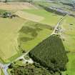
Aerial view of Gilchrist, Muir of Ord, Easter Ross, looking SE. |
1999 |
Item Level |
|
 |
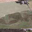
On-line Digital Images |
SC 1944618 |
Papers of James Sloan Bone, landscape historian, Inverness, Highland, Scotland |
Aerial view of Gilchrist Promontory Fort, E of Muir of Ord, Easter Ross, looking N. |
5/8/1999 |
Item Level |
|
 |
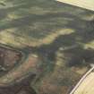
On-line Digital Images |
SC 1944619 |
Papers of James Sloan Bone, landscape historian, Inverness, Highland, Scotland |
Aerial view of fields W of Gilchrist, Muir of Ord, Easter Ross, looking N. |
5/8/1999 |
Item Level |
|
 |
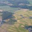
On-line Digital Images |
SC 1945133 |
Papers of James Sloan Bone, landscape historian, Inverness, Highland, Scotland |
Aerial view of Gilchrist , Muir of Ord, Easter Ross, looking W. |
17/7/2000 |
Item Level |
|
 |
On-line Digital Images |
DP 343062 |
Papers of James Sloan Bone, landscape historian, Inverness, Highland, Scotland |
Aerial view of Balvattie/Gilchrist, Tarradale cropmark features, Muir of Ord, Black Isle, looking NNW. |
19/7/2013 |
Item Level |
|