The Drums
Corn Drying Kiln (Post Medieval), Farmstead (Post Medieval)
Site Name The Drums
Classification Corn Drying Kiln (Post Medieval), Farmstead (Post Medieval)
Alternative Name(s) Rochtaughs; Rochteth; Rochpath; Rochtaith; Roughteth; Rochteath; Rochtaith; Roughtaith
Canmore ID 254406
Site Number NO36NE 30
NGR NO 35884 69012
Datum OSGB36 - NGR
Permalink http://canmore.org.uk/site/254406
- Council Angus
- Parish Cortachy And Clova
- Former Region Tayside
- Former District Angus
- Former County Angus
Field Visit (24 February 1999)
NO36NE 30 35884 69012
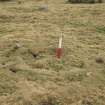
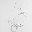
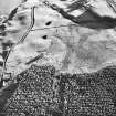
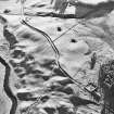
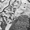
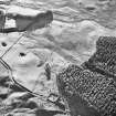
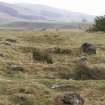
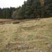
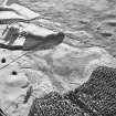
This farmstead, which comprises buildings ranged around three sides of a large yard open to the NW, together with two other buildings and a hut, is situated in rough pasture about 100m SW of The Drums. The range (CLOVA99 224) on the NE side of the yard measures 32.5m from NW to SE by 3.9m transversely within low rubble walls. It has four compartments, each with at least one entrance on the SW, and there is an outshot at the SE end. An enclosure attached to the SE end of the NE side of the building has been subdivided into three. On the SE side of the yard is a building (CLOVA99 225) that measures 10.9m from NE to SW 3.6m transversely within rubble walls no more than 0.3m in height. It has opposed entrances in the side walls and it overlies the remains of an earlier building, which extends some 8m to the SW. The range (CLOVA99 226) on the SW side of the yard measures 25.8m from NW to SE by 2.9m transversely within rubble walls no more than 0.5m in height. It has five compartments, of which the second from the NW end may have been a cart shed. Each of the other compartments has an entrance on the WSW. There is a hut (CLOVA99 229) in the S corner of the yard, 6m N of a possible midden.
The remaining two buildings (CLOVA99 227, 228), each with an attached yard, lie to the WSW and measure respectively 9.8m and 8m in length by 1.9m and 2.9m in breadth internally. The former has been subdivided into two compartments.
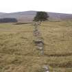
To the SW of this township there is a sheepfold attached to a long linear field boundary, which runs SW for some 475m towards a more dispersed group of buildings and cultivated ground (see NO36NE 31).
Three buildings are depicted here as roofed and named 'Rochtaughs' on the 1st edition of the OS 6-inch map (Forfarshire 1865, sheet xvii). (CLOVA99 224-229)
Visited by RCAHMS (SDB) 24 February 1999.
Measured Survey (June 2007 - September 2009)
The Glen Clova SRP survey group was formed during summer 2007 and created a measured survey of the site during 2007 and 2008. Significant historical research was also undertaken by Flora Davidson, local historian and genealogist, and a summary of this work is contained in the Rochtaith/Rochteth timeline.
Srp Note (5 November 2009)
The site is as described by RCAHMS in 1999. The following additional points were noted:
The NE range (CLOVA99 224) has a stone terrace along the façade of the SE compartment. Inside this compartment is a later pen. The outshot at the SE end contains a similar pen.
Between the NE range and the SE building runs a narrow passage to the former.
S of the SE building (CLOVA99 225) lies a yard. Its S dyke breaks the line of the linear field dyke.
Between the SE building and the SW range (CLOVA99 226) is a filled-in corn drying kiln, 2.5m in diameter.
A ditch runs along the uphill side of the SW range.
A breached dyke has linked CLOVA99 227 and CLOVA99 228.
From census records it appears that Rochteth no longer functioned as a farm by 1841. The last inhabitant died in May 1861 and Rochteth is missing from the 1871 census. The Ordnance Survey Namebook, compiled for the First Edition Ordnance Survey map in 1862, describes Rochtaughs as ‘a strip of rough ground’ by that date.
It may have been an offshoot of the flourishing adjacent farm of Fettereggie (now called Kilburn. The first written record was in the 1643 list of fencible men (i.e. men fit for military service, National Archives of Scotland GD16/50/17/4). From 1698 until at least the 1851 census it was occupied mainly by a Lindsay family which had close social relations with the Lindsay tenants of Fettereggie until the last Fettereggie Lindsay died in 1787.
In 1818 Fettereggie took over Rochteth’s extensive grazing land, leaving the last two generations of Lindsays in possession of the buildings, some of which may have already been derelict. From then on, a couple of elderly women were engaged in handloom weaving while the Lindsay family’s Ogilvy descendants worked for Fettereggie, the son as shepherd, the daughter and their aunt as agricultural labourers.
Information from SRP Glen Clova, September 2009


