
Strageath


Field System (Period Unknown), Pit(S) (Period Unknown)
Site Name Strageath
Classification Field System (Period Unknown), Pit(S) (Period Unknown)
Alternative Name(s) Strageath Mains
Canmore ID 25317
Site Number NN81NE 38
NGR NN 8949 1792
Datum OSGB36 - NGR
Permalink http://canmore.org.uk/site/25317


- Council Perth And Kinross
- Parish Muthill
- Former Region Tayside
- Former District Perth And Kinross
- Former County Perthshire
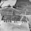
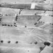
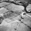
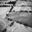
Aerial Photographic Transcription (23 December 1996 - 17 January 1997)
An aerial transcription was produced from oblique aerial photographs. Information from Historic Environment Scotland (BM) 31 March 2017.
Field Visit (26 March 1997)
NN81NE 38 8949 1792
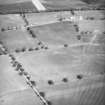
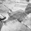
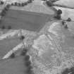
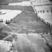
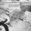
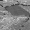
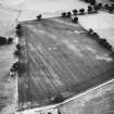
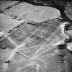
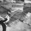
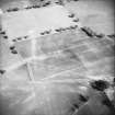
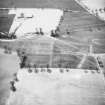
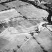
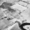
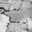
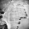
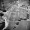
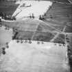
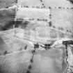
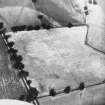
Cropmarks on oblique aerial photographs (CUCAP 1979, RCAHMSAP 1983, 1986 and 1992) reveal the presence of a field-system on the relatively flat ground to the WSW of the Roman fort (NN81NE 2). The field-system comprises a series of ditch defined rectangular plots, that range from 25m by 15m to 35m by 20m. The plots are disposed on either side of an old stream course, lying predominately to the N, and their major axis is from ESE to WNW. A scatter of pits along the N side of the field-system may be tree-throws.
Visited by RCAHMS (DCC) 26 March 1997
Management (3 July 2000)
Scheduled (with NN81NE 2.00 and 2.01) as Strageath Mains, Roman fort, annexe and field system.
Information from Historic Scotland, scheduling document dated 3 July 2000.

