
Following the launch of trove.scot in February 2025 we are now planning the retiral of some of our webservices. Canmore will be switched off on 24th June 2025. Information about the closure can be found on the HES website: Retiral of HES web services | Historic Environment Scotland
St Fillian's Chair


Cairn (Period Unassigned)(Possible), Natural Feature (Period Unknown), Well (Period Unassigned)
Site Name St Fillian's Chair
Classification Cairn (Period Unassigned)(Possible), Natural Feature (Period Unknown), Well (Period Unassigned)
Alternative Name(s) Strathearne
Canmore ID 24876
Site Number NN72SW 6
NGR NN 708 232
NGR Description NN c. 708 232
Datum OSGB36 - NGR
Permalink http://canmore.org.uk/site/24876


- Council Perth And Kinross
- Parish Comrie (Perth And Kinross)
- Former Region Tayside
- Former District Perth And Kinross
- Former County Perthshire
NN72SW 6 c. 708 232
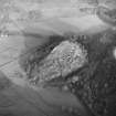
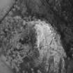
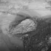
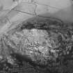
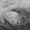
The spring of St Fillan, at the W end of Strathearne is at the foot of a rock, a quarter of a mile south of Dun-Fhaolain (St Fillan's Hill - NN 7023). It is still visited by invalids especially on 1st May and the 1st August. A white stone is thrown on the saint's cairn and rags are left. A rock on the summit of the hill formed a chair for saint. At the foot of the hill there is a basin made by the saint, on the top of a large stone.
OSA 1794.
Tradition reports that the spring at NN 7081 2326, on top of St Fillan's Hill, is the original St Fillan's Well, but, (probably at the Reformation) a spring at the foot of a rock a quarter of a mile to the south adopted the name (Anon 1896).
The well on the top of the hill is still evident and is a rock basin. The spring at the foot of the hill was situated at NN 7084 2313, (Mr P Kay, Mid Square, Dalginross, Comrie) at the edge of a stream which has now washed it away. Near this spot a large rock, on and around which several small white stones have been thrown, as if to form a cairn, can still be seen. St Fillan's Chair is at NN 7083 2325.
The basin at the foot of the hill could not be found.
Visited by OS (RD), 1 December 1966.
No change to the previous information. The hilltop well was dry; there are still a number of small white stones on two large boulders at NN 7084 2313, but no evidence of a cairn.
Surveyed at 1:2500.
Visited by OS (MJF), 29 August 1980.
Measured Survey (11 May 1988 - 13 May 1988)
RCAHMS surveyed the fort and cultivation terraces at Dundurn on 11-13 May 1988 at a scale of 1:500, using a Wild self-reducing alidade and plane-table. The survey comprised five individual plan drawings (DC11840-11844), brought together as a master plan (DC 11839). This plan was redrawn in ink (DC11845) and published at a reduced scale in 1995 (Walker and Ritchie 1995, p.164). Detailed (1:10) drawings of the rock cut slots were also produced.

