Dundurn
Fort (Early Medieval)
Site Name Dundurn
Classification Fort (Early Medieval)
Alternative Name(s) St Fillans Hill; Doundarn
Canmore ID 24873
Site Number NN72SW 3
NGR NN 70819 23257
Datum OSGB36 - NGR
Permalink http://canmore.org.uk/site/24873
- Council Perth And Kinross
- Parish Comrie (Perth And Kinross)
- Former Region Tayside
- Former District Perth And Kinross
- Former County Perthshire
NN72SW 3 7080 2327
(NN 7080 2327) Dundurn (NR)
OS 1:10000 map (1978).
For cultivation terraces around NN 7068 2326, see NN72SW 9.
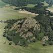
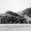
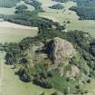
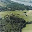
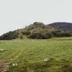
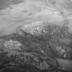
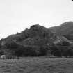
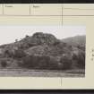
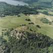
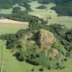
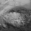
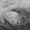
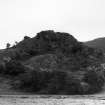
Dundurn fort occupies an isolated rocky knoll and consists of a series of ruined walls which form defended compounds and courtyards all over the flanks of the knoll, the uppermost measuring about 70ft in diameter, while the total area covered is 325 yds by 180 yds. (See plan of Dalmahoy fort, NT16NW 2). This fort is presumed to be the place mentioned in the Annals of Ulster as being under siege in 683, and to have been a principal Pictish stronghold; it may have originated in the Iron Age.
D Christison 1900; R B K Stevenson 1951; R W Feachem 1963.
This fort is generally as described. The outlines of four small, circular depressions (? hut circles) are visible on the upper reaches of the fort, on the NE and SE sides.
Surveyed at 1:2500 scale.
Visited by OS (EGC) 7 December 1966
Limited excavations were undertaken in 1976 by the Dept of Archaeology, Glasgow University to establish the date and origin of Dundurn. At least two periods were recognised in the fortifications of the citadel and the uppermost terraces. The defences, revealed by the tumbled stone of their walls, are in the form of a citadel-like boss of rock surrounded by enclosures on two levels. No wall faces could be detected in the tumble. Excavation was carried out in two areas:
1. (NN 7081 2324) on the S slope of the summit and on part of the summit area. The latter had been levelled in two phases but no structures were detected in the excavated area. On the slope there was evidence for an approximately 4.0 m wide rubble and timber-laced rampart. This rampart overlay a layer of burnt stone and charcoal which probably represented an earlier timber-laced rampart. From the evidence gained, an oval citadel may be inferred, measuring 20.0m by 15.0m internally, defended by a rubble wall 4.0m thick laced with nailed timbers.
2. (NN 7080 2325) One cut was placed where a supposed hut circle appeared to butt against the western rampart of the upper terrace enclosure but no trace of a house was revealed. A second cut was sited on fairly level ground at the eastern end of the upper terrace (NN 7086 2327) where nettles and black soil suggested human occupation; an extensive pit found here yielded only charcoal and burnt bone.
Datable finds, among them a glass ornament and a silver strap fastener, were few, but they point to an Early Historic - probably 7th century - Pictish occupation. Carbon-14 dates are awaited.
L Alcock 1976
'The nails from Dundurn resemple those from...Inchtuthil so closely as to suggest that their ultimate source was some long-abandoned Roman Fort'.
L Alcock 1979
No change to the previous information. The excavated areas are still traceable on the ground.
Surveyed at 1:2500.
Visited by OS (MJF) 10 September 1980.
Publication Account (1987)
The isolated and craggy hill of Dundurn commands extensive views to east and west along Strathearn and was an ideal choice of location for a Dark Age stronghold. Strathearn was the major route between Scottish Dalriada and southern Pictland, and it is likely that Dundurn was a Pictish fort deliberately situated in the borderland between the two. It is mentioned in the monastic annal compiled on Iona as having been under siege, 'obsessio Duin Duirn', in AD 683, although the annalist unfortunately saw no need to identify either the besiegers or the besieged. Excavations in the 1970s confirmed that the site had been occupied in the 7th century, probably in the form of a small wooden fortification on the summit of the hill; this was subsequently rebuilt in stone and a series of outer walls were built to enclose the terraces below. After the union of the Picts and Scots, Dundurn seems to have lost its strategic importance and the fort was finally abandoned sometime in the 10th or 11th century.
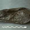
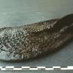
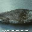
The visible walls take maximum advantage of the natural shape of the hill, with an oval citadel on the summit and four lower enclosures following the rocky terraces. At the west end of the hill, a series of less obvious earthen banks and scarps represent stock enclosures and cultivation terraces, which may be contemporary with the fort, but their date is uncertain and they could equally well belong to more recent times. The overall design of the fort is very similar to that of the contemporary Scottic stronghold at Dunadd in Argyll, and, like Dunadd, the objects found at Dundurn are of a high quality that confirms the importance of the site. They include an elaborately decorated leather shoe (luckily preserved by waterlogged conditions), a silver-plated bronze strap-end and a superb glass boss made of dark green and white glass swirled together and further decorated by blue and white spirals.
Information from ‘Exploring Scotland’s Heritage: Fife and Tayside’, (1987).
Measured Survey (11 May 1988 - 13 May 1988)
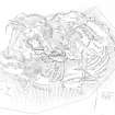
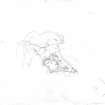
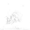
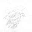
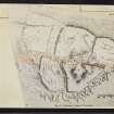
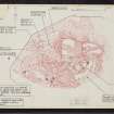
RCAHMS surveyed the fort and cultivation terraces at Dundurn on 11-13 May 1988 at a scale of 1:500, using a Wild self-reducing alidade and plane-table. The survey comprised five individual plan drawings (DC11840-11844), brought together as a master plan (DC 11839). This plan was redrawn in ink (DC11845) and published at a reduced scale in 1995 (Walker and Ritchie 1995, p.164). Detailed (1:10) drawings of the rock cut slots were also produced.
Note (8 December 2014 - 25 October 2016)
This early medieval fortification occupies the rocky hill rising out of the floor of Strath Earn on the S side of the river some 1.5km downstream from its debouchment from Loch Earn. The principle components of the fortifications are: a dun-like enclosure occupying the very summit of the hill; a wall following the line of the shoulder on the E, S and W to form a roughly triangular enclosure on the uppermost terrace of the hill; and a series of walls taking in lower terraces, including one on the SW and at least two on the N, with possibly a fourth on the NE. In addition a deeply hollowed trackway climbs the flank of the hill on the NW, where an earthwork comprising a bank and external ditch mounts the slope to cross over several terraces on the W, but also a flight of cultivation terraces; while the trackway may well be associated with the fortifications, there is no evidence to indicate that the rest of these features are associated with the early medieval occupation on the summit, though the earthwork is a substantial feature and has been shown by excavation to have been built in two phases. The dun-like enclosure on the summit measures no more than 25m from E to W by 20m transversely (0.04ha) within a grass-grown band of rubble. The triangular enclosure on the uppermost terrace takes in a much bigger area measuring a maximum of 85m from E to W by 50m transversely (0.4ha), while the walls taking in the lower terraces extend the overall area that has been enclosed to at least 2ha, albeit that large areas of this are steep and inhospitable slopes. No facing stones can be observed in the debris from these walls, but in each case they have collapsed into a massive scree of rubble, itself an indication of their original scale. The lowest of these enclosures on the NE flank of the hill is too far removed topographically from the core of the fortification to be included in the calculation of its overall extent, which also omits the earthwork on the NW. The hollow way on the NW leads up towards a gap in the wall at the NW of the lower terrace on the N flank, but there is no clearly-defined route to the summit; the excavators suggested there may once have been a built stairway on the S flank of the summit enclosure.
Excavations by Leslie Alcock in 1976-7 (Alcock, Alcock and Driscoll 1989) evaluated the perimeters of the dun-like enclosure on the summit and the uppermost terrace enclosure, radiocarbon dates and artefacts demonstrating unequivocally that the upper fortifications are early medieval in date. The sequence of construction postulated by Alcock was initiated by a hypothetical palisade in the late 6th-early 7th century, inferred from the build up of midden deposits on the slope and the presence of structural timbers recovered from an overlying wattle floor. Thereafter, a timber and stone wall was built as the first phase in the erection of the dun-like enclosure in the 7th-9th centuries; notable features in this wall, which had been burnt, were that the outer face was apparently founded on horizontal timbers set in rock-cut grooves and ledges, and that nails had been used to pin together some of the lesser wooden members. Subsequently this wall was rebuilt, and though possible beam channels were identified in the rubble core, no nails were employed. Thought to be contemporary with this reconstruction, a massive wall up to 8m thick, and originally with an external face at least 4m high, was erected around the lip of the uppermost terrace; in a subsequent phase this wall was reinforced. It is assumed that the enclosure of the lower terraces is also associated with the stone fortification of the uppermost terrace. With the exception of a natural basin known as St Fillan's Well on the W of the uppermost terrace, the interior is featureless; the basin was sectioned during the excavations, and while it collects rain water, there is no evidence for its use in antiquity.
Information from An Atlas of Hillforts of Great Britain and Ireland – 25 October 2016. Atlas of Hillforts SC2625
External Reference (14 September 2015)
This is referred to on the Pont map as "Doundarn an ancient fort" (Pont 21 (2)).
Information submitted to RCAHMS (SIH) via email by a member of the public, 14 September 2015.


