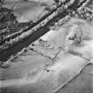
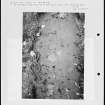
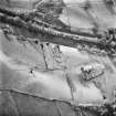
Kilmadock, St Aedh's Church
Burial Ground (Medieval), Church (Medieval)
Site Name Kilmadock, St Aedh's Church
Classification Burial Ground (Medieval), Church (Medieval)
Alternative Name(s) Kilmadock Old Parish Church; Kilmadock Church; Kylmadoc
Canmore ID 24741
Site Number NN70SW 12
NGR NN 70664 02479
Datum OSGB36 - NGR
Permalink http://canmore.org.uk/site/24741
- Council Stirling
- Parish Kilmadock
- Former Region Central
- Former District Stirling
- Former County Perthshire
NN70SW 12 70664 02479
(NN 7066 0247) Kilmadock Church (NR).
OS 6" map, (1958).
NN70SW 59 70704 02383 Manse
The parish church, dedicated to St Aedh, stood at Kilmadock until about 1756, when a new church was built at Doune. It belonged to the Priory of Inchmahome. A small part, chiefly the east gable, remained in 1845.
Statistical Account (OSA) 1798; New Statisitcal Account (NSA) 1845; Fasti Eccles Scot (H Scott ed.) 1923.
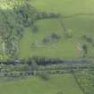
The remains of this church consist of the east gable, standing to a max. height of c.5.0m, and approximately 4.0m of the south wall forming
the SE angle. The walls are 0.8m thick and burial vaults are attached east and north sides of the remains. The numerous head-stones in the grave-yard appear to be mainly 19th century and later.
Visited by OS (WDJ) 18 October 1968.
The Annat Burn which runs nearby the church, may derive from the Celtic Annat indicating the site of an early church.
W J Watson 1926.
NN 7066 0247 A watching brief was undertaken in June 2006 during repairs to the cemetery wall surrounding St Aedh's Church (Kilmadock Old Parish Church). Most of the work involved repairs to the upper part of the wall, but in two areas the upper courses of the wall had collapsed outwards and the lower courses had to be removed to allow reinstatement. This necessitated cutting back very slightly (c 300 mm) into the cemetery fill and underlying fluvioglacial subsoil.
In one area of the wall on the SW side a 7m long section of wall required reconstruction from foundation level. A quantity of human bone (1.05kg including soil in bone cavities) and three adult molar teeth were recovered from the black soil of the cemetery fill mixed among the stones of the collapsed wall. The bones, all broken and incomplete, comprised: fragments of skull, ribs, vertebrae and long bones. Most of the bones occurred within a 1.50m section of wall collapse. They were clearly not in situ and it is likely that these human remains represent a previous disturbance of a burial, or burials, during an earlier repair to the cemetery wall. Evidence for this earlier repair was provided by modern cement in the matrix of collapsed wall stones and black soil of the cemetery fill. By contrast, the 5m long section of collapsed wall on the NW side yielded only one fragment of human bone. No other features of archaeological interest were encountered.
Sponsor: Kilmadock Heritage Society.
L J Masters, 2006.
Field Visit (August 1978)
Kilmadock, Old Parish Church and Burial-ground NN 706 024 NN70SW 12
The remains of this church are now largely reduced to the E gable, in which there is a mutilated single lancet, and a short length of the S wall. It was replaced by a new parish church in Doune in 1756.
RCAHMS 1979, visited August 1978
(Stat Acct, xx, 1798, 41, 81; NSA, x, Perth, 1231; Cowan, 1967, 102-3)
Photographic Survey (1987)
Recording of gravestones in Kilmadock Old Parish Church (St Aedh's) by Mrs Betty Willsher in 1987.
Watching Brief (June 2006)
NN 7066 0247 A watching brief was undertaken in June 2006 during repairs to the cemetery wall surrounding St Aedh's Church (Kilmadock Old Parish Church). Most of the work involved repairs to the upper part of the wall, but in two areas the upper courses of the wall had collapsed outwards and the lower courses had to be removed to allow reinstatement. This necessitated cutting back very slightly (c 300 mm) into the cemetery fill and underlying fluvioglacial subsoil.
In one area of the wall on the SW side a 7m long section of wall required reconstruction from foundation level. A quantity of human bone (1.05kg including soil in bone cavities) and three adult molar teeth were recovered from the black soil of the cemetery fill mixed among the stones of the collapsed wall. The bones, all broken and incomplete, comprised: fragments of skull, ribs, vertebrae and long bones. Most of the bones occurred within a 1.50m section of wall collapse. They were clearly not in situ and it is likely that these human remains represent a previous disturbance of a burial, or burials, during an earlier repair to the cemetery wall. Evidence for this earlier repair was provided by modern cement in the matrix of collapsed wall stones and black soil of the cemetery fill. By contrast, the 5m long section of collapsed wall on the NW side yielded only one fragment of human bone. No other features of archaeological interest were encountered.
Sponsor: Kilmadock Heritage Society.
L J Master 2006
Watching Brief (8 February 2018)
NN 70649 02459 Following a wall collapse on the southern
section of the cemetery the Rescuers of Old Kilmadock, a
local volunteer group, organised to have the wall repaired
and applied for SMC. Dr Murray Cook inspected the cleared
wall on 8 February 2018, prior to its reconstruction and
observed no earlier structures or human bone.
Archive: Stirling Council
Funder: Stirling Council
Murray Cook – Stirling Council
(Source DES Volume 19)
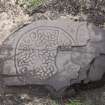
Photographic Survey (14 August 2019)
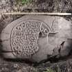
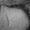
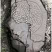
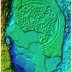
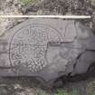
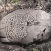
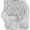
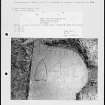
Photographic recording of carved stone found on site.
Archaeological Evaluation (14 September 2022 - 17 September 2022)
NN 70655 02486 An evaluation of seven trenches was taken at Old Kilmadock Graveyard, in September 2022, primarily to prepare a quote to lift and conserve a previously discovered early medieval cross slab. The evaluation proposed to explore the boundary of the site, particularly the bulge on the southern side, along with a walkover survey of the findspots of two other inscribed stones to explore their context. The evaluation uncovered that fragments of the
cross slab are scattered across the findspot and identified a previously unknown Ogham inscription. The excavations of the cemetery boundary identified places of soil slumping in the cemetery and at least two phases of construction of the boundary wall.
Archive: NRHE (intended)
Funder: Murray Cook and Rescuers of Old Kilmadock (ROOK)
Murray Cook, Kelly Kilpatrick, Sue MacKay and Jennifer Strachan – Stirling Council
(Source: DES Volume 23)


