Scheduled Maintenance
Please be advised that this website will undergo scheduled maintenance on the following dates: •
Tuesday 12th November from 11:00-15:00 & Thursday 14th November from 11:00-15:00
During these times, some services may be temporarily unavailable. We apologise for any inconvenience this may cause.
Allt A' Chaorainn
Cairnfield (Prehistoric), Hut Circle (Prehistoric)
Site Name Allt A' Chaorainn
Classification Cairnfield (Prehistoric), Hut Circle (Prehistoric)
Canmore ID 24629
Site Number NN69NE 11
NGR NN 6933 9965
NGR Description centred at NN 6933 9965
Datum OSGB36 - NGR
Permalink http://canmore.org.uk/site/24629
- Council Highland
- Parish Kingussie And Insh
- Former Region Highland
- Former District Badenoch And Strathspey
- Former County Inverness-shire
Field Visit (16 May 1974)
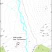
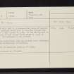
At NN 6933 9966 is a stone-walled house of unusual plan. It measures about 9.0m in diameter between the centres of a wall spread to 3.0m. In the SE the wall is broken where an oval annexe (5.0m NE-SW by 3.5m) is attached. The entrance is not evident.
In the surrounding area are several stone clearance heaps from contemporary cultivation.
Hut surveyed at 1/10,000.
Visited by OS (A A) 16 May 1974.
Field Visit (10 October 1995)
NN69NE 11 centred on 6933 9965
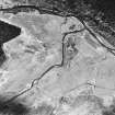
This unusual hut-circle is situated on a broad grass-covered terrace to the NE of the confluence of the Allt a' Chaorainn and the River Calder. It is roughly keyhole-shaped on plan, comprising a penannular bank enclosing an area measuring 7.4m in diameter within a stony bank spread to 3m in thickness, with a subrectangular extension to the SE, which measures 3.5m by 3m internally. The relationship of the subrectangular structure to the penannular bank is not clear but it is likely they are contemporary. The entrance is on the SW, opening through the bank adjacent to the junction of the penannular bank and the extension. Small cairns, measuring up to 4m in diameter and 0.3m in height are scattered across the terrace, largely to the NE of the hut-circle. The ground to the NE of the hut-circle has been ploughed for tree-planting, disturbing some of the cairns.
(KING95 400)
Visited by RCAHMS (DCC) 10 October 1995


