Following the launch of trove.scot in February 2025 we are now planning the retiral of some of our webservices. Canmore will be switched off on 24th June 2025. Information about the closure can be found on the HES website: Retiral of HES web services | Historic Environment Scotland
Lismore, Tirefour Castle
Broch (Iron Age)
Site Name Lismore, Tirefour Castle
Classification Broch (Iron Age)
Alternative Name(s) Lynn Of Lorn; Tirefour Broch; Tirifuir; Tirrefour Broch; Tirefuir; Tirefuar
Canmore ID 23082
Site Number NM84SE 1
NGR NM 86755 42912
Datum OSGB36 - NGR
Permalink http://canmore.org.uk/site/23082
- Council Argyll And Bute
- Parish Lismore And Appin (Argyll And Bute)
- Former Region Strathclyde
- Former District Argyll And Bute
- Former County Argyll
NM84SE 1 86755 429012
(NM 8675 4290) Tirefour Castle (NAT)
Broch (NR)
OS 1:10,000 map, (1976)
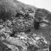
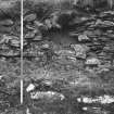
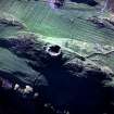
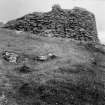
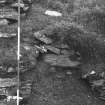
One of the best preserved monuments in the county, this broch stands on the highest point of a rocky ridge and commands an extensive view in all directions. The NW and SE flanks of the ridge fall steeply, the latter to a gently sloping terrace which in turn is bounded by a cliff which rises sheer from the shore. Access to the broch from the NE and SW along the ridge is comparatively easy. In plan the broch is almost circular. At ground level, the solid, dry-stone wall is, on average, 4.5 metres thick and the enclosed court is about 12.2 metres in diameter. The outer face of the wall stands, for the most part, to a height of at least 3 metres and reaches 4.9 metres in the SE. The inner part of the wall however, is less well preserved, the floor of the central court being buried under a mass of debris to a depth of at least 1 metre, although in the NW, the inner face is exposed to a height of 3.5 metres.
After rising almost vertically about 2.5 metres above ground level, the inner face is stepped back to form a ledge or scarcement 0.6 metres wide, though this can now be traced for only three quarters of its circuit.
Below the ledge, on the north face, there is a doorway 1 metre wide which, although now choked with debris, probably gave access to a mural cell or staircase.
The entrance to the broch faces WSW and is 1.4 metres wide at either end. The remains of an intra-mural gallery, about 2.7 metres above ground level can be traced. For the most part, these are fragmentary, but there is a well-preserved stretch of 7 metres in the NW measuring
1 metre in height and 0.6 metres in width, whilst a further short stretch, still lintelled, is visible on the east side. The sockets where the outer ends of the lintels have rested can be seen intermittently and some of the dislodged lintels are among the debris on the gallery floor. On the NE side, 0.7 metres above the level of the ledge of the inner face the wall is pierced by an opening 0.9 metres wide which appears to have served as a relieving slit rather than as a doorway.
There are protective outworks to the NE and SW, each consisting of a wall running transversely across the ridge. That to the NE survives as a grass-gown stony bank spread to a thickness of up to 5.5 metres and standing to a height of 1.5 metres externally and 0.7 metres internally. It is much reduced at its west end and there is no sign of a doorway. The outwork to the SW is similar, measuring 3 metres in thickness at the base and up to 1.1 metres in external height. There is a well-marked entrance in line with that of the broch.
RCAHMS 1975, visited May 1968.
As described.
Revised at 1:2500.
Visited by OS (DWR) 10 November 1971.
Isle of Lismore - Study and publication phase. Original fieldwork completed in 2005. Some surface survey of the central part of the island in 2007. Consolidation of Tirefour broch planned for February March 2008. Archaeological trail currently being designed by local community.
Archive deposited with RCAHMS. Copies currently lodged with Historic Scotland.
Funder: Historic Scotland, McDonald Institute Cambridge, CERS (current phase).
S Stoddart, 2007.
Field Visit (12 July 1943)
This site was included within the RCAHMS Emergency Survey (1942-3), an unpublished rescue project. Site descriptions, organised by county, vary from short notes to lengthy and full descriptions and are available to view online with contemporary sketches and photographs. The original typescripts, manuscripts, notebooks and photographs can also be consulted in the RCAHMS Search Room.
Information from RCAHMS (GFG) 10 December 2014.
Field Visit (May 1968)
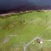
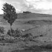
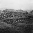
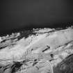
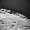
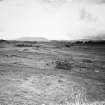
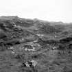
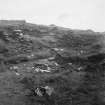
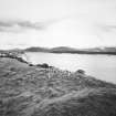
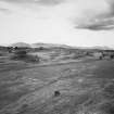
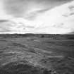
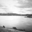
NM 867 429. Standing in a prominent position on the highest point of an elongated limestone ridge 550 m SW of Port Maluag, this broch provides a conspicuous landmark on the E side of Lismore Island (Pl. 10A, B) and is one of the best-preserved prehistoric monuments in the county. From a height of 47'9 m OD the site commands an extensive prospect in all directions, especially towards the E across the Lynn of Lorn to the mainland beyond. The NW and SE flanks of the ridge fall steeply, the latter to a gently sloping terrace about 20 m broad, whose outer limit is bounded by a precipitous cliff which rises from the shore; access to the broch is, however, comparatively easy from the NE and SW along the crest of the ridge.
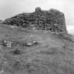
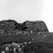
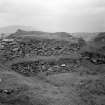
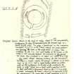
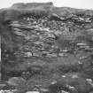
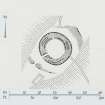
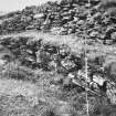
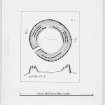
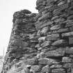
Almost circular on plan (Fig. 44), the broch is constructed, at ground-level, of a solid dry-stone wall measuring 4'5 m in average thickness, which encloses a central court about 12'2 m in diameter. Though considerably reduced by stone-robbing and collapse, the outer face of the wall (Pl. 10C) is still standing, for the most part, to a height of at least 3 m, and on the SE it rises to its maximum surviving height of 4'9 m with a uniform batter of about one in four. The footings and the first five or six courses of masonry, up to a height of about 1.5 m above ground, incorporate a considerable number of massive boulders; above this level, however, the coursing is less regular, the material used including a high proportion of thin slabs with pinnings of smaller stones.
By comparison, the inner face of the wall has suffered more severely, and the floor of the central court is buried under a mass of debris to a depth of at least I m. The best surviving portion is in the NW quadrant, where the face is exposed to a height of 3'5 m. After rising almost vertically for about 1.5 m above the present surface (i.e. about 2'5 m above the floor-level), the inner face is stepped back to form a level ledge or scarcement 0·6 m wide. At the present time the scarcement can be traced for only three-quarters of the circuit, the SE quadrant being buried under a spread of fallen stones. Above the scarcement the face continues upwards for a further 1.5 m with a batter of about one in three, the quality of the masonry being much inferior to that of the lower portion. Below the scarcement on the N, the face of the wall is interrupted by a doorway 1'0 m wide; now choked with debris, this opening probably gives access either to a mural cell or to a staircase leading upwards within the thickness of the wall.
The entrance to the broch faces WSW and is 1'4 m wide at either end. The SE side-wall of the passage is straight, but the NW side is slightly concave, thus increasing the width to a maximum of 1.5 m at a point 2'7 m from its outer end. The walling at the entrance is so ruinous that no traces can be seen of door-checks, bar-holes or an entrance to a mural guard-chamber, and the floor of the passage is hidden by debris.
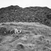
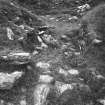
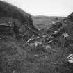
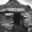
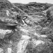
At a height of about 2'7 m above ground-level traces of an intramural gallery can be seen in the broch wall; it was probably continuous, but the collapse of the wall has completely destroyed it on either side of the main entrance, and elsewhere it is now more or less in a fragmentary condition. A well-preserved stretch is, however, visible for a distance of 7 m in the NW quadrant, measuring 1 m in height and 0·6 m in average breadth internally, and roofed by a series of large transverse lintels. At the open (S) end (Pl. 10D) it can be seen that the side-walls of the gallery are very unevenly finished internally and that the floor appears to be formed by the unpaved core-material of the solid broch wall below, indicating that the function of the gallery was merely structural. Another short section of the gallery, still lintelled but in a rather unstable condition, survives on the E, but elsewhere little remains visible except the outer casement, which stands to a maximum height of 0·8 m above the gallery floor. The sockets where the outer ends of lintel-stones have rested can be seen intermittently, and some of the dislodged lintels are lying embedded in the debris that now partly fills the gallery. On the NE, about 0'7 m above the level of the scarcement, the inner face of the broch wall is pierced by an opening 0'9 m wide, which appears to have served as a relieving-slit and not as a doorway.
The floor of the central court is buried under debris, and on the E, where there has been a particularly heavy collapse, a crude attempt has been made to rebuild the inner face of the wall both above and below the level of the scarcement.
On both the NE and SW sides the broch is protected by outworks consisting, in each case, of a boulder-faced rubble wall running transversely across the ridge. There is no evidence to show whether or not these walls were originally linked to form a continuous defence encircling the broch, but this seems unlikely. The NE outwork now appears as a grass-grown stony bank spread to a thickness of as much as 5.5 m and standing up to 1'5 m in height externally and 0'7 m internally. The surviving stretch of the outer face is at best 0.7 m high in three courses. At its Wend the wall has been reduced to a mere scarp and there is no indication of an entrance. The SW outwork is of similar construction and appearance, measuring 3'0 m in thickness at the base and up to 1.1 m in height externally. No inner facing-stones are visible, but the outer face survives to a height of 0.7m in two courses. There is a well-marked entrance, 1'5 m wide, situated almost in line with that of the broch. Immediately outside the SW outwork there are the stone foundations of a rectangular building of comparatively recent date, which may be contemporary with the turf-and-stone boundary dykes indicated on the plan.
RCAHMS 1975, visited May 1968.
Measured Survey (14 May 1968)
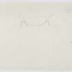
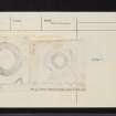
Surveyed with alidade and plane-table at 1mm:1ft, with a section at 1":12'. Redrawn in ink and published at the reduced scale of 1:1000 (site plan) and 1:500 (plan and section) (RCAHMS 1975, fig. 44).
Publication Account (1985)
The magnificent broch of Tirefour stands on the highest part of a ridge on the east coast of the island, a position that offers commanding views of the surrounding seascapes. The broch is circular on plan with the central courtyard measuring about 12m within a massive wall about 4.5m thick and still 5m in height. The entrance is on the south-west flank. The wall has been constructed in such a way that the basal part is solid rather than hollow; at a height of about 2.5m there are traces of an internal gallery, and it is likely that the upper part of the broch was of classic hollow-wall construction. At a height of about 2.5m from the original internal floor-level, there is a distinct scarcement or ledge 0.6m wide, which would have allowed internal timber buildings or floors to be keyed into the stone structure of the tower; no excavation has been undertaken and thus we do not know about any internal post-holes which might help to reconstruct such buildings more positively. Look out for the traces of two outer walls, now much denuded, which have provided additional protection for the broch on the north-east and south-west flanks.
Information from ‘Exploring Scotland’s Heritage: Argyll and the Western Isles’, (1985).
Publication Account (2007)
NM84 1 TIREFOUR CASTLE (‘Tirefuar’)
NM/8675 4291
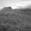
This probably solid-based broch is a conspicuous stump of masonry, visible from afar (it appears on the marine maps as a useful landmark for sailors) and overlooking the sea. It stands on a conical knoll at the north-eastern end of a rising rocky ridge with steep slopes on all sides except the south-west; from this direction the approach to the broch is quite easy.
Description
Level 1. The wall may well be a solid one (see ‘Level 2’), with an average thickness of 4.5m (15 ft), and it encloses a Central court about 12.2m in diameter. It has not been surveyed by the author to test its closeness to a true circle. The wall still stands 3.0m high in several places and is 4.9m on the south-east where the batter is marked, having an angle of 1 in 4. The basal courses contain several massive stones. The area around the main entrance is badly dilapidated.
The passage faces west-south-west, along the easiest approach, and contains some debris; it is 1.4m wide at each end but, though the door-frame is unclear, it may be at 90cm (3 ft) from the exterior. There are no signs of any guard cells although the sides of the passage are well enough preserved for any doorways in them in the inner two- thirds of its length to be visible. The inner face of the wall is much more dilapidated than the outer, although standing up to 3.5m in the south-west.
From about 8-10 o’clock is visible what seems to the author to be a secondary wall built around the interior; it is now visible as a turf-covered ledge about 60cm (2 ft) wide and rising to about 1.5m above the present grassy surface of the court. It may be about 2.5m above the original floor and seems much too wide for a scarcement, although the Commission interprets it as such. At one point there is a break in this wall and what seems to be a built face of ponderous stones – presumably the primary wallface – is visible behind it. However if there is a true scarcement behind there are no signs of it on the exposed wallface.
At some stage the broch has been cleared of much of its debris, inside and out; judging from some of the untouched brochs in Sutherland, for example, Tirefuar should be full of stone rubble and its outer wall largely buried by it. Whether the stones were cleared away in some early attempt at exploration or simply to obtain building material is unknown. There are no apparent doorways into the wall at ground level.
The thickness of the wall varies from about 4.0 – 4.3 (13-14 ft) on the east to about 4.6 – 5.8m (15-19 ft) on the north and south [4]; it is uncertain how much should be subtracted from these measurements to allow for the thickness of the secondary wall. The slightly sub-circular shape of the Central court may be caused by these irregularities.
Level 2. An upper mural gallery is clearly visible in places on the wallhead, two lengths of it (starting at about 8.30 and 1 o’clock) being still covered with its lintel roof. Looking into the broken end of the former section it is not possible to see the lintels of any gallery below. Neither is it possible to be sure whether the present rubble floor of the gallery – which is fairly level – is original (signifying a solid wall core below) or material which has tumbled in. More investigation would be needed to check this. From 3 - 5 o’clock the outer face of this gallery stands by itself and is exposed to a height of about 1.2m (4 ft).
Outer defences: there is a short forework – a boulder-faced rubble wall with a gateway in the middle of it – running across the ridge about 6m south-west of the broch which bars the direct approach to the entrance. Another cross wall is at about the same distance from the broch on the north-east.
Discussion
Without further excavation it is not possible to be sure about some of the structural features visible in this broch. If the “scarcement” is in fact a secondary wall – as the author is inclined to believe – then it probably conceals at least one doorway in the primary wall, that leading to the stair, part of which is presumably still preserved. If it is a primary scarcement then any entry to a stair should be higher up in Level 2.
A good example of a late ‘La Tène’ bun-shaped rotary quern is known from the island and is kept at a farm not far from the broch. It is possible that this was discovered inside the broch when it was cleared out [6].
New excavations
Since 2002 a multi-disciplinary project has been in progress on Lismore [7] and in 2005 new excavations started at the broch, although so far they have been confined to the outer end of the entrance and to the ground between it and the first outer wall. Some Iron Age material has already been recovered. Of some interest too – in view of what was said earlier about the rotary quern – is the discovery of a classic Fintry quern at the site of the near by dun at Park (NM/887459).
Sources: 1. NMRS site no. NM 84 SE 1: 2. Christison 1889, 375 and 427 ff.: 3. Young 1962, 190: 4. RCAHMS 1975 , 75-6, no. 147, fig. 44 and pl. 10, A-D: 5. Ritchie and Harman 1985, 134: 6. MacKie 2002b: 7. Redhouse et al. 2002. 8. Discovery and Excavation in Scotland 2005. There are more references in [1].
E W MacKie 2007
Conservation (28 February 2008 - 29 March 2008)
NM 86750 42900 Consolidation work was undertaken, 28 February–29 March 2008, on the broch of Tirefour. The main work was carried out on the seaward side, where a recent deterioration had been recorded at the site of an older major collapse. The work was supported by the landowner (Fell Estate).
Archive: RCAHMS (intended). Report: Historic Scotland and Forward Scotland.
Funder: Historic Scotland and Forward Scotland
S Stoddart (University of Cambridge), 2008


