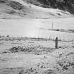
Kintraw
Cairn(S) (Prehistoric), Enclosure (Period Unknown), Standing Stone (Prehistoric)
Site Name Kintraw
Classification Cairn(S) (Prehistoric), Enclosure (Period Unknown), Standing Stone (Prehistoric)
Canmore ID 22824
Site Number NM80SW 1
NGR NM 8306 0497
Datum OSGB36 - NGR
Permalink http://canmore.org.uk/site/22824
- Council Argyll And Bute
- Parish Kilmartin
- Former Region Strathclyde
- Former District Argyll And Bute
- Former County Argyll
NM80SW 1 8306 0497
(NM 8305 0497) Standing Stone (NR)
(NM 8304 0496) Cairns (NR)
OS 6" map, Argyllshire, 2nd ed., (1900)
See also NM80NW 35.
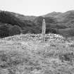
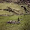
A Bronze Age complex consisting of a standing stone and three cairns (four if NM80NW 29 is included).
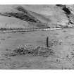
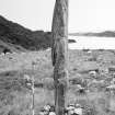
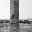
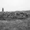
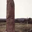
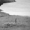
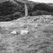
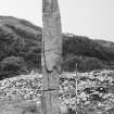
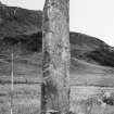
The standing stone, which leans NW, faces approximately E-W and measures 13' in height and 3'6" in breadth with a thin lozenge section and a rounded top. A horizontal notch is cut in the S edge about 4'6" from the ground.
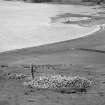
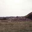
Cairn 'A' lies about 13' NE of the stone and was excavated by Simpson in 1959 and 1960, after which it was restored to its former appearance - an 8' high stone mound on the perimeter of which a number of kerb-stones were visible, giving a diameter of 48'. Outside the kerb the cairn material extended for some 8' - 10', generally as a grass-covered slope. It bore traces of superficial disturbance, including robbing on the N for the building of an adjacent sheep-fold.
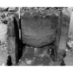
The excavation showed that the cairn had several unusual features, viz: (1) The ground surface was undisturbed except where a probable false portal had been set into it on the S of the cairn.
(2) The cairn material outside the kerb was not slip but was original support for the kerb.
(3) A segmented cist, presumably primary since it was the only burial found, was set only a few inches within the kerb on the NW.
(4) There was a gap in the centre of the cairn where a wooden post, presumably used in its setting out, had disintegrated.
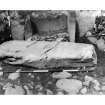
A recumbent monolith, 7'6" long, covered by collapsed cairn material, lay to the S of the false portal. That it had ever been upright was uncertain as no socket-hole was found.
The only finds were six jet beads, apparently unique in their spiral-fluted ornamentation, a medieval bronze buckle, marine shells and animal teeth. None of the finds was necessarily contemporary with the cairn.
A date somewhere in the first half of the second millenium BC is suggested for the cairn, which is thought to have been originally covered in white quartz.
Cairn 'B' lies 20' SW of the standing stone, is 11' in diameter and 1'6" high; it was also excavated in 1959 and 1960 and restored to its former appearance. It was a low, grass-covered mound which showed slight disturbance in the centre. Round the perimeter some of the unusually large kerb-stones projected. Little cairn material lay outside the kerb. Excavation revealed, on the W edge of the cairn, a small stone cist, 8" square internally, built against the inner face of the kerb, one stone of which served as a side slab. Although apparently undisturbed, it contained only a few fragments of carbonised wood. There were no small finds from this cairn.
Cairn 'C' is a low cairn lying 10' W of 'B'. It was not excavated. (Misplaced on OS 6" map) An early 18th century sketch-plan shows a row of four stones running SW from either cairn 'B' or 'C', but this is no longer visible.
The standing stone is said to have been erected to a Norse prince (Argyll County Council 1914) and is known as the "Danish King's Grave" as also apparently is cairn 'A' (Campbell and Sandeman 1964).
Argyll County Council 1914; M Campbell and M Sandeman 1964; D D A Simpson 1968..
The cairns and standing stone are generally as described, although 'B' is 8.4m in diameter and 'C' is visible as an amorphous grass-covered mound c.7.0m in diameter x 0.3m high.
Between 'B' and NM80NW 29 is the grass-covered base of a probable cairn 'D' measuring c. 23.0m in diameter with a maximum height of 1.3m. It was probably robbed to build the sheepfold nearby. Two grass-covered piles of stones alongside may also be the remains of cairns.
Surveyed at 1/10,000.
Visited by OS (R D) 4 March 1970.
Field Visit (July 1980)
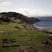
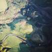
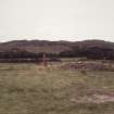
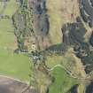
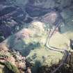
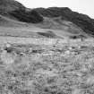
Situated on a terrace at the mouth of the Bealach Mor about 200m SSE of Kintraw farmhouse and commanding an extensive view down Loch Craignish, there is an important group of monuments comprising two cairns, a standing stone and what may be a prehistoric enclosure. The cairns were excavated in 1959-60 and in 1979 the socket of the standing stone was examined after the stone had fallen in the preceding winter; this account is based in part on the published reports (Campbell and Sandeman 1964, no.88; D D A Simpson 1968, 54-9; A Thom and A S Thom 1979, 27-31).
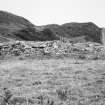
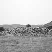
The larger cairn, which was rebuilt after the excavation, measured 15.5m in diameter and stood to a height of 2.6m. It was surrounded by a kerb of boulders, which rested on the old ground surface, and the stones were graded in size with the largest lying on the S and W. On the SW the kerb incorporated a setting of three slabs, which resembled a 'false portal'. The projecting slabs that formed the jambs of the portal (each about l.3m high) were set at right angles to the kerb, flanking a kerbstone of similar proportions. All three stones were set in ramped holes about 0.45m in depth. The space between the uprights was packed with layers of small stones and charcoal. Immediately opposite this setting a recumbent slab was found lying on the old ground surface. The body of the cairn was composed entirely of stone with larger stones towards the base and a preponderance of quartz around the rim, which the excavator suggested might have been the remains of a quartz capping to the cairn. At the centre of the cairn, and apparently resting on the old ground surface, there seems to have been a timber post which rose through the cairn material to a height of at least 1.02m; its function is unknown but it seems unlikely that it served simply as a marking-out post of the cairn. The only burial under the cairn came from a cist situated close to the kerb in the NW quadrant; it contained fragments of cremated bone and carbonised wood. Finds from the cairn were restricted to mussel- and cockle-shells and the teeth of ox and sheep or goat, as well as six fluted jet beads and a bronze buckle, which the excavator suggested had been dropped on the surface of the mound and had slipped down between the stones.
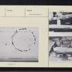
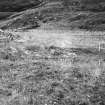
About 8.5m SW of the larger cairn there are the remains of a roughly circular kerb-cairn measuring 7.3m in diameter, which formerly stood to a height of 0.46m. Only three of the kerbstones remain in situ, several having been removed, and the remainder have fallen since the excavation. The only feature revealed in the interior was a small cist, 0.2m square, which had been built against one of the kerbstones in the NW quadrant; all that was found in it were fragments of carbonised wood. After excavation the cairn was only partially back-filled and the baulks are still visible criss-crossing the interior.
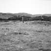
Between the two cairns there is a large standing stone which, before it fell in the winter of 1978-9, rose to a height of about 4 m and was aligned with its long axis NNE and SSW. Excavation of the stone-hole did not reveal any foundation deposit but showed that only 1m of the stone was set below the ground surface. The stone has now been re-erected and set in a concrete plinth, but it is no longer aligned on its original axis.
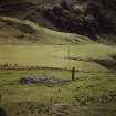
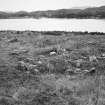
Situated 18m NW of the standing stone, there are the slight remains of a circular enclosure, which measures 17m in diameter within a low earth-and-stone bank up to 2m thick. Its date and purpose are not certain, but it and the other monuments are all shown on a copy of Edward Lhuyd's drawing of Kintraw made about 1699*, and it is clear that the enclosure was then already regarded as ancient (DES 1985, 65). The drawing also shows a circular stone setting within the enclosure and four stones extending from the exterior; neither of these features is now visible.
Besides the early monuments on the terrace, there are numerous traces of recent agriculture, including a good example of a stone-built sheep-fank, various small enclosures, clearance heaps, and earth-and-stone banks. The possibility that the standing stone may have had significance in astronomical observations in prehistoric times has been discussed on a number of occasions.
RCAHMS 1988, visited July 1980.
*The drawing is preserved in British Library (Stowe 1024, No. 80); Campbell, J L and Thomson, D, 'Edward Lhuyd in the Scottish Highlands' (1963), 306, pl. xiii. A further, but simplified, copy is in William Stukeley's manuscript Commonplace Book kept in Devize's Museum (see also PSAS, 99 (1966-7), pl. iv).
Measured Survey (July 1980)
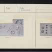
RCAHMS surveyed Kintraw cairns, standing stone and enclosure in July 1980 with plane-table and alidade producing a plan at a scale of 1:100. The plan of the cairns, standing stone and enclosure were redrawn in ink and published at a scale of 1:250 (RCAHMS 1988a, 64).


