Pricing Change
New pricing for orders of material from this site will come into place shortly. Charges for supply of digital images, digitisation on demand, prints and licensing will be altered.
Rousay, Westside, Swandro, St Mary's Church
Burial Ground (Post Medieval), Church (Post Medieval), Panel (Wood)(17th Century), Panel (Wood)(18th Century)
Site Name Rousay, Westside, Swandro, St Mary's Church
Classification Burial Ground (Post Medieval), Church (Post Medieval), Panel (Wood)(17th Century), Panel (Wood)(18th Century)
Alternative Name(s) Old Parish Church; Westside; Westness; Skaill; Old Rousay Kirk
Canmore ID 2281
Site Number HY33SE 16
NGR HY 37364 30174
Datum OSGB36 - NGR
Permalink http://canmore.org.uk/site/2281
First 100 images shown. See the Collections panel (below) for a link to all digital images.
- Council Orkney Islands
- Parish Rousay And Egilsay
- Former Region Orkney Islands Area
- Former District Orkney
- Former County Orkney
Desk Based Assessment (1970)
HY33SE 16 37364 30174
(HY 3735 3017) Church (NR) (remains of)
OS 6" map, Orkney, 2nd ed., (1900).
A roofless, single-chambered post-Reformation building with crowstepped gables, built mainly of rubble from the shore and bedded in clay. It measures 52 ft 11 ins E-W by 14 ft 3 ins transversely within walls 2 ft 6 ins wide at the sides, 3 ft and 3 ft 8 ins at the ends and standing 10 ft high. There has been a gallery at the W end, the joist holes being still visible. The S wall contains the entrance, three windows and an aumbry regarded by Dryden as a holy water stoup (D MacGibbon and T Ross 1896). An internal scarcement or footing running along the W half of the N wall and across the W gable, and a ledge on the inside of the E gable suggest that the existing church has replaced an earlier one standing in the same position.
In the National Museum of Antiquities of Scotland (NMAS) are two panels of Scots pine from the church. The older one, 23 ins high and 9 1/4 ins broad, has the date 1622 and a monogram of the initials R B and I S in relief; the other, 22 1/2 ins by 9 1/4 ins, has the date 1798 and the initials A M and I M crudely incised.
Source: RCAHMS 1946, visited 1929.
Field Visit (10 October 1972)
This church is as described and planned. The burial ground is no longer in use.
Visited by OS (AA) 10 October 1972.
Field Visit (August 1979)
St Mary's Church HY 3735 3018 HY33SE 16
Also referred to as 'Swandro Church', 'Westside Church', 'Westness Church', 'Skaill Church', this is the shell of the former parish church of Rousay, abandoned in 1815, probably comprising post-Reformation fabric on medieval foundations. Architectural fragments are built into the walls (see Introduction, p. 11). In spite of buttresses provided by General Burroughs late in the last century, the building is moving down the slope and is structurally threatened.
RCAHMS 1982, visited August 1979
(Sir Henry Dry den's drawings in NMRS; Dryden letter in The Orcadian, 22 August 1871; Name Book, Orkney, No. 16, pp. 125 and 239; MacGibbon and Ross 1896-7, i, 108-9; Dietrichson 1906, 105-9 (Norwegian text), 28-9 (separately paginated English text); Marwick 1924, 19; RCA MS 1946, ii, pp. 190-1, No. 548; 0 R 487)
Field Visit (June 2017)
Swandro Church
The old parish church at Swandro stands within a small burial ground some 500m W of the public road and 1.4km NNW of the farm at Westness, and immediately SW of the medieval tower and hall known as ‘the Wirk’ (HY33SE 17). The current building is generally ascribed to the post-Reformation period, more specifically the late 16th or early 17th century (Lowe 1984, 1). It was apparently abandoned in 1815 when a new parish church was constructed at Brinian (RCAHMS 1982, 26; HY42NW 45). A well that may have been related to the church, known as Marywell, stands about 130m to the NNW. This description of the church is limited to a brief summary of the previous work and a note of new observations based on a new measured survey and photographic record.
The first detailed record of the church was made in September 1870 by the antiquary Henry Dryden, whose notes and drawings were published some 26 years later (Macgibbon and Ross 1896, v1, 108-9; copies made by William Galloway are held within the NRHE). Though there is no explicit statement discussing phasing, his description records that ‘but for the stoup near the door, and apparently an aumbry near the east end’ the building might be assigned to the post-Reformation period. Dryden’s survey recorded details now obscured by buttressing erected at some time between 1870 and the survey for the 1st edition of the OS 25-inch map in 1879 (Orkney Sheet LXXXIX.4, 1882). That map shows the buttresses that support the gables, while a third buttress set against the S wall the doorway, maybe of the same date. A selection of the drawings was republished by Dietrichson and Meyer (1906, 105-9).
After their main visit in July 1929 RCAHMS described the church as clay-bonded and expanded on the tentative suggestion of two phases, noting that an internal footing along the W and N wall, combined with a ledge on the E gable ‘rather suggests that the existing [post-Reformation] church has replaced an earlier one standing in the same position’ (1946, v1, 191). They also noted the former presence of a gallery in the W end, one definite aumbry by the entrance and another possible example in the N wall, and ‘a built up window’ in the middle of the N wall.
In August 1979 the church was included in an archaeological survey of Rousay and adjacent islands by Dr Raymond Lamb and the resulting report includes a lengthy discussion of the ecclesiastical buildings and the architectural fragments, noting for the first time that some were included within the church’s fabric (RCAHMS 1982, 11). In May 1984 a more detailed survey of the church by Chris Lowe of the University of Durham (Lowe 1984b; 1984c) led to the assessment that the gallery was probably an insertion, with the W window, and that it had been reached by a timber stair fixed to additional joist holes in the N wall. He also identified further fragments of an earlier building, in particular a foundation course visible externally at the W gable, and noticed that lime had been used in the pointing of the later church.
In addition to the observations noted above, which support the idea that there is an earlier phase of the church along much the same footprint, it is also possible to suggest that fragments of a smaller church or chapel are visible at the E end . Firstly, a straight joint is visible in the internal face of the N wall c.6m from the E gable (possibly the ‘built up window’ noted by RCAHMS). Secondly, a few broken stones in the internal plinth visible on the N wall at this point may be taken to suggest that a wall returned to the S, and this is coincident with a drop in the floor level from E to W of about 0.1m. Thirdly, there is a poorly defined horizontal joint or lift in the stonework, visible in the E part of the N wall, marked by a change in character some 1.7m above ground outside and 2.1m above the internal floor that runs from the gable to a position roughly in line with the internal straight joint. In the S wall, at a position opposite the straight joint, the masonry twists to the W on a vertical axis as if pivoting on a weak point in the foundations. Finally, a ragged former roof line in the internal face of the E gable suggests that it has been raised, and this lines up approximately with the horizontal joint just mentioned. Taken together these features suggest the presence of an earlier and smaller building at the E end of the present church, possibly a chancel.
Post-reformation panels and tombstones
Two wooden panels from this church, one of the 17th and one of the 18th century, were donated to the National Museum of Scotland by the landowner W G Grant of Trumland in 1933 (PSAS 68, 16; RCAHMS 1946, v2, 191). Two heraldic tombstones, which were formally located at Swandro, one of 17th century date, are now located within the church at Brinian, already mentioned (RCAHMS 1946 No. 547).
Architectural fragments
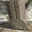
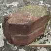
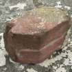
In 1870, Dryden mentioned ‘some carved fragments of the red sandstone’ then located at Westness (Macgibbon and Ross 1896, v1, 109) and RCAHMS included a description of 7 important fragments ‘removed from the Wirk and the neighbourhood of the ruined church’, which had by that time been moved to Trumland House (1946, No. 549). Some of these (Nos. 3 and 7) had been discovered during Storer Clouston’s excavation of the Wirk (1931, 28, 32). Chris Lowe undertook a thorough reanalysis of the carved architectural fragments (and unworked stone) in 1984, which resulted in the publication of a catalogue of some 22 fragments from the church and 23 from the burial ground and its enclosing wall.
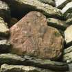
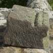
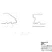
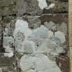
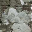
Detailed drawings of two of the 16th century stones incorporated into the church (Lowe Nos. 119 and 126) were prepared during the present survey. That in the external wall of the E gable near the NE corner is a keeled trefoil moulding with hollow chamfers and outer roll to either side, probably from a window opening of a Gothic building of 13th century date. The moulding in the S wall near the SE corner is a larger filleted trefoil roll with two additional smaller rolls beyond and a hollow chamfer and quirk, part of which is broken off. In addition to these two, a third fragment which is built into the N wall near the NE corner is a quirked roll moulding of 16th century date. Further architectural fragments, one of which matches that in the E gable, were noted in the church yard and have been photographed.
The corpus of material includes stone ascribed to both the 13th and 16th centuries, and there is agreement that it is likely to have been brought into the site from an original site elsewhere (RCAHMS 1946; 1982; Lowe 1984c). The fragments built into the church include examples of 16th century work and, without further evidence coming to light, are still best explained as material brought into Westside from another location as builder’s rubble (Lowe 1984), although it is possible that they are taken from an unfinished building at either the Wirk or the church site itself (Lamb 1982, 12).
Visited by HES (GFG, PJD, HS, SW) and William Wyeth 15-16 June 2017


