|
Photographs and Off-line Digital Images |
G 813026 PO |
Collection of material assembled by Iain Thornber, Kinlochmoidart, Highland, Scotland |
Loch Tearnait, Crannog.
Distant view. |
1990 |
Item Level |
|
|
Photographs and Off-line Digital Images |
G 813027 PO |
Collection of material assembled by Iain Thornber, Kinlochmoidart, Highland, Scotland |
Loch Tearnait, Crannog.
General view. |
1990 |
Item Level |
|
|
Photographs and Off-line Digital Images |
G 813028 PO |
Collection of material assembled by Iain Thornber, Kinlochmoidart, Highland, Scotland |
Loch Tearnait, Crannog.
General view. |
1990 |
Item Level |
|
|
Photographs and Off-line Digital Images |
BP 183/2 |
Historic Scotland Archive Project |
Maritime photographs: Copy of the RAF vertical 106G/Scot/UK 35 : 7102. Taken on 27 April 1946. |
|
Item Level |
|
|
Manuscripts |
MS 5287/1 |
Historic Scotland Archive Project |
Maritime Survey Archive: Archive Contents List for the survey archive on the crannog at Loch Tearnait, a Sound of Mull Archaeological Project (SOMAP). |
1998 |
Item Level |
|
|
Manuscripts |
MS 5287/2 |
Historic Scotland Archive Project |
Maritime Survey Archive: Proforma survey record forms from the 1998 dive season at the crannog at Loch Tearnait, a Sound of Mull Archaeological Project (SOMAP). |
1998 |
Item Level |
|
|
Manuscripts |
MS 5287/3 |
Historic Scotland Archive Project |
Maritime Survey Archive: Large survey plan of the crannog at Loch Tearnait, a Sound of Mull Archaeological Project (SOMAP). |
1998 |
Item Level |
|
|
Manuscripts |
MS 5287/4 |
Historic Scotland Archive Project |
Maritime Survey Archive: Web for Windows survey measurements of the crannog at Loch Tearnait, a Sound of Mull Archaeological Project (SOMAP). |
1998 |
Item Level |
|
|
Manuscripts |
MS 5287/5 |
Historic Scotland Archive Project |
Maritime Survey Archive: Site plan (taken from survey measurements MS 5287/4) of the crannog at Loch Tearnait, a Sound of Mull Archaeological Project (SOMAP). |
1998 |
Item Level |
|
|
Manuscripts |
MS 5287/6 |
Historic Scotland Archive Project |
Maritime Survey Archive: Proposed scheduling document of the crannog at Loch Tearnait, a Sound of Mull Archaeological Project (SOMAP). |
1998 |
Item Level |
|
|
Manuscripts |
MS 5287/7 |
Historic Scotland Archive Project |
Maritime Survey Archive: Unpublished report for the Nautical Archaeological Society: ‘An Initial Survey of a crannog Situated in Loch Tearnait, Movern Penensular.’ |
1998 |
Item Level |
|
 |
On-line Digital Images |
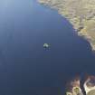
DP 094514 |
RCAHMS Aerial Photography Digital |
Oblique aerial view of the crannog in Loch Tearnait, looking W. |
30/8/2010 |
Item Level |
|
 |
On-line Digital Images |
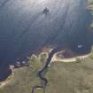
DP 094515 |
RCAHMS Aerial Photography Digital |
Oblique aerial view of the crannog in Loch Tearnait, looking W. |
30/8/2010 |
Item Level |
|
 |
On-line Digital Images |
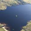
DP 094516 |
RCAHMS Aerial Photography Digital |
Oblique aerial view of the crannog in Loch Tearnait, looking SSW. |
30/8/2010 |
Item Level |
|
 |
On-line Digital Images |
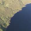
DP 094521 |
RCAHMS Aerial Photography Digital |
Oblique aerial view of the field boundaries, building and the crannog in Loch Tearnait, looking NE. |
30/8/2010 |
Item Level |
|
 |
On-line Digital Images |
SC 2383739 |
Records of the Ordnance Survey, Southampton, Hampshire, England |
Loch Tearnait, NM74NW 1, Ordnance Survey index card, Recto |
c. 1958 |
Item Level |
|
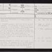 |
On-line Digital Images |
SC 2383740 |
Records of the Ordnance Survey, Southampton, Hampshire, England |
Loch Tearnait, NM74NW 1, Ordnance Survey index card, page number 1, Recto |
c. 1958 |
Item Level |
|
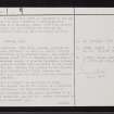 |
On-line Digital Images |
SC 2383741 |
Records of the Ordnance Survey, Southampton, Hampshire, England |
Loch Tearnait, NM74NW 1, Ordnance Survey index card, page number 2, Verso |
c. 1958 |
Item Level |
|
 |
On-line Digital Images |
SC 2383742 |
Records of the Ordnance Survey, Southampton, Hampshire, England |
Loch Tearnait, NM74NW 1, Ordnance Survey index card, page number 3, Recto |
c. 1958 |
Item Level |
|
|
Manuscripts |
MS 5279 |
Historic Scotland Archive Project |
Maritime archive: Administrative information for the Sound of Mull Archaeological Project (SOMAP).
Includes: Archive Contents list; Blank contents sheets; NAS Code of Practice; SOMAP Code of Practice; Lochaline Dive Centre Information; Project Proposals and Publicity Press Cuttings. |
1994 |
Batch Level |
|
|
Photographs and Off-line Digital Images |
BP 183/1 PO |
Historic Scotland Archive Project |
Maritime photographs: Oblique aerial photographs of the crannog at Loch Tearnait from 1998. |
1998 |
Batch Level |
|
|
All Other |
551 166/1/1 |
Records of the Ordnance Survey, Southampton, Hampshire, England |
Archaeological site card index ('495' cards) |
1947 |
Sub-Group Level |
|


