Loch Tearnait
Crannog (Period Unassigned)
Site Name Loch Tearnait
Classification Crannog (Period Unassigned)
Canmore ID 22674
Site Number NM74NW 1
NGR NM 7480 4702
Datum OSGB36 - NGR
Permalink http://canmore.org.uk/site/22674
- Council Highland
- Parish Morvern
- Former Region Highland
- Former District Lochaber
- Former County Argyll
NM74NW 1 7480 4702.
There are the ruins of a stronghold on a small island in Loch Tearnate (Tearnait).
NSA 1845.
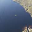
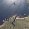
(NM 7480 4702) Blundell (1913) suggests that the island in Loch Tearnait is a crannog. It is nearly circular, 70ft in diameter, and stands in 12ft of water. Its timber foundation seems to have been laid from its centre to the circumference and the boulders on top, none too heavy for a man to handle, are of granite and whinstone ferried from opposite sides of the loch. The island once had a retaining wall built round it, save in two places for boats. Traditionally, there was a building on the island, which was a sanctuary (information from J Ross, gamekeeper).
F O Blundell 1913.
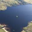
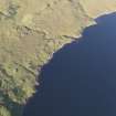
An overgrown crannog composed of rubble, built upon a shallowing of the loch. It survives to 1.7m above water level and measures 29.0m from NE to SW by 24.0m transversely, with its size increasing below the water by another 6.0m. A single boat noost is apparent in the SE, and in the S arc are four stones of a retaining wall. There is no trace of a causeway, though tradition asserts that there was one, and no building was seen on the island. The tradition that it was a sanctuary is still known locally.
Visited by OS (NKB) 16 June 1970.
(NM 7480 4702) Crannog (NR)
OS 1:10,000 map, (1975)
Crannog, Loch Tearnait: This small island, situated in the middle of Loch Tearnait, is said (Blundell 1913) formerly to have been fortified by a perimeter wall. The island is circular, measuring about 18m in diameter at the date of visit; it is composed mainly of granite boulders, although an outcrop of granite bedrock was identified at the modern boat-inlet on the SE. Whereas the surface is now featureless, a foundation structure of radial timbers was described in 1912 (Blundell 1913), when the water-level may have been lower than at present.
The name Tearnait ('refuge') is explained in local tradition by the reputed use of the island as a sanctuary for suspected criminals, and this tradition seems to provide the only evidence for the former existence of an early monastic community, implied by a modern reference to 'the lay abbot of Tearnait' (Townend 1965).
The island is evidently at least partly artificial in origin, and its position close to the overland route between Glensanda and Kinlochaline no doubt made it a suitable location for a fortified dwelling in the medieval period.
RCAHMS 1980; P Townend (ed.) 1965; F O Blundell 1913.
Project (1994 - 2005)
Survey of maritime sites including: Dartmouth: Eilean Rubha an Ridire; Evelyn Rose (Possibly): Ardtornish Point; Glen Carradale: Loch Aline Jetty; Hispania: Sgeir Mor; John Preston: Rubha Dearg; Loch Tearnait, Crannog; Pelican: Calve Island; Rondo: Dearg Sgeir; Shuna: Rubha Aird Seisg; Strathbeg: Cnap A' Chailbhe; Swan: Duart Point; Thesis: Rubha an Ridire; Unknown: Calve Island; Unknown: Scallaslte Bay and a stone quay and Ardtornish.


