Pricing Change
New pricing for orders of material from this site will come into place shortly. Charges for supply of digital images, digitisation on demand, prints and licensing will be altered.
Upcoming Maintenance
Please be advised that this website will undergo scheduled maintenance on the following dates:
Thursday, 30 January: 11:00 AM - 3:00 PM
During these times, some functionality such as image purchasing may be temporarily unavailable. We apologise for any inconvenience this may cause.
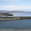
Easdale Harbour
Harbour (Period Unassigned)
Site Name Easdale Harbour
Classification Harbour (Period Unassigned)
Canmore ID 22617
Site Number NM71NW 4
NGR NM 7391 1709
Datum OSGB36 - NGR
Permalink http://canmore.org.uk/site/22617
- Council Argyll And Bute
- Parish Kilbrandon And Kilchattan
- Former Region Strathclyde
- Former District Argyll And Bute
- Former County Argyll
Field Visit (July 1971)
Slate has been quarried at several sites on the islands of Nether Lorn, and remains of old workings with accompanying dwellings may be seen at Cullipool, Black Mill Bay and Toberonochy, Luing and Balvicar and Ardcaple, Seil. The most important quarries, however, were on the island of Easdale and the smaller island of Elalnbeich which, during the first half of the 19th century, became united to Seil by a causeway formed by the vast accumulation of quarry waste. (1)
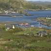
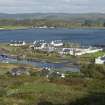
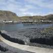
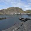
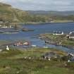
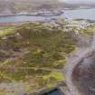
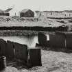
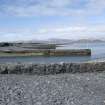
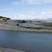
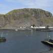
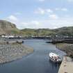
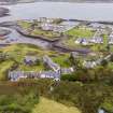
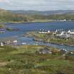
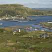
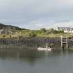
In contract with to the quarries at Ballachulish most of the good beds of slate at Easdale lay near or below ground level, and as more efficient pumps were introduced during the 19th century the workings were carried down to considerable depths. In 1869 the principal quarry at Ellanbeich (Ellenabeich) had a surface area of about 140m by 75m and a depth of some 50m. This quarry, which contained an elaborate system of railway tracks, was protected from the sea by a narrow wall of unquarried rock strengthened by a masonry wall, and when this was breached by a storm in November 1881 the entire quarry was flooded, (2) so that it now presents the appearance of a tidal basin. Most of the disused workings on Easdale Island, the oldest of which are two situated near the SE shore of the island, are also flooded. The only industrial building of importance is the ruinous engine house, probably of mid-19th century date, situated immediately east of Ellanbeich (Ellenabeich) quarry. This provided motive power for the railway system and also for the pumps in the quarry. The harbours of Ellanbeich and Easdale were built c.1826 (3) and both have jetties with vertically-set masonry. The NW quay at Easdale Island, incorporating a flight of steps, is particularly well preserved; the area to the NW is divided by rows of slate slabs, resembling headstones, into a series of compartments originally ten in all, for stacking graded loads of slates ready for shipping (around.NM7388 1709; see NRHE image AG/4851).
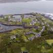
Most of the quarrier’s dwellings, both an Ellanbeich and on Easdale Island, are single-storeyed cottages of rubble masonry, harled and whitewashed having slate paving slabs at the street front and neatly slated roofs. The existing buildings probably date from the first quarter of the 19th century, and the internal layout corresponds closely with a survey plan of 1856. (4) Each cottage has two main rooms separated by a lobby and closet, the latter normally entered from the kitchen, the internal partitions are timber-framed with slate infilling. The main group of cottages at Ellanbeich is arranged as two back-to-back rows, each in blocks of five, four and four, separated by streets from a third row of dwelling son the WSW and a series of walled gardens of walled gardens on the ENE.
The arrangement of cottages in Easdale is less systematic than at Ellanbeich; some are grouped round three sides of a square, while other extend W and NW of the harbour. A considerable part of the island of Easdale is covered with an intricate network of dry-stone walls forming small closely-grouped enclosures. Similar enclosures formerly existed at Ellanbeich, and may be the remains of allotments used of the intensive potato-cultivation that was observed there in 1800. (5)
Quarrying operations at Easdale were at first conducted on an ad hoc basis, the necessary materials being gathered from the slate debris on the shore or quarried above water-level by the workmen engaged in particular building works. During the first half of the 18th century the quarries were greatly developed, with permanent crews of quarries preparing slates for shipment on vessels engaged in trade between the Clyde and the East Coast. (6)
When the management was taken over by the ’Marble and Slate Company of Netherlorn’ in 1745, eight crews of four men were employed, with an annual production of 500,000 slates. By 1771 the workforce had increased to thirteen crews at Easdale and five at Ellanbeich, and nineteen elsewhere on Seil and on Luing, and a production in 1795 of about 5 million slates. (7) At this period quarrying was restricted to the seams above low water level, although a system of outflow channels and sluices allowed these levels to be worked in all states of the tide.
In 1800 the quarries at Ellanbeich, which had apparently been worked down to low water level, were described as exhausted (8) but the introduction of soon after this of improved sources of power for pumping and for transport , including a windmill and steam engines, permitted work at Easdale and Ellanbeich to be carried down to great depths described above. Peak production was estimate in 1869 as about nine million slates, but this output was greatly reduced by the flooding of Ellanbeich quarry in 1881; the production at Easdale continued intermittently until c.1914. (9)
(1) The sound separating Ellanbeich from Seil is represented on a map of 1787 by G Langlands (NRS, RHP 975/1).
(2) Gillies, PH, Netherlorn, (1909), 16
(3) Bremner D, The Industries of Scotland (1869), 427
(4) ‘Ground Plan of present Quarriers Houses’ inset in unexecuted plan for the rebuilding of houses at Ellanbeich , 1856 (NRS, RHP 970/13)
(5) Leyden, Tour, 56
(6) Mackay, W The Letter Book of the Bailie John Steuart of Inverness 1715-1752, SHS (1915), Index, s.v. ‘Slate’
(7) NRS Breadalbane Collections, GD 112/18/nos. 21-4, 54-5, Marble Company Ledgers, Minute Books, Journals, passim; Stat Acct xiv (1795), 161-2
(8) Leyden, Tour, 56
(9) NSA, vii (Argyll) , 77-8; Gillies, PH, Netherlorn, (1909),10-16; Bremner D, The Industries of Scotland (1869), 425-8
RCAHMS 1975, visited July 1971


