|
Manuscripts |
MS 2363 |
|
Coachford realignment and climbing lane. Report of an archaeological evaluation by GUARD, 2004. |
2/2005 |
Item Level |
|
 |
On-line Digital Images |
SC 2372150 |
Records of the Ordnance Survey, Southampton, Hampshire, England |
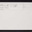
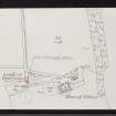
Pitlurg Castle, NJ44NW 1, Ordnance Survey index card, Recto |
c. 1958 |
Item Level |
|
 |
On-line Digital Images |
SC 2372151 |
Records of the Ordnance Survey, Southampton, Hampshire, England |
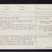
Pitlurg Castle, NJ44NW 1, Ordnance Survey index card, page number 1, Recto |
c. 1958 |
Item Level |
|
 |
On-line Digital Images |
SC 2372152 |
Records of the Ordnance Survey, Southampton, Hampshire, England |
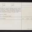
Pitlurg Castle, NJ44NW 1, Ordnance Survey index card, page number 2, Verso |
c. 1958 |
Item Level |
|
 |
On-line Digital Images |
SC 2372153 |
Records of the Ordnance Survey, Southampton, Hampshire, England |
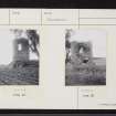
Pitlurg Castle, NJ44NW 1, Ordnance Survey index card, Recto |
c. 1958 |
Item Level |
|
 |
On-line Digital Images |
SC 2372154 |
Records of the Ordnance Survey, Southampton, Hampshire, England |
Pitlurg Castle, NJ44NW 1, Ordnance Survey index card, Recto |
c. 1958 |
Item Level |
|
|
All Other |
551 166/1/1 |
Records of the Ordnance Survey, Southampton, Hampshire, England |
Archaeological site card index ('495' cards) |
1947 |
Sub-Group Level |
|


