
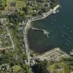
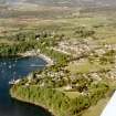
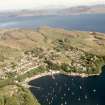
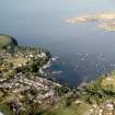
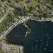
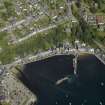
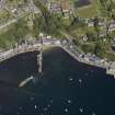
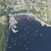
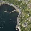
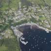
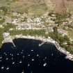
Mull, Tobermory Harbour, Old Pier


Pier (19th Century) (1801)-(1814)
Site Name Mull, Tobermory Harbour, Old Pier
Classification Pier (19th Century) (1801)-(1814)
Alternative Name(s) Tobermory Bay; Main Street; Telford Pier; Sound Of Mull
Canmore ID 171606
Site Number NM55NW 19.01
NGR NM 50579 55243
Datum OSGB36 - NGR
Permalink http://canmore.org.uk/site/171606


- Council Argyll And Bute
- Parish Kilninian And Kilmore
- Former Region Strathclyde
- Former District Argyll And Bute
- Former County Argyll
NM55NW 19.01 50579 55243
Pier [NAT]
OS 1:2500 map, 1976.
(Location cited as NM 506 553). Pier, Tobermory, built 1801-14 by engineer Thomas Telford. A 300ft (91.4m) drystone rubble pier, with a wall on the north-east side. Built for the British Fisheries Society.
J R Hume 1976.

