Pricing Change
New pricing for orders of material from this site will come into place shortly. Charges for supply of digital images, digitisation on demand, prints and licensing will be altered.
Upcoming Maintenance
Please be advised that this website will undergo scheduled maintenance on the following dates:
Thursday, 9 January: 11:00 AM - 3:00 PM
Thursday, 23 January: 11:00 AM - 3:00 PM
Thursday, 30 January: 11:00 AM - 3:00 PM
During these times, some functionality such as image purchasing may be temporarily unavailable. We apologise for any inconvenience this may cause.
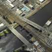
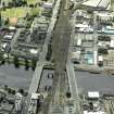
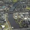
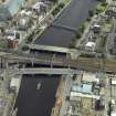
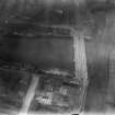
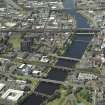
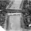
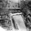
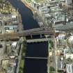
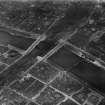
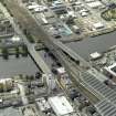
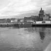
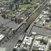
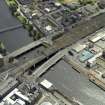
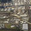
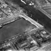
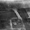
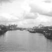
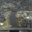
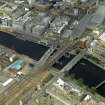
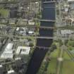
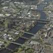
Glasgow, Lower Harbour, George The Fifth Bridge
Graffiti (21st Century), Road Bridge (20th Century)
Site Name Glasgow, Lower Harbour, George The Fifth Bridge
Classification Graffiti (21st Century), Road Bridge (20th Century)
Alternative Name(s) King George The Fifth Bridge; George The Fifth Bridge; Oswald Street; Broomielaw; Commerce Street; Clyde Place; River Clyde
Canmore ID 163185
Site Number NS56SE 520
NGR NS 58645 64810
Datum OSGB36 - NGR
Permalink http://canmore.org.uk/site/163185
- Council Glasgow, City Of
- Parish Glasgow (City Of Glasgow)
- Former Region Strathclyde
- Former District City Of Glasgow
- Former County Lanarkshire
NS56SE 520.00 58645 68410
George the Fifth Bridge [NAT]
OS 1:1250 map, 1967.
NS56SE 520.01 NS 58648 64874 Iron gate
Location formerly entered as NS 5864 6481.
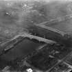
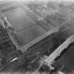
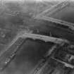
George V Bridge links the area of Tradeston on the south side of the River Clyde with the Glasgow city centre, and was originally commissioned in 1914. However, the First World War delayed construction, the bridge not being opened until 1928. The project led to the truncation of a the goods shed on Clyde Place, the west gable of which had to be rebuilt by the Clyde Navigation Trust in 1929.
(Undated) information in NMRS.
King George V Bridge, built 1924-8. T M Somers and Considere Constructions Ltd, engineers (£249,877). The memorial stone was laid on 12 July 1927. A three-span, reinforced concrete continuous beam bridge, faced with Dalbeattie granite. The outer spans are 110.5ft (33.7m) and the central span 146ft (44.5m) long, with a 50ft (15.2m) carriageway.
J R Hume 1974.
King George V Bridge. The most recent of the bridges near the old city centre, crossing the river askew from Commerce Street to Oswald Street, and built 1924-7, though first proposed in 1914. It pretends to be, in the tradition of Glasgow civic bridges, a three-arch bridge of granite, but it is not. After a proposed granite replica of Glasgow Bridge had been vetoed by the Navigation Trust, Thomas P M Somers (City Engineer) decided on a reinforced concrete bridge, invited competitive designs, and chose that of Considere Constructions Ltd; contractor Melville, Dundas and Whitson.
There are three 'arches'; the two piers aligned in relation to those of the adjacent railway bridges (NS56SE 140.00) and giving a middle span of 44.5m (146ft), with a height of 5.5m (18.5ft) above high water to accommodate coasting vessels, including 'puffers', which used the Broomielaw quays under and upstream of the railway bridges. The resulting profile of road and parapet is unusual and rather inelegant, rising from the river banks by straight lines which are joined by a short curve over the crown of the middle arch. The 'arches' are actually reinforced concrete box girders with curved soffits, the facades clad with grey Dalbeattie granite modelled to represent arches, spandrels and cornice. The balustrade is also granite, solid and polished. The concrete soffit of the box girders has been covered with a roughcast rendering, probably in response to weathering.
E Williamson, A Riches and M Higgs 1990.
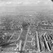
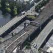
This bridge carries the A77 public road across the River Clyde, between Oswald Street and the Broomielaw (to the N) and Commerce Street and Clyde Place (to the S). It is situated at the upstream (E) end of the Lower Harbour, and its the westernmost of the Central Glasgow group of bridges, the others being the approach viaducts (NS56SE 140.00) to Central Station, and Glasgow bridge (NS 56SE 144).
The river here forms the boundary between the civil parishes of Glasgow (to the N) and Govan (to the S).
The location cited defines the centre of the main span. The available map evidence indicates that the bridge extends from NS 58655 64868 to NS 58642 64744.
Information from RCAHMS (RJCM), 19 December 2005.
Construction (1924 - 1927)
George V Bridge, Glasgow
Considere construction - designer; Melville, Dundas and Whitson - contractors
Project (2007)
This project was undertaken to input site information listed in 'Civil engineering heritage: Scotland - Lowlands and Borders' by R Paxton and J Shipway, 2007.
Publication Account (2007)
George V Bridge is a three-span, polished Dalbeattie granite-faced reinforced concrete beam bridge of box girders with curved soffits continuous over the piers. It was proposed before the Great War but not erected until 1924–27.
The bridge has been regarded by some as an elegant fraud, in that it appears to be an arch bridge built entirely of granite, which would have been impracticable. In fact, the City Engineer adopted the arch form and granite finish in order to blend it in with Telford’s Jamaica Street Bridge elevation in Aberdeen granite. The central span is 166 ft with a clearance above high water of only 18 1/2 ft.
Each pier is founded on cylindrical caissons which were floated into position on the ebb tide and settled on to the river bed. They were then sunk into final position by removing their temporary bases and excavating down to a solid foundation. The superstructure rests on cast-steel roller bearings set on the lintel girders, which resist the thrust arising from pressure on the abutments.
The cost was about £170 000, of which approximately a quarter was for the granite facing. The engineer was T. P. M. Somers, City Engineer, the designer, Conside're Construction, and the contractor, Melville, Dundas & Whitson.
R Paxton and J Shipway 2007
Reproduced from 'Civil Engineering heritage: Scotland - Lowlands and Borders' with kind permission of Thomas Telford Publishers.
Field Visit (28 September 2017)
Graffiti has been noted at the southern end of the western parapet of the bridge.
Visited by HES Survey and Recording (JRS, AMcC) 28 September 2017.


