
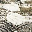
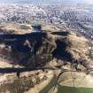
Edinburgh, Holyrood Park, Powderhouse Corner


Enclosure (Period Unassigned), Quarry (Period Unassigned)
Site Name Edinburgh, Holyrood Park, Powderhouse Corner
Classification Enclosure (Period Unassigned), Quarry (Period Unassigned)
Alternative Name(s) Queen's Park; Queen's Drive; Salisbury Crags
Canmore ID 157300
Site Number NT27SE 3978
NGR NT 2730 7280
NGR Description NT 2730 7280 and NT 2731 7275
Datum OSGB36 - NGR
Permalink http://canmore.org.uk/site/157300


- Council Edinburgh, City Of
- Parish Edinburgh (Edinburgh, City Of)
- Former Region Lothian
- Former District City Of Edinburgh
- Former County Midlothian
Field Visit (15 December 1998)
NT27SE 3978 2730 7280 and 2731 7275
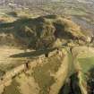
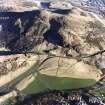
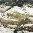
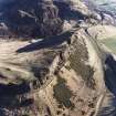
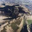
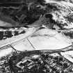
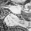
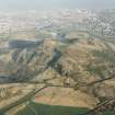
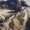
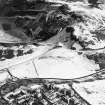
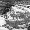
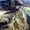
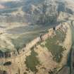
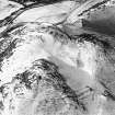
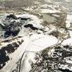
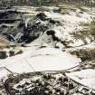
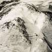
An enclosure (NT 2730 7280) lies at the SE end of Salisbury Crags above the angle in the Queen's Drive known as Powderhouse Corner. It is formed on three sides by a low grass-grown bank 1.8m thick and 0.15m high, and on the fourth, the E, by the foot of rock outcrop. A small quarry (NT 2731 7275) has been cut into outcrop 30m to the SSE. Both are plotted on an archaeological map of Holyrood Park (RCAHMS 1999).
Visited by RCAHMS (ARG), 15 December 1998.
RCAHMS 1999.

