
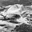
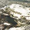
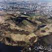
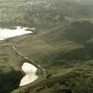
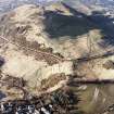
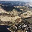
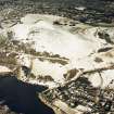
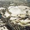
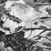
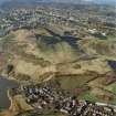
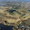
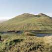
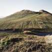
Edinburgh, Holyrood Park, Arthur's Seat


Rig And Furrow (Medieval) - (Post Medieval)
Site Name Edinburgh, Holyrood Park, Arthur's Seat
Classification Rig And Furrow (Medieval) - (Post Medieval)
Alternative Name(s) Queen's Park
Canmore ID 157282
Site Number NT27SE 3968
NGR NT 2809 7289
NGR Description NT 2809 7289 to NT 2802 7305
Datum OSGB36 - NGR
Permalink http://canmore.org.uk/site/157282


- Council Edinburgh, City Of
- Parish Edinburgh (Edinburgh, City Of)
- Former Region Lothian
- Former District City Of Edinburgh
- Former County Midlothian
Field Visit (15 December 1998)
NT27SE 3968 2809 7289 to 2802 7305
See also NT27SE 76 and 135.
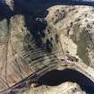
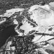
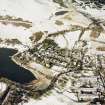
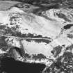
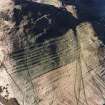
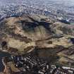
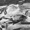
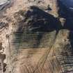
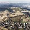
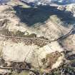
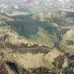
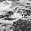
An area of rig-and-furrow cultivation overlies the SE margin of the cultivation terraces below Arthur's Seat (NT27SE 76 and 135). The rigs are aligned from NE to SW and measure between 6m and 7.5m in breadth by up to 0.2m in height. They are plotted at 1:5,550 on an archaeological map of Holyrood Park (RCAHMS 1999).
Visited by RCAHMS (ARG), 15 December 1998.
NMRS, MS/726/96 (84, no. 108); RCAHMS 1999.

