
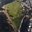
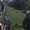
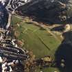
Edinburgh, Holyrood Park, Royal Park Terrace


Air Raid Shelter(S) (Second World War)(Possible)
Site Name Edinburgh, Holyrood Park, Royal Park Terrace
Classification Air Raid Shelter(S) (Second World War)(Possible)
Alternative Name(s) Queen's Park; Meadowbank Lodge
Canmore ID 157270
Site Number NT27SE 3958
NGR NT 2773 7411
NGR Description Centred NT 2773 7411
Datum OSGB36 - NGR
Permalink http://canmore.org.uk/site/157270


- Council Edinburgh, City Of
- Parish Edinburgh (Edinburgh, City Of)
- Former Region Lothian
- Former District City Of Edinburgh
- Former County Midlothian
NT27SE 3958 centred 2773 7411
A cultural heritage survey of Holyrood Park, Edinburgh, was undertaken in February 1996. The survey was designed to identify and evaluate the archaeological remains present withing Holyrood Park, through the examination of desk-based sources and a field inspection. A large number of sites were already recorded within the park and are listed in the NMRS. The following list is of sites not previously recorded (excluding rig and furrow and unassociated field banks), the majority of which relate to quarrying activities or are features associated with 19th-century use and management of the park.
NT 2722 7410 ?Air raid shelters, and allotments.
A full report will be lodged with the NMRS.
Sponsor: Historic Scotland
D Alexander 1996
Field Visit (15 December 1998)
Two rows of three subrectangular hollows lie immediately within the Park wall about 17m to the W of the entrance from Meadowbank. They are aligned from E to W and are of similar dimensions, measuring between 11.5m and 12m in length, and 3.5m and 4.5m in breadth; they are dug 0.5m deep on the uphill side. Each has a hollow in its NW corner suggestive of an entrance. Their function is unknown, but they may be all that remain of air-raid shelters.
This area was given over to allotments in the 1940s, as revealed by RAF vertical aerial photography (CPE/Scot/UK/276 5396, flown 23 August 1947), but the regularity of their plans argues against them being the foundations of huts associated with this phase of use. They are plotted at 1:5,550 on an archaeological map of Holyrood Park (RCAHMS 1999).
Visited by RCAHMS (ARG), 15 December 1998.
NMRS, MS/726/96 (77, no. 90); RCAHMS 1999.
Condition Survey (12 March 2018 - 15 April 2018)
The 2018 CFA Archaeology Ltd condition survey found the site as previously described.
Information from Graeme Carruthers (CFA Archaeology Ltd) July 2018. OASIS ID: cfaarcha1-317194, no.88

