|
Photographs and Off-line Digital Images |
A 54747 |
Records of the Ordnance Survey, Southampton, Hampshire, England |
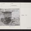
General view |
1971 |
Item Level |
|
 |
On-line Digital Images |
SC 2367010 |
Records of the Ordnance Survey, Southampton, Hampshire, England |
Dornoch, Station Road, St Michael's Well, NH79SE 8, Ordnance Survey index card, page number 1, Recto |
c. 1958 |
Item Level |
|
 |
On-line Digital Images |
SC 2367011 |
Records of the Ordnance Survey, Southampton, Hampshire, England |
Dornoch, Station Road, St Michael's Well, NH79SE 8, Ordnance Survey index card, Recto |
c. 1958 |
Item Level |
|
 |
On-line Digital Images |
SC 2367012 |
Records of the Ordnance Survey, Southampton, Hampshire, England |
Dornoch, Station Road, St Michael's Well, NH79SE 8, Ordnance Survey index card, page number 2, Verso |
c. 1958 |
Item Level |
|
 |
On-line Digital Images |
SC 2367013 |
Records of the Ordnance Survey, Southampton, Hampshire, England |
Dornoch, Station Road, St Michael's Well, NH79SE 8, Ordnance Survey index card, page number 1, Recto |
c. 1958 |
Item Level |
|
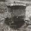 |
On-line Digital Images |
SC 2569863 |
Records of the Ordnance Survey, Southampton, Hampshire, England |
General view |
1971 |
Item Level |
|
|
All Other |
551 166/1/1 |
Records of the Ordnance Survey, Southampton, Hampshire, England |
Archaeological site card index ('495' cards) |
1947 |
Sub-Group Level |
|


