
Creag An Amalaidh


Field System (Period Unassigned), Hut Circle(S) (Prehistoric)
Site Name Creag An Amalaidh
Classification Field System (Period Unassigned), Hut Circle(S) (Prehistoric)
Canmore ID 14750
Site Number NH79NE 1
NGR NH 755 973
Datum OSGB36 - NGR
Permalink http://canmore.org.uk/site/14750


- Council Highland
- Parish Dornoch
- Former Region Highland
- Former District Sutherland
- Former County Sutherland
NH79NE 1 755 973.
(Centred NH 755 973) Settlement and Field System (NR)
OS 6" map, (1969)
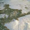
A settlement of five stone-walled huts (A-E) within an associated field system, and two indeterminate structures (X and Y).
Huts A, B, C and D, defined by walls of bare rubble stones, are built up on the slope. The RCAHMS (1911) have described and planned cells, recesses and sophisticated entrances, but in all cases appear to have misinterpreted areas of tumble or fortuitous arrangements. Hut 'E', set into the slope, is overgrown and less substantial than the others.
'A' (RCAHMS No. 117) is about 8.0m in diameter within a wall about 2.0m thick all round. No outer facing-stones and only occasional inner facing-stones are visible. The position of the entrance is not evident. The NE arc is mutilated and a modern track skirts the SW side. The RCAHMS describe the wall widening at the entrance in the NE and several recesses in the inner wall, but these are not evident.
'B' (RCAHMS No. 116, fig. 15) measures about 7.0m in diameter within a wall with both faces visible intermittently, giving a wall thickness of 1.9m. The entrance is not evident. A field wall extends from the SE arc of the hut, and it is partly this, and partly tumble, that the RCAHMS have assumed to be a splayed entrance and chamber.
'C' (RCAHMS No. 112, fig. 13) is 9.0m in diameter within a wall, the inner face of which is visible for the majority of the periphery. One or two outer facing-stones can be seen in the S arc, giving a wall thickness of 1.9m at this point. Elsewhere the wall is spread to about 2.5m widening to about 3.5m at the entrance in the NW, which is apparently 'clubbed'. Outside the lower SW arc of the hut are two or three set stones, possibly a revetment. A field wall extends from the N and S walls of the hut. The RCAHMS describes three recesses, one of which is a later rectangular structure, and the others are due to tumble. Their 'hearth' is a fortuitous arrangement of stones.
'D' (RCAHMS No. 113, fig. 14) is 9.0m in diameter within a wall with both faces visible intermittently, giving a wall thickness of 2.0m widening to about 3.5m at the entrance in the NW, the details of which are obscured by tumble. The RCAHMS describe a bed of stones and two recesses inside the hut, but these are probably due to tumble.
'E' is about 8.0m in diameter within a wall spread to about 2.0m all round. Occasional inner facing-stones are discernible, and a slight gap in the NW arc may indicate the entrance. A field wall skirts the SE side of the hut. The RCAHMS describe the wall widening at the entrance but this is not apparent.
Some 25.0m NNE of hut 'D' is a circular structure described by OS (R D L) as a hut circle. It is defined by a ruined wall spread to about 1.5m and measures about 4.8m between wall centres. No entrance is apparent. It is set slightly into the slope, and may be associated with the settlement, but it seems to be too small for a hut.
A 'possible hut circle' noted by OS (R D L) at NH 7562 9728, is a clearance heap which has been excavated.
'X' is a sub-circular structure described by the RCAHMS as a hut circle of unusual form (RCAHMS No. 111, fig. 12). It measures 5.9m in diameter within a stone wall of indeterminate thickness, faced internally with occasional stones set on edge. The entrance appears to be in the SW, where there is considerable mutilation, obscuring what the RCAHMS describe as a small compartment on its NW side. All that remains of a 'small circular compartment' described by the RCAHMS as abutting on the outer wall in the NW are three set stones on the perimeter of a slight hollow. There is a break of 2.5m in the SSW arc of the main structure leading into a subrectangular annexe which measures about 5.0m NNE-SSW by 3.3m within a wall of similar construction to the main feature.
'Y', described by the RCAHMS as two circular enclosures joined by connecting walls (RCAHMS 1911, No. 114) is similar to 'X' in that it is laid on the slope. It is visible as a subrectangular structure with bowed ends and measures internally 12.0m NW-SE down the slope by 5.0m wide at the higher N end, and 4.0m at the S end, within a wall spread to about 2.2m. Only occasional inner and outer facing-stones can be seen. Internal divisions described by the RCAHMS are not evident and they may have mis-interpreted tumble. No entrance is evident.
An outer enclosure described by the RCAHMS is visible only as a line of seven stones forming no recognisable pattern.
'X' and 'Y' are probably domestic structures of indeterminate period. The field system is defined by stone clearance heaps (some noted as a few small mounds (RCAHMS No. 133), lynchets and field walls forming cultivation plots, average size 20.0m by 15.0m.
RCAHMS 1911, visited 1909; Visited by OS (R D L) 4 April 1964 and
(N K B) 20 November 1969.
Revised at 1:10,000.
Visited by OS (J M) 8 May 1975.
The five hut circles (A-E) and the field system are as described by OS (N K B). The probable domestic structures (X and Y) are hut circles of a 'key-hole' shape, the hut occupying the upper NE side, and the annexe the lower SW. (See NC80NE 21 for type-site enlargement). The circular structure 25m NNE of hut D is a clearance heap which has been dug into. Revised at 1:10,000.
Visited by OS (N K B) 11 June 1981.
Field Visit (7 July 1909)
111. Creag an Amalaidh.
Some 150 yards NW. of the cairn on Creag an Amalaidh (No. 133) is a hut circle of unusual form. The main enclosure is sub-oval in form and is 37' in length. A slight constriction near the middle divides it into two compartments, that at the N. measuring 19' across and that at the S. 12'. The entrance is by a passage 10' long and 2' wide leading into the larger compartment at its SW. end. The wall of the smaller compartment where it bounds the passage takes the form of a mound of earth and stone 7' in width. On the opposite or W. side the passage is flanked by a small circular compartment, of about 4' interior diameter, entering 7' from the exterior through a passage about 3' long. Abutting on the outer main wall towards the NW. is a small circular compartment with an interior diameter of about 6' 6". The walls of the structure have been formed entirely of undressed stone, built without mortar, about 4' 6" in thickness except, as above mentioned, on the side of
the entrance. They are almost completely ruined (fig. 12 [SC 1665067]).
OS 6-inch map: Sutherland Sheet cix.
RCAHMS 1911, visited (AOC) 7th July 1909.

