Balintraid, Pier
Pier (19th Century)
Site Name Balintraid, Pier
Classification Pier (19th Century)
Alternative Name(s) Balintraid Pier; Nigg Bay; Cromarty Firth
Canmore ID 14599
Site Number NH77SW 11
NGR NH 74157 71054
Datum OSGB36 - NGR
Permalink http://canmore.org.uk/site/14599
- Council Highland
- Parish Kilmuir Easter
- Former Region Highland
- Former District Ross And Cromarty
- Former County Ross And Cromarty
NH77SW 11 74157 71054
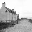
For Pier House (NH 74087 71113), see NH77SW 53.
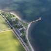
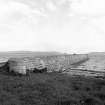
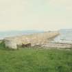
(Location cited as NH737707) Pier, built 1817. A long, straight coursed-rubble pier with curved end.
J R Hume 1977.
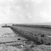
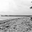
A Telford-designed pier in dilapidated condition. Stone facing is particularly badly eroded on the West side. One section at far end of pier is collapsed. Sand and shingle is accreting on West side and eroding on East side. The last 30m of the pier is in a particularly parlous state subject to storm damage.
CFA/MORA Coastal Assessment Survey 1998.
NH77SW 11 7415 7106
A long, straight coursed-rubble pier with curving tip. Built by Thomas Telford in 1817.
J R Hume 1977
Long, coursed tooled rubble pier with curved seaward end and with high coped rubble protective wall continuous along SW side. (Historic Environment Scotland List Entry)
The 9th report to the Commission on Highland Roads and Bridges, 1821, notes " a Landing Pier of massive dimensions has been erected for the express purpose of faciliatating the importation of lime, coals and other articles of consumption in the very fertile district of Easter Ross, and for the exportation of corn and timber." the cost is noted as amounting to "about Two Thousand Four Hundred Pounds; of which Mr Kenneth Macleay contributes a Moiety." (Am Baile)
Field Visit (2013 - 2014)
This was constructed by Thomas Telford in 1817. The cost when built was about £2,000. A long coursed tooled rubble pier with curved seaward end and with high coped rubble protective wall continuous along SW side. This was built for importing lime, coals and other articles of consumption and for exporting corn and timber.
There is extensive weathering and decay to some of the masonry and the pier is deteriorating. Several sections of the parapet have collapsed and further masonry is being eroded. The main part of the pier is approximately 90m long and the seaward extension a further 15m approximately and it is 7m wide approximately.
There is modern rock armouring on the shore either side of the pier. The pier is in a dilapidated condition. Stone facing is particularly eroded on W side. One section of far end of pier is collapsed and sand and shingle is accreting on W side and eroding on E. The final 30m of pier is severely subject to storm damage.
Visited by Scotland's Coastal Heritage at Risk (SCHARP) 2013


