
Backside Of Lipney


Archaeological Landscape (Post Medieval)
Site Name Backside Of Lipney
Classification Archaeological Landscape (Post Medieval)
Alternative Name(s) Loss Burn
Canmore ID 145031
Site Number NS89NW 72
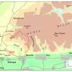
NGR NS 8400 9860
NGR Description Centred on NS 8400 9860
Datum OSGB36 - NGR
Permalink http://canmore.org.uk/site/145031


- Council Stirling
- Parish Logie (Stirling)
- Former Region Central
- Former District Stirling
- Former County Stirlingshire
Field Visit (21 May 1997)
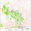
NS89NW 72.00 centred on 8400 9860
NS89NW 72.01 NS 8341 9871 Farmstead (MENS97 76-9)
NS89NW 72.02 NS 8360 9870 Rig; Field-system; Enclosures; Head-dyke
NS89NW 72.03 NS 8381 9853 Huts (MENS97 109, 170)
NS89NW 72.04 NS 8434 9828 Hut (MENS97 145)
NS89NW 72.05 NS 8399 9839 Enclosures
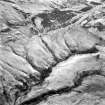
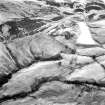
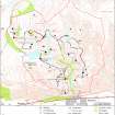
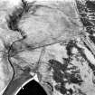
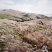
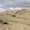
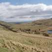
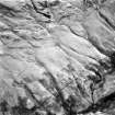
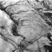
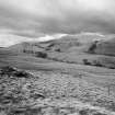
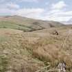
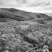
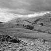
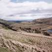
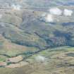
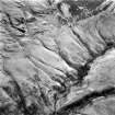
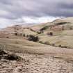
A farmstead and field-system are situated on the sloping ground to the S of the Loss Burn. The farmstead comprises three rectangular buildings (MENS97 76-8) ranged around a courtyard, with an enclosure on the E and a kiln (MENS97 79) to the NNE. A scatter of huts and turf-banked enclosures lie within and at the edges of the field-system.
(MENS97 76-9, 109, 145, 170)
Visited by RCAHMS (DCC) 21 May 1997

