
Ashentrool


Archaeological Landscape (Medieval) - (Post Medieval)
Site Name Ashentrool
Classification Archaeological Landscape (Medieval) - (Post Medieval)
Alternative Name(s) Loss Hill
Canmore ID 144994
Site Number NS89NW 56
NGR NS 8305 9960
NGR Description centred on NS 8305 9960
Datum OSGB36 - NGR
Permalink http://canmore.org.uk/site/144994


- Council Stirling
- Parish Logie (Stirling)
- Former Region Central
- Former District Stirling
- Former County Stirlingshire
Field Visit (5 June 1997)
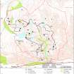
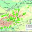
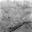
NS89NW 56.00 centred on 8305 9960
NS89NW 56.01 NS 8300 9939 Farmsteads; Enclosures (MENS97 98-101, 136-44)
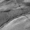
NS89NW 56.02 NS 8300 9960 Field-systems; Enclosures; Trackways; Rig; Head-dyke (Possible)
NS89NW 56.03 NS 8271 9962 Building (MENS97 135)
NS89NW 56.04 NS 8297 9993 Shieling-huts (MENS97 81-5)
NS89NW 56.05 NS 8304 9986 Shieling-huts (MENS97 86-7, 168-9)
NS89NW 56.06 NS 8299 9982 Copper Mine (MENS97 80)
NS89NW 56.07 NS 8318 9971 Hut (MENS97 88)
NS89NW 56.08 NS 8320 9951 Copper Mines; Enclosure
NS89NW 56.09 NS 8357 9935 Building; Enclosure (MENS97 89)
NS89NW 56.10 NS 8299 9969 Mining Activity
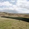
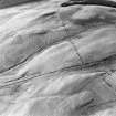
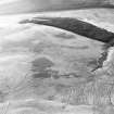
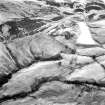
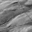
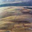
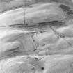
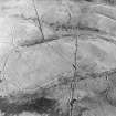
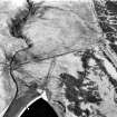
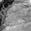
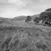
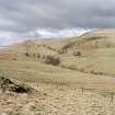
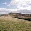
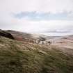
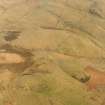
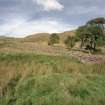
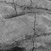
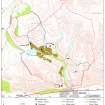
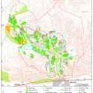
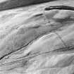
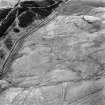
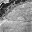
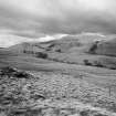
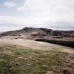
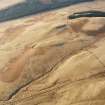
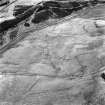
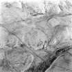
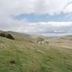
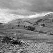
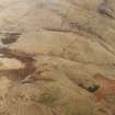
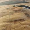
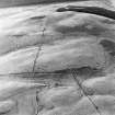
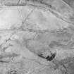
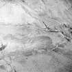
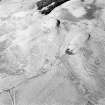
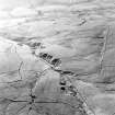
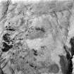
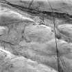
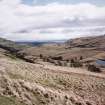
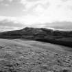
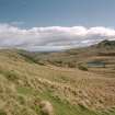
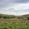
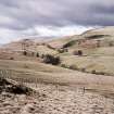
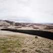
On the hillside around Ashentrool there is an extensive palimpsest of settlement, cultivation remains and mining activity. Settlement is focused around Ashentrool where two distinct phases can be identified. A farmstead which was depicted as ruinous on the 1st edition of the OS 6-inch map (Perthshire and Clackmanannshire 1865-6, sheet cxxxiii; Parts of Stirlingshire 1865-6, sheets x and xi), post-dates three farmsteads to the N. Further buildings and shieling-huts are scattered across the hill.
Cultivation remains, comprising three differing types of rig and an extensive network of banks, cover much of the hill. The banks serve to define cultivated ground, stock enclosures and larger intakes of grazing. Small scale copper mining in the mid-18th century is confined to the flanks of Loss Hill.
(MENS97 80-9, 98-101, 135-44)
Visited by RCAHMS (DCC) 6 May and 5 June 1997

