|
Photographs and Off-line Digital Images |
RC 3343 |
List C Survey |
General view |
1975 |
Item Level |
|
|
Manuscripts |
MS 2776/1/4 |
Historic Scotland Archive Project |
Survey archive: Site record sheets, site record sheets with field notes and monument forms from the Inner Moray Firth (Moray, Beauly and Cromarty Firth) Coastal Assessment Survey. Sheet 4. |
9/1998 |
Item Level |
|
|
Prints and Drawings |
BD 104/1/4 |
Historic Scotland Archive Project |
Survey archive: 1:25,000 OS Pathfinder map depicting site locations from the Moray, Beauly and Cromarty Firth Coastal Assessment Survey. Sheet 4. |
9/1998 |
Item Level |
|
 |
On-line Digital Images |
SC 1643137 |
List C Survey |
General view |
1975 |
Item Level |
|
 |
On-line Digital Images |
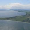
DP 341328 |
Papers of James Sloan Bone, landscape historian, Inverness, Highland, Scotland |
General oblique aerial view of the Inner Moray Firth with Chanonry Ness in the foreground, looking SW. |
18/5/2008 |
Item Level |
|
 |
On-line Digital Images |
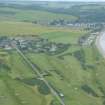
DP 342832 |
Papers of James Sloan Bone, landscape historian, Inverness, Highland, Scotland |
Aerial view of Fortrose golf course and Rosemarkie, Black Isle, looking N. |
26/7/2012 |
Item Level |
|
 |
On-line Digital Images |
SC 2366028 |
Records of the Ordnance Survey, Southampton, Hampshire, England |
Chanonry Ness, Cross, NH75NW 2, Ordnance Survey index card, Recto |
c. 1958 |
Item Level |
|
 |
On-line Digital Images |
SC 2366029 |
Records of the Ordnance Survey, Southampton, Hampshire, England |
Chanonry Ness, Cross, NH75NW 2, Ordnance Survey index card, Recto |
c. 1958 |
Item Level |
|
 |
On-line Digital Images |
SC 2366030 |
Records of the Ordnance Survey, Southampton, Hampshire, England |
Chanonry Ness, Cross, NH75NW 2, Ordnance Survey index card, Verso |
c. 1958 |
Item Level |
|
|
Photographs and Off-line Digital Images |
BS 97/4 CS |
Historic Scotland Archive Project |
Survey photographs: From the Moray, Beauly and Cromarty Firth Coastal Assessment Survey - Avoch, Fortrose and Chanonry Point. |
1998 |
Batch Level |
|
|
All Other |
551 166/1/1 |
Records of the Ordnance Survey, Southampton, Hampshire, England |
Archaeological site card index ('495' cards) |
1947 |
Sub-Group Level |
|


