
Cromal Mount, Ardersier


Earthwork (Medieval), Mound (Medieval), Pin (Bronze)(Period Unassigned)
Site Name Cromal Mount, Ardersier
Classification Earthwork (Medieval), Mound (Medieval), Pin (Bronze)(Period Unassigned)
Alternative Name(s) Campbelltown; Tom Mhoit; Ardersier Motte; Cromwell's Mount; Cromall Mount; Cromal Mount; Hillhead Of Ardersier
Canmore ID 14316
Site Number NH75NE 2
NGR NH 78221 55560
Datum OSGB36 - NGR
Permalink http://canmore.org.uk/site/14316


- Council Highland
- Parish Ardersier
- Former Region Highland
- Former District Inverness
- Former County Inverness-shire
NH75NE 2 7822 5556.
(NH 7822 5556) Cromal Mount (NAT)
Fort (NR] (Remains of)
OS 25" map, Ross-shire, (1870)
Cromal, or Tom, Mhoit, corrupted into Cromwell's Mount, is circular, c. 20' high, with its top surrounded by a rampart aboug 5' high, and which is nearly straight on the W side. An earthen mound once formed a raised approach on the SE; on its removal a section of the rampart in the same arc was also destroyed but revealed a layer of small calcined, or decomposing, stones level with the interior area and exposed fragments of charred wood in the section of the rampart.
New Statistical Account (NSA) 1845; T D Wallace 1888.
A brass pin from Cromwell's Fort, Ardersier, is listed (item no. 139) in an inventory of the Northern Institutions Museum, 1827. This pin may well have been lost between then and 1877, but could be in the present Inverness Museum. Donated by Sir T D Lauder.
J Barron 1915.
Cromall (popularly Cromwell's) Mount is a 'saucer-mote' with a mound of slight elevation and a diameter of 60', within a ditch and rampart. It may not have had a bailey - or this has disappeared.
W M Mackenzie 1927.
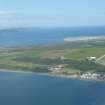
Cromal Mount, a possibly artificial, but more likely natural, sandy hillock on the brink of a raised beach. The sides have partly been scarped and the top levelled, and an earthen rampart (up to 4.0m wide and 1.0m maximum height) has been placed around the brink of the summit enclosing a roughly D-shaped area measuring 35.0m NNW-SSE by 25.0m. The original approach was probably in the E on the line of the modern approach, but quarrying here and in the S has destroyed the rampart and the entrance, and probably the alleged ditch. Some 20.0m E of the base of the hillock is an earthen embankment up to 10.0m wide and 2.5m high surmounted by a modern wall. It is uncertain if this is contemporary with the site or later. The summit of the mound has been mutilated by a concrete water tank.
The site appears to be medieval rather than pre-historic, and probably has been a motte.
Visited by OS (AA) 14 September 1973.
The pin was not seen in Inverness Museum.
Re-surveyed at 1:2500.
Visited by OS (RD) 16 August 1964.
Cromal Mount was surveyed and three trenches cut to assess nature of any archaeological deposits present. No archaeological features were found in the excavated trenches and it was concluded that the present appearance of the site, a well defined mound and bank is the product of quarrying for sand. The remains of a low bank which encloses the summit of the mound on two sides pre-dates the quarry but is of unknown date or purpose. The identification of the site as a motte cannot be confirmed.
Sponsor: SDD HBM-AOC.
S Carter 1989.
Field Visit (April 1979)
Cromal Mount NH 782 555 NH75NE 2
This motte has been scarped from a natural mound which occupies a slight promontory. Sand-digging has removed all traces of a ditch which may have guarded the line of easiest approach. The mound stands about 6m high to a level summit measuring about 25m in diameter within a bank up to 1.5m high.
RCAHMS 1979, visited April 1979
NSA, xiv, Inverness, 470-1; Meldrum 1975, 144
External Reference (14 December 2011)
Scheduled as 'Cromal Mount, mound and earthworks [comprising] the earthwork remains of a late medieval fortification. The remains comprise a re-shaped natural hillock overlooking the Moray Firth to the west. The monument is known locally as Cromal or Cromwell's Mount and lies 70m WSW of Hillhead farm [Hillhead of Ardersier: NH75NE 18].
Information from Historic Scotland, scheduling document dated 14 December 2011.

