Pricing Change
New pricing for orders of material from this site will come into place shortly. Charges for supply of digital images, digitisation on demand, prints and licensing will be altered.
Innermessan
Field Boundary (Post Medieval)(Possible), Rig And Furrow(S) (Medieval) - (Post Medieval)(Possible)
Site Name Innermessan
Classification Field Boundary (Post Medieval)(Possible), Rig And Furrow(S) (Medieval) - (Post Medieval)(Possible)
Canmore ID 141573
Site Number NX06SE 98
NGR NX 08350 63938
NGR Description Centre
Datum OSGB36 - NGR
Permalink http://canmore.org.uk/site/141573
- Council Dumfries And Galloway
- Parish Inch
- Former Region Dumfries And Galloway
- Former District Wigtown
- Former County Wigtownshire
NX06SE 98 centred on NX 08396 63846
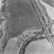
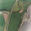
Aerial photography (RCAHMSAP 1995) has identified the cropmarks of a ditch, apparently forming two sides of a possible rectangular enclosure 350m N of Innermessan Farm (NX06SE 54). These two sides appear to join at a corner-angle (reminiscent of Roman camps) and the longer side is visible for about 130m. The cropmarks are situated at the edge of a low cliff overlooking Loch Ryan.
Information from RCAHMS (KB) 23 February 1999
This field boundary has been recorded as a cropmark on oblique aerial photographs (RCAHMSAP 1995). It is depicted on the 1st edition of the OS 6-inch map (Wigtownshire 1849, sheet 85NX06SE). There is also a block of rig orientated SW-NE, with a 7m spacing between furrows.
Information from RCAHMS (KHJM) 21 Nov 2011
Aerial Photographic Transcription (21 November 2011)
Geophysical Survey (10 September 2012 - 15 September 2012)
NX 0839 6384 Two extensive community geophysical surveys were carried out 10–15 September 2012 by volunteers as part of a series of events by Discovering Dumfries and Galloway’s Past, run by the University of Glasgow.
The magnetic survey focused on the area to the N of the base of the Motte of Innermessan (NX06SE 3), whilst the resistivity survey focused on a possible field boundary noted on aerial photographs, 350m to the N of Innermessan Farm (NX06SE 98). A number of features were visible in the resistance survey, which probably related to post-medieval agriculture, and the use of this area in WW2, including pipes connected to an extant 1940s water tank. A number of other features, including possible building platforms may relate to earlier activity in this area. The magnetic survey failed to record any traces of features associated with a bailey, but did locate a double-ditched feature, apparently cut by the motte ditch.
Report: Dumfries and Galloway SMR (intended)
Funder: The Scottish Government and The European Community, Dumfries and Galloway LEADER 2007–2013, The Crichton Foundation and The University of Glasgow
Giles Carey, University of Glasgow
2012
Note (8 June 2022)
The location, classification and period of this site have been reviewed and changed from FIELD BOUNDARY (PERIOD UNASSIGNED)(POSSIBLE), RIG AND FURROW(S) (MEDIEVAL) - (POST MEDIEVAL)(POSSIBLE).


