
Pricing Change
New pricing for orders of material from this site will come into place shortly. Charges for supply of digital images, digitisation on demand, prints and licensing will be altered.
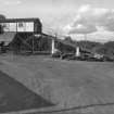
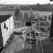
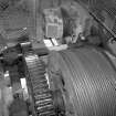
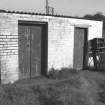
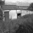
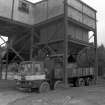
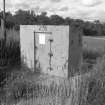
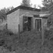
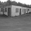
Carbrook Clay Mine


Fire Clay Works (19th Century) - (20th Century)
Site Name Carbrook Clay Mine
Classification Fire Clay Works (19th Century) - (20th Century)
Alternative Name(s) Larbert, Craigend Refactories Ltd.; Torwood Mine
Canmore ID 140166
Site Number NS88NW 49
NGR NS 8350 8546
Datum OSGB36 - NGR
Permalink http://canmore.org.uk/site/140166


- Council Falkirk
- Parish Muiravonside
- Former Region Central
- Former District Falkirk
- Former County Stirlingshire
Closed October 1982

