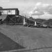
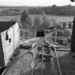
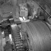
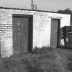
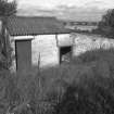
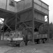
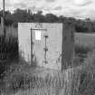
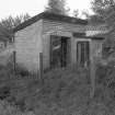
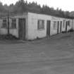
Accessibility

Font Size

100% 150% 200%

Background Colour

Default Contrast
Close Reset

Carbrook Clay Mine

Fire Clay Works (19th Century) - (20th Century)

Site Name Carbrook Clay Mine

Classification Fire Clay Works (19th Century) - (20th Century)

Alternative Name(s) Larbert, Craigend Refactories Ltd.; Torwood Mine

Canmore ID 140166

Site Number NS88NW 49

NGR NS 8350 8546

Datum OSGB36 - NGR

Permalink http://canmore.org.uk/site/140166

Ordnance Survey licence number AC0000807262. All rights reserved.
Canmore Disclaimer. © Bluesky International Limited 2025. Public Sector Viewing Terms

Toggle Aerial | View on large map

Digital Images

Carbrook Clay Mine
View from SE showing winder house and ramp
Digital image of B 10106/8
Carbrook Clay Mine
View from SE showing winder house and ramp
Digital image of B 10106/8Carbrook Clay Mine
View looking ENE down ramp from winder house
Digital image of B 10108/17Carbrook Clay Mine
View showing winder cable drive and final gear drive
Digital image of B 10107/19Carbrook Clay Mine
View looking South East at substation (on left) and battery room (on right)
Digital image of B 10106/7Carbrook Clay Mine
View looking North East at fan room and mine vent shaft outlet
Digital image of B 10106/3Carbrook Clay Mine
View looking South West at winder house and storage area
Digital image of B 10107/15Carbrook Clay Mine
View looking North at steel-built explosive store
Digital image of B 10106/2Detail showing notice on door of explosive store room of Carbrook Clay Mine, Falkirk.
Digital image of B 10105/20Carbrook Clay Mine
View from N showing former explosive store
Digital image of B 10106/6Carbrook Clay Mine
View from E showing offices, stores and 'baths'
Digital image of B 10106/10

Administrative Areas

  • Council Falkirk
  • Parish Muiravonside
  • Former Region Central
  • Former District Falkirk
  • Former County Stirlingshire

Architecture Notes

Closed October 1982

References

MyCanmore Image Contributions


Contribute an Image

MyCanmore Text Contributions