
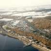
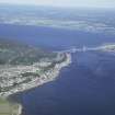
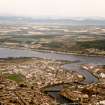
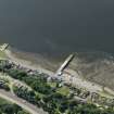
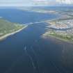
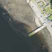
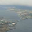
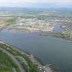
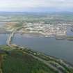
North Kessock, General


Cottage(S) (Period Unknown), Slipway(S) (20th Century)
Site Name North Kessock, General
Classification Cottage(S) (Period Unknown), Slipway(S) (20th Century)
Canmore ID 13394
Site Number NH64NE 41
NGR NH 655 479
NGR Description Centred NH 655 478
Datum OSGB36 - NGR
Permalink http://canmore.org.uk/site/13394


- Council Highland
- Parish Knockbain
- Former Region Highland
- Former District Ross And Cromarty
- Former County Ross And Cromarty

