Accessibility

Font Size

100% 150% 200%

Background Colour

Default Contrast
Close Reset

Allt Bad A' Chrasgaidh

Hut Circle (Prehistoric)

Site Name Allt Bad A' Chrasgaidh

Classification Hut Circle (Prehistoric)

Canmore ID 130415

Site Number NC70SE 60

NGR NC 7512 0187

Datum OSGB36 - NGR

Permalink http://canmore.org.uk/site/130415

Ordnance Survey licence number AC0000807262. All rights reserved.
Canmore Disclaimer. © Bluesky International Limited 2025. Public Sector Viewing Terms

Toggle Aerial | View on large map

Digital Images

Allt Bad a' Chrasgaidh, oblique aerial view, taken from the SSW, centred on a township. A possible homestead, enclosure and building are visible in the top left-hand corner of the photograph, and a hut-circle is shown in the top right-hand corner.
Allt Bad a' Chrasgaidh, oblique aerial view, taken from the SSW, centred on a township. A possible homestead, enclosure and building are visible in the top left-hand corner of the photograph, and a hut-circle is shown in the top right-hand corner.Allt Bad a' Chrasgaidh, oblique aerial view, taken from the NE, centred on a township. Hut-circles, rig and various small cairns are visible in the bottom half of the photograph, and a hut-circle is shown in the top left-hand corner.Allt Bad a' Chrasgaidh, oblique aerial view, taken from the NW, showing a township and a hut-circle.Morvich burn, oblique aerial view, taken from the NE, centred on a township. A hut-circle is visible in the bottom half of the photograph, and enclosures, a building and a structure are shown in the top-right hand corner.Allt Bad a' Chrasgaidh, oblique aerial view, taken from the WNW, centred on a township. A possible homestead, enclosure and building are visible in the bottom left-hand corner of the photograph, and a hut-circle is shown in the top right-hand corner.Allt Bad a' Chrasgaidh, oblique aerial view, taken from the NE, centred on a township. Hut-circles, rig and various small cairns are visible in the bottom half of the photograph, and a hut-circle is shown in the top left-hand corner.Morvich Burn, oblique aerial view, taken from the NW, centred on a township. Sheepfolds are visible in the centre top half of the photograph, a hut-circle in the centre bottom half, and enclosures, a building and a structure are shown in the centre right half.Morvich Burn, oblique aerial view, taken from the NW, centred on a township. Sheepfolds are visible in the centre top half of the photograph, a hut-circle in the bottom right-hand corner, and enclosures, a building and a structure are shown in the centre right half.

Administrative Areas

  • Council Highland
  • Parish Golspie
  • Former Region Highland
  • Former District Sutherland
  • Former County Sutherland

Activities

Field Visit (26 April 1995)

NC70SE 60 7512 0187

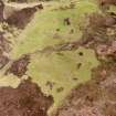
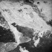
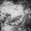
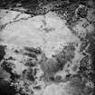
This hut-circle is situated on a rocky terrace to the SE of the township (NC70SE 55). It measures 7m in diameter within a bank, 1m in thickness and 0.6m in height. The inner face, which is composed of large boulders, incorporates at least one in situ erratic. There are gaps in the bank on the WNW, SW and SSE, any of which may have been the entrance.

(ROG95 116)

Visited by RCAHMS (DCC) 26 April 1995

References

MyCanmore Image Contributions


Contribute an Image

MyCanmore Text Contributions