
Achnagarron


Building(S) (19th Century), Hut (19th Century), Poor House (19th Century)
Site Name Achnagarron
Classification Building(S) (19th Century), Hut (19th Century), Poor House (19th Century)
Alternative Name(s) Balclaggan
Canmore ID 123973
Site Number NC70SW 76
NGR NC 7367 0445
Datum OSGB36 - NGR
Permalink http://canmore.org.uk/site/123973

- Council Highland
- Parish Rogart
- Former Region Highland
- Former District Sutherland
- Former County Sutherland
Field Visit (6 July 1995)
NC70SW 76 7367 0445
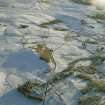
Two buildings and a hut are disposed along a wooded terrace at the base of the ridge to the SE of Achnagarron.
The easternmost structure (ROG95 966, NC 7367 0445) is depicted as roofed on the 2nd edition of the OS 6-inch map (Sutherland 1907, sheet civ) and identified as a poor house. It measures 13.8m from WNW to ESE by 3.6m transversely within mortared rubble walls 0.7m in thickness and up to 1.5m in height.
The second building (ROG95 968, NC 7358 0450), which measures 7.5m by 3m within mortared-rubble footings, lies along the terrace to the WNW and is shown as roofed on both the 2nd edition map and the 1st edition of the OS 6-inch map (Sutherland 1879, sheet civ). A further building, which is shown on the 1st and 2nd editions and the current 1:2500 OS map, has been destroyed by the public road. The hut (ROG95 967, NC 7362 0445) measures 3m by 2.4m within faced-rubble footings and is shown as roofed on both the 1st and 2nd edition maps.
(ROG95 966-8)
Visited by RCAHMS (DCC) 6 July 1995

