|
All Other |
MS 731/17 |
Records of the Royal Commission on the Ancient and Historical Monuments of Scotland (RCAHMS), Edinbu |
Afforestable Land Survey field database (Rogart survey, 1995). Held as attribute table in GIS and in Oracle Field/AP table. Please see DX001425 |
1995 |
Item Level |
|
|
Photographs and Off-line Digital Images |
E 94945 PO |
Papers of James Sloan Bone, landscape historian, Inverness, Highland, Scotland |
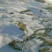
Oblique aerial photograph of Culdrain and Blairmore centred on the remains of hut-circles and cairns in an archaeological landscape, taken from the NNW. |
30/12/2000 |
Item Level |
|
|
Photographs and Off-line Digital Images |
H 92068 PO |
Papers of James Sloan Bone, landscape historian, Inverness, Highland, Scotland |
General oblique aerial view centred on the farmstead and remains of the hut-circles, small cairns, buildings, township and farmsteads, taken from the NNW. |
30/12/2000 |
Item Level |
|
 |
On-line Digital Images |
SC 1906921 |
Papers of James Sloan Bone, landscape historian, Inverness, Highland, Scotland |
Oblique aerial view of the area around Culdrain, Rogart, East Sutherland, looking SE. |
2000 |
Item Level |
|
|
Digital Files (Non-image) |
DX 001425 |
Records of the Royal Commission on the Ancient and Historical Monuments of Scotland (RCAHMS), Edinbu |
RCAHMS Structures Database - Rogart |
1995 |
Item Level |
|
|
Digital Files (Non-image) |
TM 000355 |
Records of the Royal Commission on the Ancient and Historical Monuments of Scotland (RCAHMS), Edinbu |
Zip file containing all survey linework collected during the RCAHMS Afforestable Land Survey of the Rogart area 1995. |
1995 |
Item Level |
|
|
Digital Files (Non-image) |
TM 002205 |
Records of the Royal Commission on the Ancient and Historical Monuments of Scotland (RCAHMS), Edinbu |
Zip file containing all survey linework collected during the RCAHMS Afforestable Land Survey of the Rogart area 1995. SHP and Geojson file formats with extra attribution added to the linework. |
1995 |
Item Level |
|


