Scheduled Maintenance
Please be advised that this website will undergo scheduled maintenance on the following dates: •
Tuesday 3rd December 11:00-15:00
During these times, some services may be temporarily unavailable. We apologise for any inconvenience this may cause.
Dremergid
Field System (Medieval) - (Post Medieval), Hut (Medieval) - (Post Medieval)
Site Name Dremergid
Classification Field System (Medieval) - (Post Medieval), Hut (Medieval) - (Post Medieval)
Canmore ID 122425
Site Number NC70NW 18.04
NGR NC 7383 0644
Datum OSGB36 - NGR
Permalink http://canmore.org.uk/site/122425
- Council Highland
- Parish Rogart
- Former Region Highland
- Former District Sutherland
- Former County Sutherland
Field Visit (9 April 1981)
On a ridge are three hut circles (A-C) (hut C newly located at NC 7375 0661) and an accompanying field system. The complex of features is generally as planned by the RCAHMS (1911).
The field system is denoted by numerous stone clearance heaps, spaced on average from 5.0m to 20.0m apart, with occasional traces of lynchets and banks. With the exception of the two field plots mentioned, no other measurable plots are discernible.
Revised at 1:10,000
Visited by OS (J M) 9 April 1981.
Field Visit (11 May 1995)
NC70NW 18.04 7383 0644
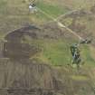
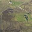
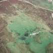
An earth-and-stone field bank encloses a semi-improved subrectangular field to the NNW of Dremergid, within which traces of ridging, measuring about 4m between furrows, are visible. The ridging extends beyond the area shown as improved on the 1st and 2nd editions of the OS 6-inch map (Sutherland 1879, 1907, sheet xcvi); the improved ground corresponds to a patch of smooth ground to the SW of a marked plough scar. To the NE of the plough scar there is a scatter of small cairns and two hut-circles, presumably part of the site to the N (see NC 70NW 18.02 and 03; ROG95 287, 953). A bank along the NW side of the field overlies a further hut-circle (ROG95 289; see NC 70NW 18.02). About 0.5m to the NE of the field bank on the NE side of the field there are the boulder footings of a rectangular hut (ROG95 286, NC 7385 0647) which measures 4.1m from E to W by 2.3m internally.
(ROG95 286)
Visited by RCAHMS (DCC) 11 May 1995


