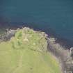
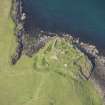
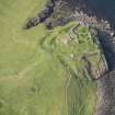
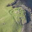
Skye, Duntulm Castle
Castle (Medieval), Dun (Prehistoric)(Possible)
Site Name Skye, Duntulm Castle
Classification Castle (Medieval), Dun (Prehistoric)(Possible)
Alternative Name(s) Dun David; Castle Of Duntulm
Canmore ID 11392
Site Number NG47SW 1
NGR NG 40994 74359
Datum OSGB36 - NGR
Permalink http://canmore.org.uk/site/11392
- Council Highland
- Parish Kilmuir
- Former Region Highland
- Former District Skye And Lochalsh
- Former County Inverness-shire
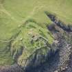
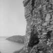
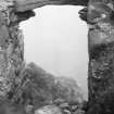
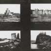
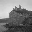
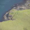
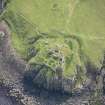
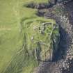
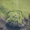
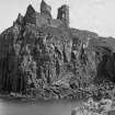
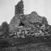
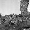
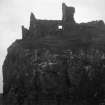
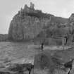
Duntulm Castle, 14 /15th century with subsequent additions Now a much eroded and stone-robbed ruin, sea-girt and defended to landward by a wide ditch. It surmounts an outcrop of pillared basalt on which, in prehistoric times, a broch or dun -Dun Dhaibhidh (David's fort) -is believed to have stood. The late medieval curtain wall of irregular plan was contemporary with a four-storey tower to the landward side, only the vaulted cellar of which survives. The curtain was remodelled in the 16th century when the castle's defences were updated. Abutting the tower immediately to its north, another tower was added, probably as part of the early 17th century renovations (a good section of its wall collapsed as recently as 1990). Duntulm's ascendency as the symbol of Macdonald patrimony peaked around 1650. The original tower was embellished at parapet level and a new rectangular structure erected to the north-west of the enclosure. The only surviving evidence of an entrance is on the seaward side, giving acces to a cleft in the cliff edge which leads down to the sea.
[During the 13th and 14th centuries, Duntulm and the lands of Trotternish were caught up in the rivalry between the Earls of Ross and the Lords of the Isles, and through the later middle ages they continued to be the subject of territorial feuding between the Macdonalds and the Macleods. The 17th century brought a more settled era, Trotternish being finally settled in favour of the Macdonalds. Their return to north Skye was marked by an extensive rebuilding and enlargement of Duntulm, in accordance with their charter of 1618. This required Sir Donald Macdonald ('Donald Gorm Og', 9th chief) to make the castle his residence and, if it be derelict, 'with all convenient diligence prepair materiallis and cause build ane civile and cornelie house'. Duntulm was abandoned for the last time c.1732, its stones used to build Sir Alexander Macdonald's new residence - Monkstadt House, about 5 miles away.]
Taken from "Western Seaboard: An Illustrated Architectural Guide", by Mary Miers, 2008. Published by the Rutland Press http://www.rias.org.uk
NG47SW 1 40994 74359
NG 4098 7434 Duntulm Castle (NR) (Ruins of) Fosse (NR)
OS 6" map, Isle of Skye, Inverness-shire, 2nd ed., (1904)
Duntulm Castle, the later seat of the Macdonalds of Sleat, stands on a quadrangular site 50' above the level of the sea, and has cliffs sinking steeply to the sea on three sides, while the fourth or landward approach slopes downward to a dry ditch cut through rock and earth. Midway a broad track crosses at nearly outside level, but this seems to have been formed in late times for convenience of approach. The depth of the ditch varies, but at some parts, where least worn down, is from 10'- 15'.
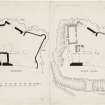
The principal structure of 15th century date, about 82' in length and 30' in breadth, lies athwart the site fronting the ditch, and from the buildings screen walls return, closely following the cliff edge, and enclosure an area, irregular in shape, of about 800 square yards; the interior level of the enclosure is very irregular and there are indications of vaulted substructures, in places built against the outer wall, over nearly the whole of it. A small 17th century tower has been added to the main block, with which it communicated, and projects within the courtyard. Beyond the tower in the NW corner of the enclosure is a later house 34' in length and 15' in breadth within walls 2' 2" thick. The walls of the enciente vary considerably in thickness. The NE angle of the enclosure is a projecting bastion circular on the lower part, the upper part being angular. The E angle of the main block is aldo an angular bastion.
The building throughout is in the local basaltic rubble, some of which is much weather-worn. It is in a very bad condition and much of it has fallen within recent years (RCAHMS 1928).
Historical Note: The earliest reference to Duntulm is by Munro (M Martin 1934) in 1549 where it is noted as 'the castell of Donntwyline pertaining to Donald Gromsone'. Another reference to Duntulm, dated by Skene (1886-90) to the late 16th century, notes it as a ruin; in 1617 the Privy Council required Sir Donald Macdonald of Sleat to make it his seat and if the present buildings were not suitable to build or rebuild. (The ancient seat of the Sleat Macdonalds or Clan Husdein had been Dun Scaich: NG51SE 1 - RCAHMS 1928, No 599).
In or about 1732 Duntulm was abandoned in favour of Monkstadt House (NG36NE 7) the castle providing material for the rebuilding of that place.
The traditional predecessor of this castle was Dun David, or Dun Dhaibhidh. RCAHMS refer to it thus:- "Dun David, now the site of the ruins of Duntulm Castle. Martin (1934) names a Dun David but does not specify it further". On his map Duntulm Castle and Dunvegan Castle are given their own names.
W F Skene 1886-90; RCAHMS 1928; M Martin 1934; J Macintyre 1938; S Gordon 1950.
Duntulm Castle: as described above but in poor condition. No trace of the supposed Dun David was found.
Visited by OS (C F W) 25 April 1961.
NG47SW 1 40994 74359
NMRS REFERENCE
CUTTINGS
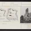
Cutting showing photograph of a portrait of Sir Alexander Macdonald of Sleat with Duntulm Castle in the background.
Original in Scottish National Portrait Gallery
Late 18th Century. - Cutting missing at time of upgrade (19.1.1999)
Non-Guardianship Sites Plan Collection, DC23446.
Field Visit (4 June 1921)
Duntulm Castle.
This later seat of the Macdonalds of Sleat occupies the seaward end of a flat ridge running almost due north on the south side of Port Duntulm, about 2 miles south of Rudha Hunish, the termination of the peninsula of Trotternish and the most northerly point of Skye. It stands on a quadrangular site fifty feet above the level of the sea, and has cliffs sinking steeply to the sea on three sides, while the fourth or landward approach slopes downwards to a dry ditch cut through earth and rock to a width, where most sharply defined, on the western curve, of 14 feet, elsewhere broadening to about 25 feet. Midway a broad track crosses at nearly outside level, but this seems to have been formed in late times for convenience of approach. The depth of the ditch varies, but at some parts, where least worn down, is from 10 to 15 feet. (Fig. 289.)
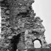
The buildings are arranged in a manner usual on a promontory site. The principal structure, which has been a substantial oblong block of 15th century date, about 82 feet in length and 30 feet in breadth, lies athwart the site fronting the ditch, and from the buildings screen walls return, closely following the sinuosities of the cliff edge, and enclose an area, irregular in shape, of about 800 square yards; the interior level of the enclosure is very irregular and there are indications of vaulted substructures, in places built against the outer walls, over nearly the whole of it. An early photograph familiar in reproduction shows the buildings in much better preservation than at present. The front building is now greatly reduced; the basement has been vaulted and one vaulted chamber still exists at the southern angle. It measures 15 feet 6 inches by 18 feet 1 inch and is partly filled with debris, but can be entered through a broken window in the southern face; the vault rises to about 8 feet above the present floor. There is an aumbry at the northern end and a fireplace with flue through the vaulting at the south-east corner. There has been, apparently, a second vaulted chamber adjoining, and beyond this to the east the principal entrance, which has passed through the block to the courtyard. A tall 17th century tower, measuring 16½ by 13½ feet, has been added to the main block, with which it communicated, and projects within the courtyard; it contained a vaulted storey at the level of the upper floor of the main block, an upper storey and an attic floor, but there may be an undercroft under the debris and not now accessible. In the vaulted storey a scale and platt stair has been inserted at a later time. The roof was gabled and the north gable remains, the skewput having the usual cavetto. A window, 4 feet by 2 feet 6 inches, with a pointed arch head lit the vaulted chamber. Beyond the tower in the north-west corner of the enclosure is a later house 34 feet in length and 15 feet in breadth within walls 2 feet 2 inches thick. The west wall is built against the wall of enceinte, while the north gable is built upon the wall. There is an opening through both walls on the west side, 3 feet wide, and to the south of it a silled opening in the east wall with a wider gap. There are joist holes in both lateral walls, 7 feet inches from ground level.
The walls of the enceinte vary considerably in thickness. The west face, which is throughout original, has a thickness of 4 feet 4 inches. At the north-west corner is a corbelled projection about 10 feet from the ground constructed in thin continuous slabs of stone. The projection still rises to some 4 or 5 feet in height and is some 4½ feet wide on each side of the angle, while the lower slabs are continued as a string-course along the northern face of the wall as far as a re-entrant angle. From this angle the wall returns as a flat receding angle and near the apex is a postern or sea-gate which opens below the level of the present interior, as the ground outside is but a narrow ledge, which drops to the sea-level in perpendicular cliffs; access here could be got only by some artificial means. The north-eastern angle of the enclosure is a projecting bastion circular on the lower part, the upper part being angular. The eastern angle of the main block is also an angular bastion. The building throughout is in the local basaltic rubble, some of which is much weather worn. It is in a very bad condition and much of it has fallen within recent years. To the south of the castle is a natural oval mound about 3 feet high with a very slight rampart or rim round the top known as Cnoca Mhoid ("Moot Hill ").
HISTORICAL NOTE. The earliest specific mention of Duntulm is in the Description of the Isles appended to Skene's Celtic Scotland (vol. iii. p. 432), which he dates between 1577 and 1595 : "Thair was ane castell in Trouternes callit Duncolmen (c was frequently confused with t), quhairof the wallis standis yet." The next is in the obligation imposed upon Sir Donald Macdonald of Sleat by the Privy Council in 1617: "that the said Sir Donald sall makhis residence and duelling at Duntillum, and, yf he has not a sufficient comelie house ansuerableto his estate alreddy thair that he sall withall convenient diligence prepair materiallis andcaus build ane civile and comelie house, and, yf his hous be decayit, that he sall repair and mend the same."
The history of Duntulm is bound up with that of the Trotternish lands, which, after the forfeiture of the Macdonald, Lords of the Isles, became a royal baillary. In 1498 Alexander Macleod of Dunvegan was granted the office of baillie. Later, however, in the same month and year the same office was conferred upon Torquil Macleod of Lewis with the lands of "Duntullyn," i.e. Duntulm (1). But in 1510 Gilleasbuig Dubh, son of Hugh Macdonald ofSleat, was baillie (2), and from this time the Sleat family maintained a claim on these lands as rivals of the Dunvegan Macleods. In 1549 Trotternish is said by Dean Monro to belong to Donald (Macdonald) Gormson of Sleat. Finally, during the closing years of the 16th century a series of royal charters to Donald Gorm Mor, culminating in a confirmation of 1618 to his successor, Donald Gorm Og ("the younger "), settled the Trotternish lands upon the Sleat family, who were to compensate the Dunvegan Macleods with a sum of money. Thereafter Sir Donald was to make his dwelling at Duntulm, as expressed above. The ancient seat of the Sleat Macdonalds or Clan Huisdein had been Dun Scaich (NG51SE 1). In all the various official documents applying to these Trotternish lands there is no reference to the castle.
RCAHMS 1928, visited 4 June 1921.
OS map: Skye iv.
(1) R.M.S., s.a., Nos. 2420, 2424 ; (2) Reg. Sec. Sig., in Origines Parochiales, ii., part 1, p. 351.
Publication Account (1985)
There has probably been a defensive structure on the site of the castle at Duntulm for centuries, but the ruined buildings which now stand there have obliterated any traces of an earlier fortress. The lands of Trotternish were the subject of rival claims by the MacLeods of Dunvegan and the MacDonalds of SIeat, and it was probably to consolidate their possession that the MacDonalds moved to Duntulm from Dun Scaich (no. 24) in the early 17th century. King James V visited the castle in 1540 and is said to have been favourably impressed by its strength and hospitality, but in the early 17th century Sir Donald MacDonald improved it as a dwelling. It was abandoned about 1730 when the family went to live at Monkstadt, a little further south.
The castle stands on a crag, with cliffs and steep slopes on three sides and a dry ditch on the fourth. The earliest surviving structure is a rectangular building facing the ditch, with a wall enclosing the summit of the rock. Very little of this earliest building remains, though there is a barrel-vaulted basement at the southwest corner. The main entrance was across the ditch, but there is also a sea-gate in the wall on the opposite side of the courtyard. A small tower with a vaulted room on the ground floor was added in the 17th century and parts of this tower still stand to the full height. Another building was added in the north-west corner of the courtyard.
Among those who died in the dungeon here was Hugh MacDonald, cousin of Don aid Gorm, the 8th chief He had plotted to supplant Donald Gorm but the plan miscarried and, after hiding in Dun an Sticir, North Uist (no. 57) for some time, Hugh was captured and left in the dungeon at Duntulm with a plate of salt beef and an empty pitcher.
Information from ‘Exploring Scotland’s Heritage: Argyll and the Western Isles’, (1985).


