
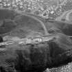
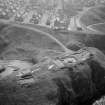
Portknockie, General


Village (Period Unassigned)
Site Name Portknockie, General
Classification Village (Period Unassigned)
Canmore ID 106904
Site Number NJ46NE 31
NGR NJ 4896 6844
NGR Description Centred NJ 4896 6844
Datum OSGB36 - NGR
Permalink http://canmore.org.uk/site/106904


- Council Moray
- Parish Rathven
- Former Region Grampian
- Former District Moray
- Former County Banffshire
NJ46NE 31 centred 4896 6844

