Following the launch of trove.scot in February 2025 we are now planning the retiral of some of our webservices. Canmore will be switched off on 24th June 2025. Information about the closure can be found on the HES website: Retiral of HES web services | Historic Environment Scotland
Killegray, Teampull Na H' Annait
Burial Ground (Medieval), Chapel (Medieval), Well (Medieval)
Site Name Killegray, Teampull Na H' Annait
Classification Burial Ground (Medieval), Chapel (Medieval), Well (Medieval)
Alternative Name(s) Killigray House
Canmore ID 10475
Site Number NF98SE 1
NGR NF 97523 84672
Datum OSGB36 - NGR
Permalink http://canmore.org.uk/site/10475
- Council Western Isles
- Parish Harris
- Former Region Western Isles Islands Area
- Former District Western Isles
- Former County Inverness-shire
Field Visit (6 June 1914)
Church, Island of Killegray.
At the north-western extremity of the island of Killegray in the Sound of Harris, on a small promontory rising direct some 20 feet above the shore, are the grass-covered foundations of a rectangular building rising less than a foot above the ground. It lies almost due east and west, and measures 21 feet in length by 12 feet in breadth internally, the mound of the wall being about 3 feet 6 inches thick. The door seems to have been in the centre of the western gable. About ¼ mile to the south is a fine spring of water. The church and the well are in all likelihood the Teampull na h'Annait and the Tobar na h'Annait mentioned in The Statistical Account, X., p.375. Part of the wall of Killegray House, according
to local tradition, is all that remains of an old church said to have occupied this site.
RCAHMS 1928, visited 6 June 1914.
Harris xxii (unnoted).
Desk Based Assessment (29 March 1966)
(NF 9752 8468) Burial Ground (Disused) (NAT)
OS 6" map, Inverness-shire, 2nd ed., (1903
(Area: NF 975 846) The grass-covered foundations of a rectangular building (less than 12ins above ground) lie at the NW extremity of Killigray, on a small promontory rising direct some 20ft above the shore. Almost due E-W, they are 12 x 21ft, the mound of the wall 3 1/2ft thick, with a door probably in the centre of the W gable. The church, and a well (1/4 mile to the S- at NF 9748 8418), are thought to be the Teampull na h'Annait and the Tobar na h'Annait mentioned in the Stat. Acct.
Part of the wall of Killigray House (NF 9769 8414) according to local tradition, is all that remains of an old church said to have occupied this site.
Information from OS (BRS) 29 March 1966
OSA 1795; RCAHMS 1928.
Field Visit (7 July 1969)
The footings of a small chapel, known locally as Teampull na h' Annait, measuring externally 8.6m E-W and 5.5m N-S, situated within a disused burial ground. The outer wall face is evident and survives to about 4 courses at the NE corner, giving a width of c.0.9m. The W wall is pierced for a doorway.
At least one grave can be seen within the chapel and there are a number in the burial ground marked by crude head- and foot-stones.
No evidence of a church was seen at Killegray House, now derelict.
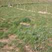
At NF 9747 8421 there is a spring enclosed within a drystone wall and covered by a large stone lintel, probably Tobar na h'Annait. It is now disused and silted up, but water still issues.
Chapel and well re-surveyed at 1/10000.
Visited by OS (N K B), 7 July 1969.
Field Visit (22 June 2012)
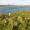
The remains of this medieval chapel and burial-ground stand on an exposed and eroding headland at the extreme N end of Killegray. The chapel measures 8.5m from E to W by 5m transversely over walls reduced to little more than grass-grown footings 0.9m thick and surviving up to 0.6m high in three courses at the NE corner, now exposed by erosion. A doorway, 1m wide, is situated in the middle of the W end. The burial-ground is roughly oval on plan and measures a maximum of about 20m from E to W by 15m transversely. Defined by the eroding coastal edge elsewhere, it is demarcated by a break of slope at the S and a short stretch of bank at the SW, 0.4m in width and 0.3m in height. It contains seventeen simple stone grave markers, one of them standing within the chapel, and the remainder to the S.
The chapel had evidently gone out of use long before the end of the 18th century when its remains were described as ‘faint traces' in the Statistical Account (1791-9 vol.10, 375). The 1st edition of the OS 6 inch map (Inverness-shire (Hebrides) 1882, Sheet XXII), depicts only the burial ground, annotating it as (Disused), a status supported by the contemporary Name Book (Harris No.5, p.163) which refers to the burial-ground as ‘seldom or never used’. In addition to visits by RCAHMS and the Ordnance Survey in the 20th century, the burial-ground was noted by JS McEwen in 1966 (MS 2321/05). The spring noted in previous descriptions is situated about 485m to the S (at NF 97491 84170). It now provides the water to Killegray House, and is covered by a mesh screen and protected within a fenced enclosure.
Visited by RCAHMS (GFG) 22 June 2012


