Pricing Change
New pricing for orders of material from this site will come into place shortly. Charges for supply of digital images, digitisation on demand, prints and licensing will be altered.
Field Visit


Date 18 March 2009
Event ID 579744
Category Recording
Type Field Visit
Permalink http://canmore.org.uk/event/579744
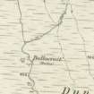
This remains of this smallholding, which comprise a building, two enclosures and cultivation remains, are situated in rough ground on the N side of a tributary into the Glenmore Burn, 125m NE of Achavoulaig Butt (NS07SW 23). The single drystone building is generally as described by previous authorities, with its entrance to the NW and a later pen in the N corner. There are turf walled enclosures to the NE and SW and cultivation remains to the SE. A Foulis estate map (1758-9) depicts a single building and a yard in this position, at the extreme S of the lands of Balnakailly farmstead (NS07SW 29). The building and yards are also depicted on Mackinlay's map of 1823.
Visited by RCAHMS (GFG, ARG) 18 March 2009.