Pentland Hills
551 232/6
Description Pentland Hills
Collection Scotland's Rural Past
Catalogue Number 551 232/6
Category All Other
Permalink http://canmore.org.uk/collection/1541061
Description Pentland Hills
Collection Scotland's Rural Past
Catalogue Number 551 232/6
Category All Other
Permalink http://canmore.org.uk/collection/1541061
Collection Level (551 232) Scotland's Rural Past
> Batch Level (551 232/6) Pentland Hills
| Preview | Category | Catalogue Number | Title | Date | Level |
|---|---|---|---|---|---|
 |
On-line Digital Images | DP 106297 | Logan Burn: building (Hare Hill House) viewed from N side of valley | 27/2/2011 | Item Level |
 |
On-line Digital Images | DP 106298 | Logan Burn: building (Hare Hill House) viewed from SW (photographed by Robin Murdoch) | 24/3/2007 | Item Level |
 |
On-line Digital Images | DP 106299 | Logan Burn: building (Hare Hill House) viewed from NW (photographed by Robin Murdoch) | 24/3/2007 | Item Level |
 |
On-line Digital Images | DP 106300 | Logan Burn: building (Hare Hill House) viewed from S showing terrace on S side of building | 20/7/2008 | Item Level |
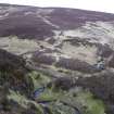 |
On-line Digital Images | DP 106301 | Logan Burn: enclosure and access track viewed from N | 27/2/2011 | Item Level |
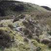 |
On-line Digital Images | DP 106302 | Logan Burn: enclosure wall viewed from W | 22/4/2008 | Item Level |
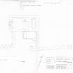 |
On-line Digital Images | SC 1248665 | Measured survey of Hare Hill House, Logan Burn drawn at 1:100 | 28/2/2011 | Item Level |
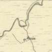 |
On-line Digital Images | SC 1248666 | Logan Burn as depicted on the 1st Edition of the Ordnance Survey 6-inch map (Edinburghshire 1853, sheet 11) | 9/2011 | Item Level |
 |
On-line Digital Images | DP 106305 | Capelaw: view of farmstead and enclosure looking SW (photographed by Ken Adams during site survey) | 17/5/2008 | Item Level |
 |
On-line Digital Images | DP 106306 | Capelaw: looking SW towards Kirkton, showing upstanding SE (front) and SW (end) walls | 19/4/2008 | Item Level |
 |
On-line Digital Images | DP 106307 | Capelaw: looking NE, showing boulder foundation and upper mortared courses in the upstanding SW (end) wall | 16/11/2010 | Item Level |
 |
On-line Digital Images | DP 106308 | Capelaw: looking SE, showing two phases of build in the SE (front) wall (facing) | 25/1/2011 | Item Level |
 |
On-line Digital Images | SC 1248673 | Capelaw as depicted on the 1st Edition of the Ordnance Survey 6-inch map (Edinburghshire 1854, sheet 12) | 9/2011 | Item Level |
 |
On-line Digital Images | SC 1248674 | Capelaw: measured survey drawn at 1:100 | 24/1/2011 | Item Level |
 |
On-line Digital Images | DP 106399 | Cockrigend: ruins of farmstead (1) | 2010 | Item Level |
 |
On-line Digital Images | DP 106400 | Cockrigend: ruins of farmstead (2) | 2010 | Item Level |
 |
On-line Digital Images | DP 106401 | Cockrigend: looking W | 2010 | Item Level |
 |
On-line Digital Images | DP 106402 | Cockrigend: looking S | 2010 | Item Level |
 |
On-line Digital Images | DP 106403 | Cockrigend: looking N | 2010 | Item Level |
 |
On-line Digital Images | DP 106404 | Cockrigend: eroded river bank at NT 14805 58738 | 2010 | Item Level |
 |
On-line Digital Images | DP 106405 | Cockrigend: sheepfold at NT 15005 58647 | 2010 | Item Level |
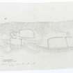 |
On-line Digital Images | SC 1248932 | Cockrigend:measures survey drawn by Midlothian Field Group | 1983 | Item Level |
 |
On-line Digital Images | DP 106284 | Upper Friarton looking W, showing rubble walls in E end | 18/3/2008 | Item Level |
 |
On-line Digital Images | DP 106285 | Upper Friarton looking N towards Spital Farm | 18/3/2008 | Item Level |

© Historic Environment Scotland. Scottish Charity No. SC045925