Pentland Hills
551 232/6
Description Pentland Hills
Collection Scotland's Rural Past
Catalogue Number 551 232/6
Category All Other
Permalink http://canmore.org.uk/collection/1541061
Description Pentland Hills
Collection Scotland's Rural Past
Catalogue Number 551 232/6
Category All Other
Permalink http://canmore.org.uk/collection/1541061
Collection Level (551 232) Scotland's Rural Past
> Batch Level (551 232/6) Pentland Hills
| Preview | Category | Catalogue Number | Title | Date | Level |
|---|---|---|---|---|---|
 |
On-line Digital Images | DP 106323 | Grain Burn: square structure and lazy beds in NW of enclosure | 11/4/2009 | Item Level |
 |
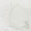
On-line Digital Images | SC 1248695 | Grain Burn: measured survey drawn at 1:500 by Midlothian Field Group (drawn up by Jane Murray) | 4/1983 | Item Level |
 |
On-line Digital Images | DP 106324 | Fala Knowe: looking E towards Lawhead Farm | 28/3/2009 | Item Level |
 |
On-line Digital Images | DP 106325 | Fala Knowe: NW wall | 28/3/2009 | Item Level |
 |
On-line Digital Images | DP 106326 | Fala Knowe: NW corner | 28/3/2009 | Item Level |
 |
On-line Digital Images | DP 106327 | Fala Knowe: SE corner | 28/3/2009 | Item Level |
 |
On-line Digital Images | DP 106328 | Fala Knowe: enclosure bank looking SW | 12/7/2008 | Item Level |
 |
On-line Digital Images | DP 106329 | Fala Knowe: N gatepost in Penicuick/Logan estates' march dyke | 28/3/2009 | Item Level |
 |
On-line Digital Images | DP 106330 | Fala Knowe: S gatepost in Penicuick/Logan estates' march dyke | 28/3/2009 | Item Level |
 |
On-line Digital Images | SC 1248706 | Fala Knowe as depicted on the 1st Edition of the Ordnance Survey 6-inch map (Edinburghshire 1854, sheet 12) | 9/2011 | Item Level |
 |
On-line Digital Images | SC 1248707 | Fala Knowe: measured survey of building, enclosure and rig drawn at 1:200 | 16/3/2010 | Item Level |
 |
On-line Digital Images | SC 1248708 | Fala Knowe: measured survey of building drawn at 1:100 | 16/3/2010 | Item Level |
 |
On-line Digital Images | DP 106276 | Gutterford: viewed from Cock Rig, looking E | 16/10/2008 | Item Level |
 |
On-line Digital Images | DP 106277 | Gutterford: viewed from above, looking SW (1) | 16/10/2008 | Item Level |
 |
On-line Digital Images | DP 106278 | Gutterford: viewed from above, looking SW (2) | 16/10/2008 | Item Level |
 |
On-line Digital Images | DP 106279 | Gutterford: looking NE, showing shelter wall extending from SW corner of building | 16/10/2008 | Item Level |
 |
On-line Digital Images | DP 106280 | Gutterford: looking NW, showing pen attached to SE wall | 16/10/2008 | Item Level |
 |
On-line Digital Images | DP 106281 | Gutterford: boundary stone in wall leading to Cock Rig summit (c NT 155 595) | 16/10/2008 | Item Level |
 |
On-line Digital Images | SC 1248635 | Gutterford as depicted on the 1st Edition of the Ordnance Survey 6-inch map (Edinburghshire 1853-8, sheet xvii) | 9/2011 | Item Level |
 |
On-line Digital Images | DP 106318 | Saltersyke: E end of building (two-compartment 19th c phase) | 8/3/2011 | Item Level |
 |
On-line Digital Images | DP 106319 | Saltersyke: W end of building (earlier phase) 1 | 22/4/2008 | Item Level |
 |
On-line Digital Images | DP 106320 | Saltersyke: W end of building (earlier phase) 2 | 22/4/2008 | Item Level |
 |
On-line Digital Images | SC 1248688 | Saltersyke as depicted on the 1st Edition of the Ordnance Survey 6-inch map (Edinburghshire, 1852 , sheet 17) | 9/2011 | Item Level |
 |
On-line Digital Images | SC 1248689 | Saltersyke: measured plan drawn at 1:100 | 27/3/2011 | Item Level |

© Historic Environment Scotland. Scottish Charity No. SC045925