 |
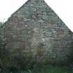
On-line Digital Images |
DP 085384 |
Threipmuir: E gable of long range (rebuilt W gable of unit G) |
25/11/2008 |
Item Level |
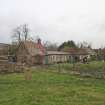 |
On-line Digital Images |
DP 085385 |
Threipmuir: view by Ken Adams |
25/11/2008 |
Item Level |
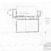 |
On-line Digital Images |
SC 1209219 |
Threipmuir: measured survey created at 1:200 |
6/2008 |
Item Level |
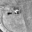 |
On-line Digital Images |
DP 085386 |
Threipmuir: enlarged extract of aerial photograph OS_69_235_400 shown at 1:1000 (Crown Copyright Ordnance Survey) |
5/2008 |
Item Level |
 |
On-line Digital Images |
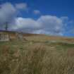
DP 085566 |
Kirkton Cottage and Garden |
10/3/2008 |
Item Level |
 |
On-line Digital Images |
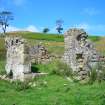
DP 085567 |
Kirkton Cottage porch |
10/3/2008 |
Item Level |
 |
On-line Digital Images |
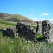
DP 085568 |
Kirkton Cottage looking N to Capelaw |
10/3/2008 |
Item Level |
 |
On-line Digital Images |
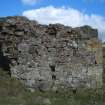
DP 085569 |
Kirkton Cottage W wall double drain |
10/3/2008 |
Item Level |
 |
On-line Digital Images |
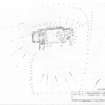
SC 1209598 |
Kirkton Cottage measured survey |
8/3/2008 |
Item Level |
 |
On-line Digital Images |
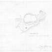
SC 1248641 |
Boghall Burn: measured survey of enclosure drawn at 1:300 by by Midlothian Field Group, 5 May 1983 |
14/9/2010 |
Item Level |
 |
On-line Digital Images |
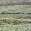
DP 106288 |
Leips: central enclosure viewed from above, looking S towards Woodhouselee Hill rig. The top line of whins lie in the middle of the enclosure. |
2/5/2011 |
Item Level |
 |
On-line Digital Images |
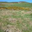
DP 106289 |
Leips: building in central enclosure, looking N |
2/5/2011 |
Item Level |
 |
On-line Digital Images |
DP 106290 |
Leips: NW corner of building in central enclosure, looking SE towards E enclosure and Woodhouselee Hill rig |
2/5/2011 |
Item Level |
 |
On-line Digital Images |
DP 106291 |
Leips: E enclosure looking E along S wall |
2/5/2011 |
Item Level |
 |
On-line Digital Images |
SC 1248651 |
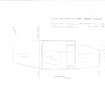
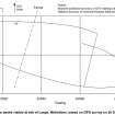
Leips: measured survey drawn at 1:500 (incorporating 1983 sketch and 2011 GPS survey) |
19/5/2011 |
Item Level |
 |
On-line Digital Images |
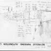
SC 1248652 |
Leips: GPS plot of enclosure by Don Matthews, EAFS, 17 May 2011 |
17/5/2011 |
Item Level |
 |
On-line Digital Images |
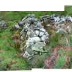
SC 1248653 |
Leips: field sketch by Geoff Water sketch per Midlothian Field Group, 5 May 1983 |
5/5/1983 |
Item Level |
 |
On-line Digital Images |
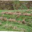
DP 106310 |
Back Spittal: front of principal building looking NE (photographed by Ken Adam) |
19/5/2009 |
Item Level |
 |
On-line Digital Images |
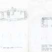
DP 106311 |
Back Spittal: rear of principal building looking SW (photographed by Ken Ada |
19/5/2009 |
Item Level |
 |
On-line Digital Images |
DP 106312 |
Back Spittal: measured survey |
5/2009 |
Item Level |
 |
On-line Digital Images |
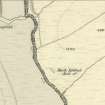
DP 106313 |
Back Spittal as depicted on the 1st Edition of the Ordnance Survey 6-inch map (Edinburghshire 1853-8, sheet xvii) |
9/2011 |
Item Level |
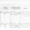 |
On-line Digital Images |
SC 1248680 |
Back Spittal as described in the Name Book for the 1st Edition of the Ordnance Survey 6-inch map (Edinburghshire 1853-8, sheet xvii) |
12/1/2009 |
Item Level |
 |
On-line Digital Images |
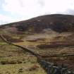
DP 106321 |
Grain Burn: looking SW, showing Penicuik / Logan estate boundary wall overlying the SE edge of the enclosure |
11/4/2009 |
Item Level |
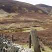 |
On-line Digital Images |
DP 106322 |
Grain Burn: looking SW towards enclosure (centre) and Grain Hill (rear) |
11/4/2009 |
Item Level |


