551 434/7/3
Description Rubh An Dunain
Collection Dr Colin and Dr Paula Martin
Catalogue Number 551 434/7/3
Category All Other
Permalink http://canmore.org.uk/collection/1407344
Collection Hierarchy - Sub-Group Level
Collection Level (551 434) Dr Colin and Dr Paula Martin
> Group Level (551 434/7) Maritime Landscape
>> Sub-Group Level (551 434/7/3) Rubh An Dunain
| Preview | Category | Catalogue Number | Title | Date | Level |
|---|---|---|---|---|---|
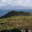 |
On-line Digital Images | DP 175315 | Headland fort from the NE, looking towards Rum. (Colin Martin) | 2008 | Item Level |
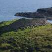 |
On-line Digital Images | DP 175316 | Headland fort from the NE. (Colin Martin) | 2008 | Item Level |
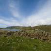 |
On-line Digital Images | DP 175318 | Headland fort, wall from interior looking N over Loch na h-Airde. (Edward Martin) | 2008 | Item Level |
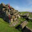 |
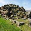
On-line Digital Images | DP 175320 | Headland fort, entrance. Scale 2 metres. (Colin Martin) | 2008 | Item Level |
 |
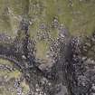
On-line Digital Images | DP 175322 | Headland fort, interior of wall showing scarcement. Scale 2 metres. (Colin Martin) | 2008 | Item Level |
 |
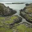
On-line Digital Images | DP 175326 | Vertical photograph by aerial drone of the two nausts with their upper hauling bays. (Edward Martin) | 2008 | Item Level |
 |
On-line Digital Images | DP 175327 | The nausts at mid-tide, with the water just beginning to enter the lower basins. (Colin Martin) | 2008 | Item Level |
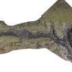 |
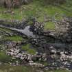
On-line Digital Images | DP 175328 | Rectified vertical photomosaic of the canal, quay, and nausts taken by aerial drone. (Edward Martin) | 2008 | Item Level |
 |
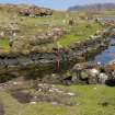
On-line Digital Images | DP 175330 | Oblique panorama of the upper canal and nausts. (Edward Martin) | 2008 | Item Level |
 |
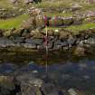
On-line Digital Images | DP 175331 | The upper canal from the edge of the northernmost naust. The 2-m pole marks a distinctive change in the stonework of the revetment on the far side of the canal. (Colin Martin) | 2008 | Item Level |
 |
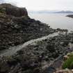
On-line Digital Images | DP 175332 | Detail of the change in the stonework between the lower and upper sectors of the canal. Scale 2 metres. (Colin Martin) | 2008 | Item Level |
 |
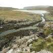
On-line Digital Images | DP 175333 | The lower end of the canal’s outlet to the sea, photographed at low water. This sector is not strictly a canal, but a cleared strip which runs towards the nausts to facilitate landing. Even so, some revetment to the edges is evident. The headland fort is visible at the upper left. (Colin Martin) | 2008 | Item Level |
 |
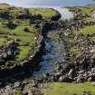
On-line Digital Images | DP 175334 | The upper canal leading into Loch na h-Airde. The naust entrances are partly obscured (centre right), while the blockage of the canal towards its entrance into the loch is clear. (Colin Martin) | 2008 | Item Level |
 |
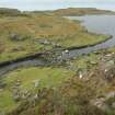
On-line Digital Images | DP 175335 | The upper canal leading into Loch na h-Airde, with the blockage part-way along it. The left-hand revetment is relatively intact, but that on the right appears to have been dismantled to its foundations and the stones thrown onto the bank. Tradition asserts that this was done to bring larger vessels into the loch. (Colin Martin) | 2008 | Item Level |
 |
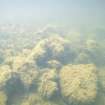
On-line Digital Images | DP 175337 | The upper canal leading into Loch na h-Airde, with the blockage part-way along it. (Colin Martin) | 2008 | Item Level |
 |
On-line Digital Images | DP 175340 | Tumbled stonework from the quay on the E side of the canal entrance into Loch na h-Airde. (Colin Martin) | 2008 | Item Level |
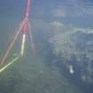 |
On-line Digital Images | DP 175342 | The edge of the quay on the E side of the canal entrance into Loch na h-Airde. (Colin Martin) | 2008 | Item Level |
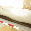 |
On-line Digital Images | DP 175345 | Boat component discovered at the N end of the loch by Dr David Macfadyen in 2000. It is a bite, part of a small four-oared boat of Norse type, and has been C14-dated to around 1100 AD. Scale 50 centimetres. (Colin Martin) | 2008 | Item Level |
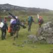 |
On-line Digital Images | DP 175349 | Access to Rubh’ an Dùnain is not easy. By land the loch is a 5-mile trek each way, often in poor weather and carrying equipment. This severely restricted work on the site in 2009. (Colin Martin) | 2008 | Item Level |
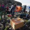 |
On-line Digital Images | DP 175352 | Filming, archaeological, and aerial drone equipment come ashore at Rubh’ an Dùnain. The drone system is in the box, centre foreground. (Colin Martin) | 2008 | Item Level |
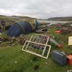 |
On-line Digital Images | DP 175353 | Setting up base camp on site in 2009. (Colin Martin) | 2008 | Item Level |
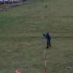 |
On-line Digital Images | DP 175354 | Setting out one of the primary baselines. (Colin Martin) | 2008 | Item Level |
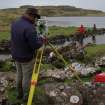 |
On-line Digital Images | DP 175357 | Dr Chris Burgess established a survey network with Total Station. Within this framework the detailed survey was carried out with traditional methods. (Colin Martin) | 2008 | Item Level |
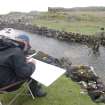 |
On-line Digital Images | DP 175359 | Roger Miket plots measurements as Peter Martin calls them out. | 2008 | Item Level |


