551 434/7/3
Description Rubh An Dunain
Collection Dr Colin and Dr Paula Martin
Catalogue Number 551 434/7/3
Category All Other
Permalink http://canmore.org.uk/collection/1407344
Collection Hierarchy - Sub-Group Level
Collection Level (551 434) Dr Colin and Dr Paula Martin
> Group Level (551 434/7) Maritime Landscape
>> Sub-Group Level (551 434/7/3) Rubh An Dunain
| Preview | Category | Catalogue Number | Title | Date | Level |
|---|---|---|---|---|---|
 |
Digital Files (Non-image) | WP 004457 | Rubh' an Dunain, Bracadale, Skye. Data Structure Report | 9/2009 | Item Level |
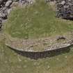 |
On-line Digital Images | DP 175311 | Vertical aerial photograph from drone of the headland fort at Rubh’ an Dùnain. (Edward Martin) | 2008 | Item Level |
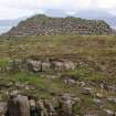 |
On-line Digital Images | DP 175314 | Headland fort from the NE, looking towards Rum. (Colin Martin) | 2008 | Item Level |
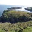 |
On-line Digital Images | DP 175317 | Headland fort from the NE, looking towards the islet of Sgeir Mhòr and the sheltered anchorage between. (Colin Martin) | 2008 | Item Level |
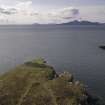 |
On-line Digital Images | DP 175319 | Headland fort, aerial view from drone looking S. (Edward Martin) | 2008 | Item Level |
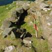 |
On-line Digital Images | DP 175321 | Headland fort, intramural chamber adjacent to entrance. Scale 2 metres. (Colin Martin) | 2008 | Item Level |
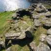 |
On-line Digital Images | DP 175323 | Headland fort, detail of chamber and external wall (on right) showing evidence of re-build. Scale 2 metres. (Colin Martin) | 2008 | Item Level |
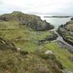 |
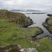
On-line Digital Images | DP 175324 | Headland fort (skylined, on left), the two nausts below it, and the canal leading into Loch na h-Airde. The islet of Sgeir Mhòr and the sheltered anchorage lie beyond. (Colin Martin) | 2008 | Item Level |
 |
On-line Digital Images | DP 175325 | Headland fort (skylined, on left), the two nausts below it, and the canal leading into Loch na h-Airde. The islet of Sgeir Mhòr and the sheltered anchorage lie beyond. Rum is on the horizon, and the headland on the far left is Dùnan Thalasgair on Eigg, which according to tradition was a watch-post and signal-stance linked to Rubh’ an Dùnain. (Colin Martin) | 2008 | Item Level |
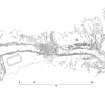 |
On-line Digital Images | DP 175329 | Interpretative survey drawing derived from the rectified vertical photomosaic of the canal, quay, and nausts. (Colin Martin) | 2008 | Item Level |
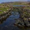 |
On-line Digital Images | DP 175336 | The upper canal leading into Loch na h-Airde, with the blockage part-way along it. The left-hand revetment is relatively intact, but that on the right appears to have been dismantled to its foundations and the stones thrown onto the bank. Tradition asserts that this was done to bring larger vessels into the loch. Scale 2 metres. (Colin Martin) | 2008 | Item Level |
 |
On-line Digital Images | DP 175338 | Oblique photomosaic taken from an elevated pole of the canal blockage. Scales 2 metres. (Edward Martin) | 2008 | Item Level |
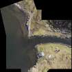 |
On-line Digital Images | DP 175339 | Rectified vertical mosaic taken by aerial drone of the stone-built quay features on either side of the canal entrance into Loch na h-Airde. (Edward Martin) | 2008 | Item Level |
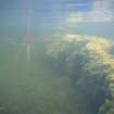 |
On-line Digital Images | DP 175341 | The edge of the quay on the E side of the canal entrance into Loch na h-Airde. (Colin Martin) | 2008 | Item Level |
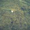 |
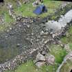
On-line Digital Images | DP 175343 | The basin beyond the entrance of the canal into Loch na h-Airde is deeper than its surroundings, relatively weed free, and filled with soft mud. Organic material tends to accumulate here. The items visible in this photograph are probably modern in origin but given its location adjcent to the quay earlier material may well be buried in the aenerobic substratum. (Colin Martin) | 2008 | Item Level |
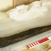 |
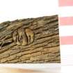
On-line Digital Images | DP 175344 | Boat component discovered at the N end of the loch by Dr David MacFadyen in 2000. It is a bite, part of a small four-oared boat of Norse type, and has been C14-dated to around 1100 AD. Scale 50 centimetres. (Colin Martin) | 2008 | Item Level |
 |
On-line Digital Images | DP 175346 | Treenail, or wooden fastening peg, from a boat component discovered at the N end of the loch by Dr David MacFadyen in 2000 which has been C14-dated to around 1100 AD. The treenail has been tightened with a wedge. Scale in centimetres. (Colin Martin) | 2008 | Item Level |
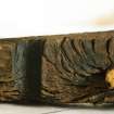 |
On-line Digital Images | DP 175347 | Part of a boat component discovered at the N end of the loch by Dr David Macfadyen in 2000. The piece is a bite, part of a small four-oared boat of Norse type, and has been C14-dated to around 1100 AD. This detail shows a wooden peg or treenail, and a slot cut in its side. Scale in centimetres. (Colin Martin) | 2008 | Item Level |
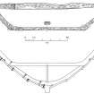 |
On-line Digital Images | DP 175348 | Top and side views of the bite found at the N end of the loch by Dr David Macfadyen in 2000. Below is a reconstruction of how it might have fitted into the midships section of a four-oared boat of the Norse faering type. (Colin Martin) | 2008 | Item Level |
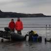 |
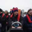
On-line Digital Images | DP 175350 | Access by boat from Glenbrittle is convenient but entirely weather dependant. This demanded a much more flexible approach predicated on exploiting windows of opportunity with a small family-based team. Here Dr Paula Martin and Peter Martin prepare to set out for the site with a load of equipment. (Colin Martin) | 2008 | Item Level |
 |
On-line Digital Images | DP 175351 | Fast, comfortable access is available – at a price – by rigid inflatable boat from Elgol. This occasion, in 2012, was underwritten by the BBC, who were making a programme. At centre is Dr Jon Henderson (University of Nottingham) who was presenting the programme and providing expertise on the archaeology of the site. On the right is Edward Martin, who has been developing drone photography and photographic rectification for the project. (Colin Martin) | 2008 | Item Level |
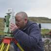 |
On-line Digital Images | DP 175355 | Dr Chris Burgess established a survey network with Total Station. (Edward Martin) | 2008 | Item Level |
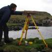 |
On-line Digital Images | DP 175356 | Within the Total Station network much of the detailed survey was done by plane table. (Colin Martin) | 2008 | Item Level |
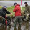 |
On-line Digital Images | DP 175358 | Beginning a survey of the canal. From left, Roger Miket, who first recognised the site’s potential in the 1980s, Dr David Caldwell of the National Museums of Scotland, and Peter Martin (Colin Martin) | 2008 | Item Level |


